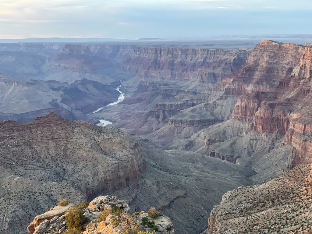
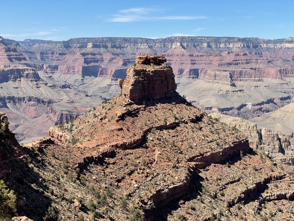
Widely known and wildly popular, this place calls to people from all over the world who want to gaze down into the depths of the striking red canyon that was carved out here by the Colorado River over millions of years. Take a hike, ride a mule, or just simply waltz along the rim staring down into the massive crevasse Mother Nature left here for us to enjoy. Soak it all in from a variety of levels and perspectives while learning about the geology and history of the indigenous people that were here before us today. The cherry on top about visiting this place is that there are plenty of options that don’t require much effort to get to (although there’s plenty of that too).
As one of the most visited national parks, the Grand Canyon is second only to the Smokies on the eastern side of the country. The park boundaries follow along the Colorado River through a section of northwestern Arizona, but most of it is not really accessible unless you plan to go backpacking. Visitors and their families could easily spend one or two full days here and see a majority of the park.
The South Rim sits on the Coconino Plateau and is the most frequently trafficked area of the park and open year-round. There is a sizable village area that has multiple food options, campgrounds, lodges, museums, and stores. Bathrooms are everywhere, including pit toilets at trailheads and even every few miles on the major hiking trails. The North Rim on the Kaibab Plateau is only accessible during the warmer months, but is also home to a much smaller seasonal village area that offers similar options to guests.
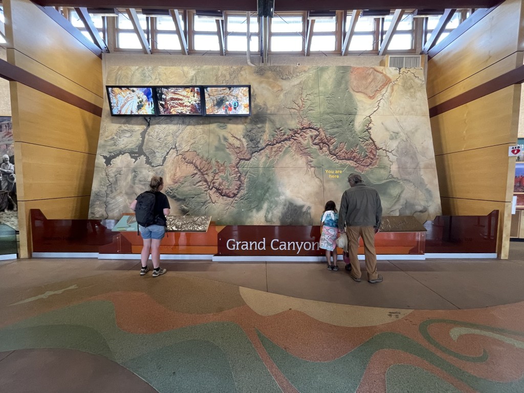
Reception is pretty good up on the canyon rim with a very reliable signal around the visitor centers and village areas. Carrying a park map (offered complimentary with your entrance fee) is always recommended. If you go without a specific plan, head to the South Rim Visitor Center during operating hours and talk to a park ranger about your options. They are there to help you make your adventure the best they can, but be mindful as to not take up too much of their time so they can do their jobs and help other people, too!
When to go and how long
One really great thing about the Grand Canyon is that you can really make this a destination during any season. It does get extremely hot in summertime (also beware of monsoon storms) and I wouldn’t recommend hiking in the middle of the day, but the majority of the park’s attractions don’t really require you to. Spring and fall are definitely cooler and it will be more enjoyable outside, but it can get very cold when the sun goes down and through the night. Winter is cold, but beautiful. Red rock cliffs with a light dusting of snow really are a treat for the eyes. Always check the weather forecast before you go and plan accordingly. Much of the area has little vegetation, so changes by season are minimal but spring wildflowers and golden fall foliage do exist.
Unless you plan on doing some long distance hiking, you could probably cover the southern rim of the park in one to two days, depending if you are planning to participate in any of the other available activities.
The northern rim is very remote and not accessible from late fall through late spring due to snow and road closures. If you are comfortable and have experience backpacking through snow, you could potentially reach it in the winter by foot. This region is mostly a summer destination. The opening/closing dates vary by year, so check the NPS website in advance if you are thinking about adding this to your itinerary.
Where to stay
You have a lot of options, but the stuff closest to the park often gets booked up in advance. The southern rim of the Grand Canyon is only about 1.5 to 2 hours drive northwest of the major city of Flagstaff, Arizona, and is a great option if you are just planning a day trip, but there are smaller towns closer than that if you don’t want to drive back and forth.
If you are spending a couple days inside the park, there are several lodges and camping areas directly in the South Rim Village. Less than 10 minutes south of the park boundary in the community of Tusayan, you can find plenty more accommodation options. About an hour south in the city of Williams, there are even more.
The north rim region has a different entry point and the closest major cities are Page, Arizona and St. George, Utah, both of which are over 4 hour’s drive away. Those two cities both have their own small airports and rental cars are available (reservations recommended as usual). It’s not recommended to try visiting the north and south rims in the same day unless you want to spend more than 5 hours driving around the rim, or backpacking/long-distance hiking between them. I would suggest visiting them on separate days if you want to see both, but at this time the North Rim is still closed due to the wildfires in July 2025.
For more information about hotel lodging options, this page on the NPS website provides all your overnight lodging options within a two hour radius of the park.
There are also some Grand Canyon campsites with seasonal availability on both the north and south rims which are also usually booked long in advance. For some, reservations are required, and for others they are not (but still recommended). Most campsites have minimal amenities like pit toilets and water, and are mostly primitive, but there is also one Trailer Village (for RV campers) in the south rim area with full hook-ups. Camping is a great way to save money if you don’t mind sacrificing a bed and bathroom at the end of the day.
I heard there is a specific area within both the North and South Rim Campgrounds is set aside as a hiker and biker camping spot which is only about $5 or $6 per person. Spots are limited and you must check in at the backcountry office or ranger station before settling in, so be sure to arrive early. Seems like a great deal.
How to get around
You can reach the Grand Canyon from Flagstaff (nearest commercial airport is the Flagstaff Pulliam Airport), where you either have the option of renting a car (reservations recommended) OR hopping on a bus via the local public transportation. It is not necessary to have your own car to visit the Grand Canyon, but it will definitely give you more flexibility.
From Williams, Arizona, the historic Grand Canyon Railway can also take you into the South Rim Village. This train predates the national park status of the canyon and has been bringing tourists there since 1901! The trip takes a little over 2 hours one-way. Both Williams and the Grand Canyon can be reached by public transportation.
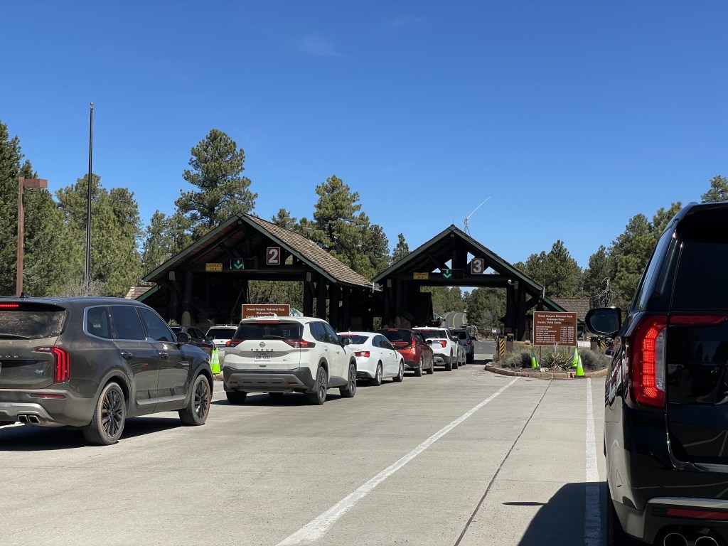
The southern rim area is accessible from two entrances: the south and the east. Most people enter through the south entrance. The wait to get into the park if you are driving yourself here can get long in the mornings. The east entrance is generally less trafficked, but a bit more off the beaten path. Desert View Drive connects these two entrances and runs along the southern rim of the canyon.
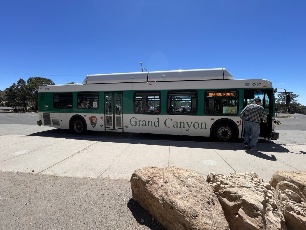
The South Rim Village hosts a well-organized FREE shuttle service system that will get you around town and to/from any of the major viewpoints. It consists of three major lines: blue line gets you anywhere in the village, orange line takes you east on Desert View Drive and stops at several viewpoints, trailheads and a museum, and the red line brings guests west on Hermit Road to more outlooks and hiking trails. Do check in advance to see the schedules for each of these shuttle routes as they do vary by season. During the height of tourist season and even during the spring and fall, these shuttles are often packed to full capacity.
In the small community of Tusayan, the purple line shuttle brings guests into the park as well. This route only runs during the summer season.
An early morning line for hikers (called the Hikers’ Express Shuttle) also runs a couple times in the morning to a few selected trailheads year-round.
There is no shuttle service in the North Rim Village. It can only be reached by personal vehicle (more than a 5-hour drive from the South Rim Village) or hiking trail (21 miles from the South Rim Village).
Riding a bicycle is also a method of transportation guests can use to get around in the park. Check out the NPS page on biking trails for the rules of the road and where you can ride. Bike rentals are available in the South Rim Village near the Visitor Center.
Food and money
Prices around here are pretty reasonable. This is a very popular tourist destination and there are a lot of options for food and lodging, and therefore pricing is more competitive. There are plenty of restaurants inside the park near or inside of the lodges (note that some are by reservation only, inquire in advance). Basic grocery items are also available for sale in the village.
Tusayan is a quick drive south of the South Rim Village and is home to a variety of restaurants and stores.
Lodging inside the park is more expensive than staying outside and commuting in, but you are of course paying for proximity. Campsite prices are generally average.
If you are visiting the North Rim Village, I would recommend bringing some of your own food or you will be relying on the small general store in the area and a few restaurants.
A full list of food options is linked here (from the NPS website).
What to do around South Rim Village
This place was designed to host a lot of tourists. There’s a lot to do around here, and this is probably one of the largest developments I’ve ever seen inside a national park. Here you will find a visitor center, information and ranger stations, lodges, campsites, bike rentals, restaurants, a general store, gift shops, museums, water bottle refilling stations, restrooms everywhere, a shuttle service, a medical clinic, and more.
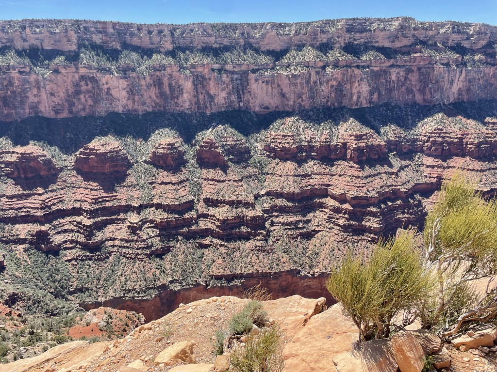
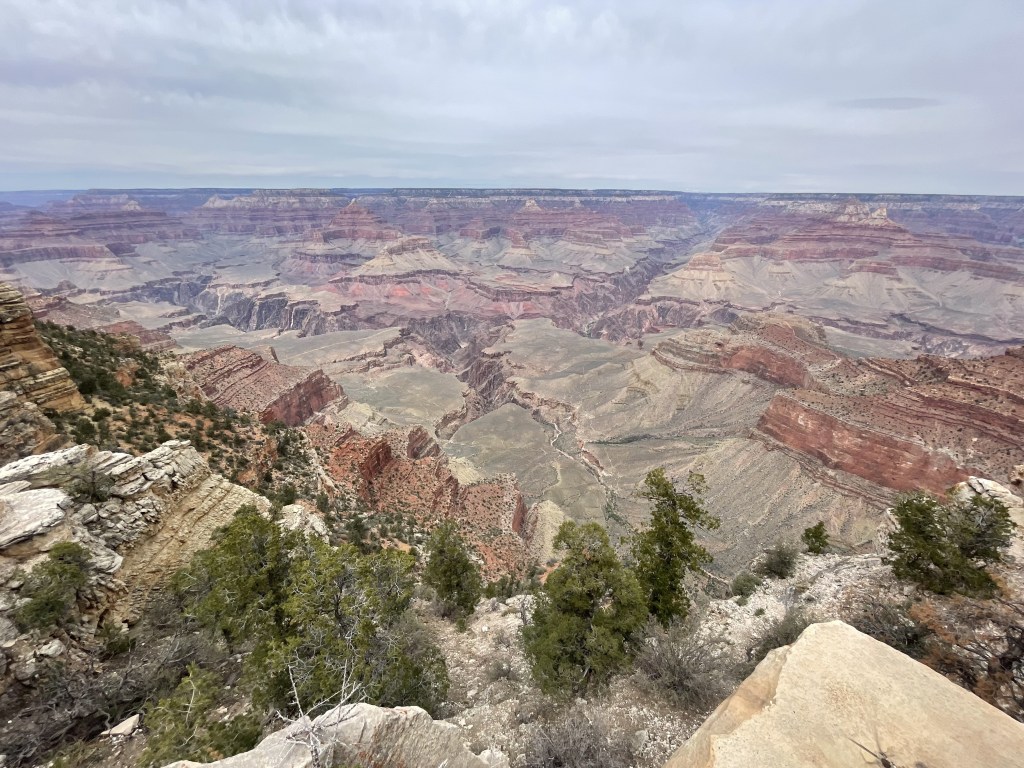
There are so many viewpoints, you could spend all day hopping from one to the next using the shuttles. However, all viewpoints east of South Kaibab/Yaki Point on the orange route will require you to drive your own vehicle or ride a bike to get to. Because I haven’t been to all of them, I can’t really say which ones are the best, but I have yet to visit one that wasn’t absolutely amazing. Most viewpoints are accessible to individuals with limited mobility as well as to pets. You can download the NPS mobile app and use it to see a preview of most of the viewpoints, then determine for yourself if you want to go there.
The Rim Trail stretches about 13 miles around the village area. For the most part, it is all paved and basically flat. You can walk along it for 15 minutes and turn around or walk the entire thing, the choice is yours, making it a great activity for just about anyone. The option also exists to drive or ride the shuttle to different points along the trail if you would rather break up the day that way.
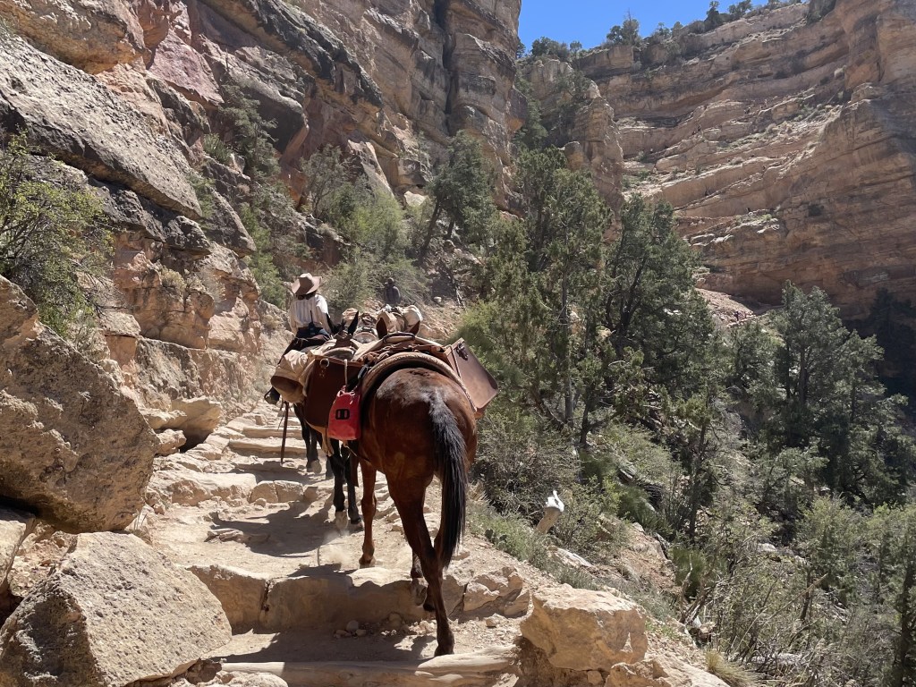
If you’re not a hiker and you still want to descend down into the canyon, consider booking a tour riding a mule from the south rim with this park-approved vendor. Keep in mind there is a lot of controversy as to whether or not having these animals work in this way is ethical, but they are indeed prepared and trained for this job. These are usually sold out in advance, so be sure to make reservations. Permits may also be required if you plan to camp somewhere on the trail.
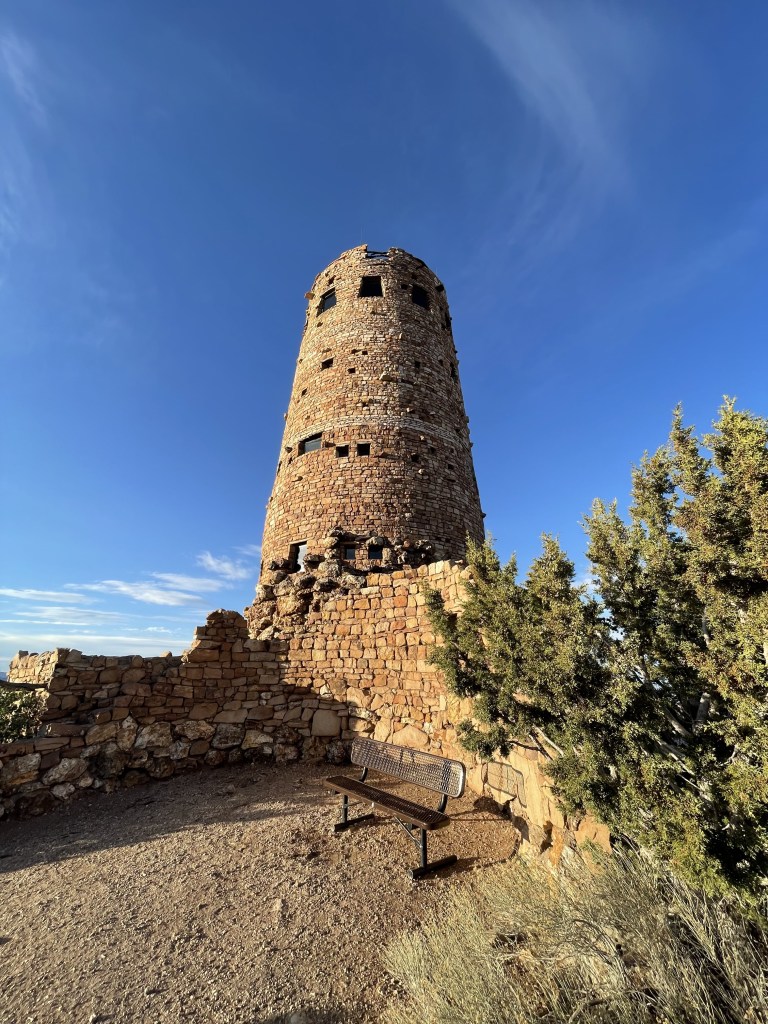
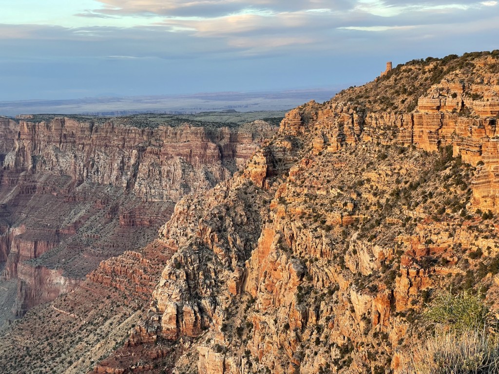
Heading east from the South Rim Village on Desert View Drive will bring you to several more viewpoints that offer a different perspective of the canyon, as well as a handful of forested picnic areas you can stop at to enjoy your pre-packed lunch. The final viewpoint nearest the eastern entrance is the Desert View Watchtower, which is a small developed area with a campsite, visitor center, trading post, gas station, market and deli. These facilities are not operational year-round, so check in advance if you are planning to go here, but the views are still accessible. You can climb the watch tower for free, but spots are limited and you may be waiting around for a while. On this side of the park you will also find the Tusayan Pueblo Museum, which is currently closed until further notice per the NPS website.
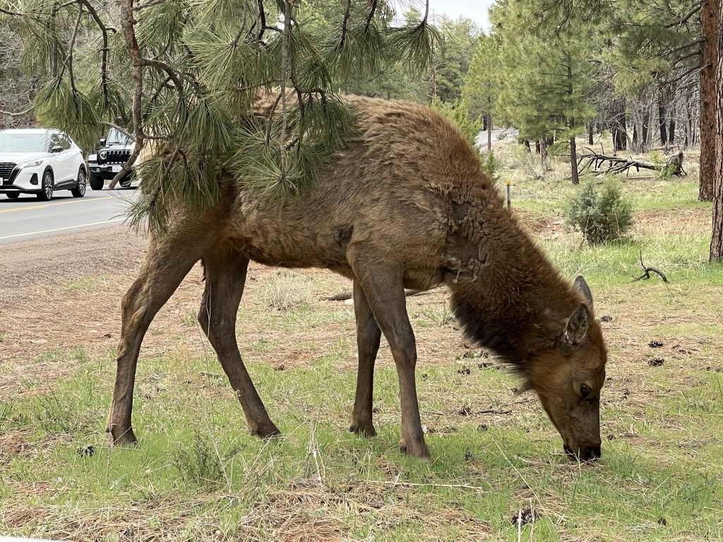
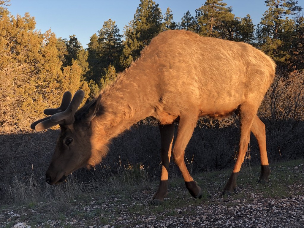
Elk sightings are super common around here. Please, let them live their lives in peace, do not try to feed them and DO NOT approach them for any reason!!! They will charge at you if they feel threatened, I have watched tourists try to get the perfect photo with an elk only to be chased by one instead. Other animals like squirrels and bighorn sheep also hang out around here, and should be treated the same. Leave them alone and take your photos from a safe distance. Keep nature wild.
The NPS has made this destination possible to bring along your dog, which is very uncommon for any of the national parks. While they cannot go below the rim (so basically no hiking), they are permitted at all the viewpoints and the trails above the rim. The village has a kennel if you need to part ways with your dog or cat for a few hours or the entire day, and does also offer overnight boarding in the event you are backcountry camping somewhere your pet can’t join you.
What to do around North Rim Village*
[*The North Rim Village (including the burning down of the historic Grand Canyon Lodge, North Rim Visitor Center, and several other structures) was severely affected by the Dragon Bravo fire in July 2025 and the area is closed until further notice. As these happenings are so recent, it is unclear what the plans are for rebuilding.]
The northern rim is far more remote, and mostly only open from late spring into the fall when the area begins to see snow. Because I have not been here as an adult I do not feel qualified to tell you if you should add it to your itinerary. Only about 1 in 10 annual visitors come to this region of the park. There are many viewpoints that must be driven or biked to. There is no park shuttle service here. Dining, camping, and lodging options are limited but they do exist, and the area also has a gas station. Water faucets are available at the campsites.
I would recommend making the North Rim Visitor Center your first stop, as I always do.
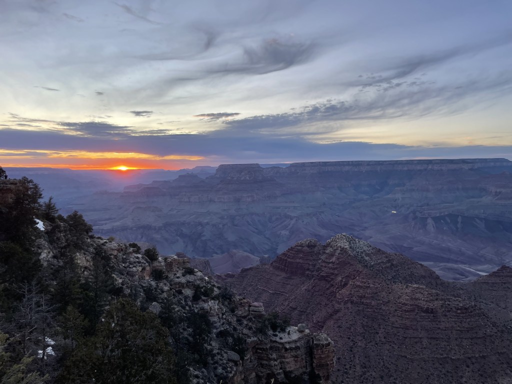
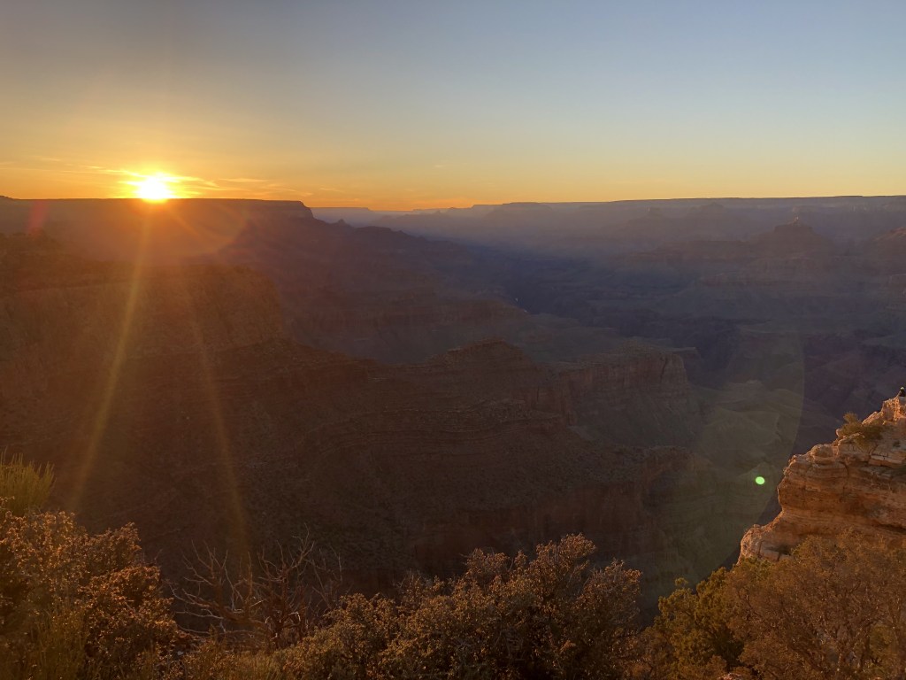
For the best views, drive the scenic Cape Royal Road to the various viewpoints, which are typically right on the side of the road and do not require any hiking to get to. Visit one or all of them, and try to catch a sunrise or sunset while you’re there!
If you want to go down into the canyon without hiking there, check to see if you can take a ride on a mule from this park-approved vendor. Keep in mind there is a lot of controversy as to whether or not having these animals work in this way is ethical, but they are indeed prepared and trained for this job.
Watch out for the herd of bison that call this place home. DO NOT get out of your car to approach them and follow the speed limits! Other large animals like elk roam these lands as well, but the bison are only found on the north rim. Check in at the visitor center as to how to coexist with all of the beautiful creatures that call this place home.
Dogs don’t really have anything to do around here though, so if you are planning to bring yours along I would definitely suggest going to the southern rim instead. They can only hang out with you at the campground and on paved surfaces like most outlooks here.
If you are planning a trip to North Rim Village, click here to see a PDF of the northern rim guide offered by the NPS. This shows a detailed map of the area, recommendations, and a list of services available to guests.
Hiking the Grand Canyon
This requires its own section because all canyon hikes come with a warning–
This is NOT easy hiking, regardless of the distance.
You are hiking in the desert. Temperatures increase the further down into the canyon you go. Conditions are dry and water is only available from a few select spots along the trail (check at the visitor center before you start hiking).
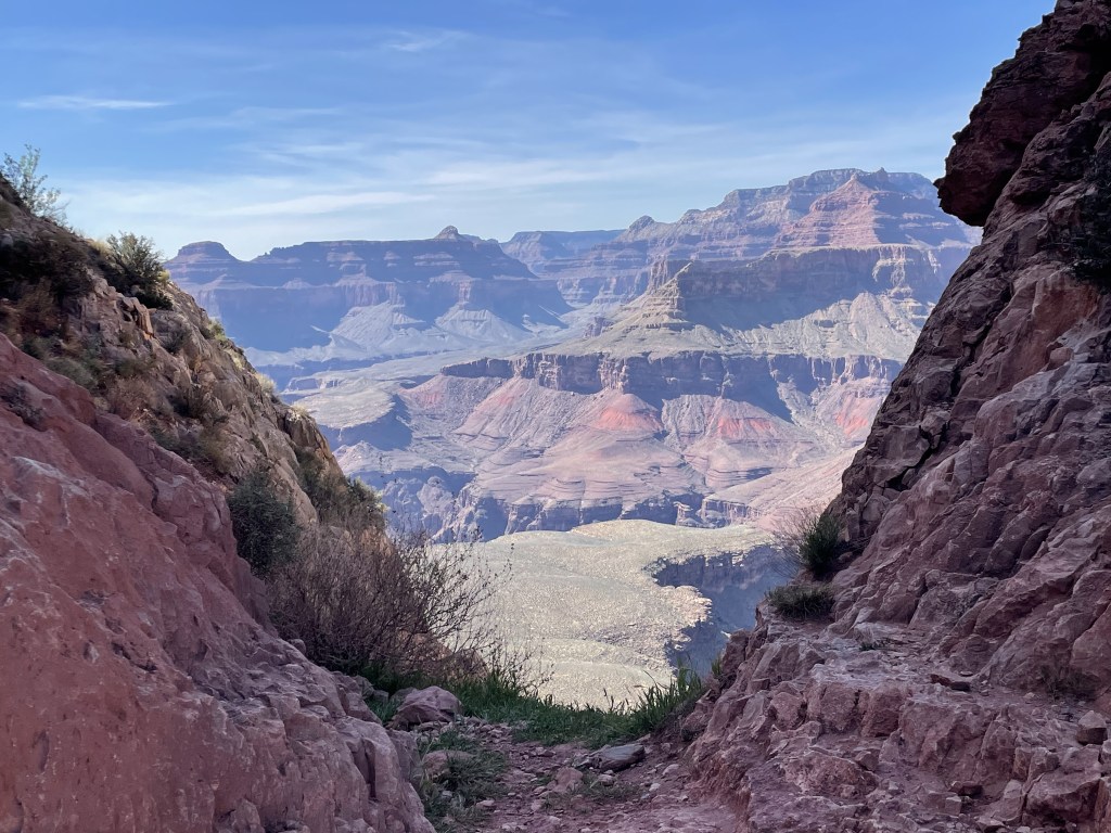
Most trailheads begin at the high point along the rim, and from there you descend down into the canyon, meaning that the second half of your hike is climbing back up (while you are already tired). While the grade isn’t super steep on most of the trails, it can be the equivalent of climbing miles upon miles of stairs depending how far down you go. Longer trails are not recommended for individuals who aren’t long-distance hikers or trail runners, and the park straight-up advises most guests against it. It is suggested that you pick a trailhead and hike down as far as you feel comfortable, then to turn around and hike back up.
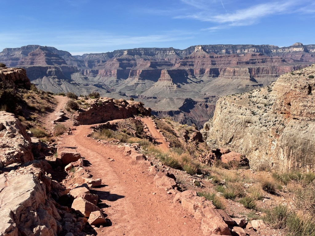
From the two southern rim trailheads nearest the South Rim Village (South Kaibab and Bright Angel), there are rest areas with bathrooms on the trails at roughly every 1.5 mile mark along the routes. Views are spectacular pretty much the whole time. Those spots do make for nice break points (I sat down to enjoy my lunch at one of them). About a mile down from South Kaibab Trailhead is Ooh Aah Point, a very popular spot. Bright Angel is slightly less steep and has some interesting views and a couple archway tunnels to walk through, and is accessible directly from the South Rim Village. Grandview Trail (to the east of the village) and Hermit Trail (to the west) offer hikers an opportunity to explore different parts of the canyon, but they are a bit more difficult (steeper grade and fewer bathrooms/rest areas along the route).
Trailhead access is as follows:
- South Kaibab TH is on the orange route (east of village)
- Bright Angel TH is on the blue route (directly in the village)
- Hermit TH is on the red route (west of village)
- Grandview Trail, New Hance Trail, Tanner Trail and Cape Solitude Trail are not stops on any route and can only be accessed by personal vehicle (all 4 are east of village)
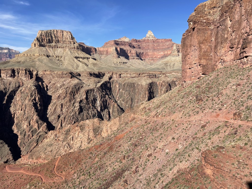
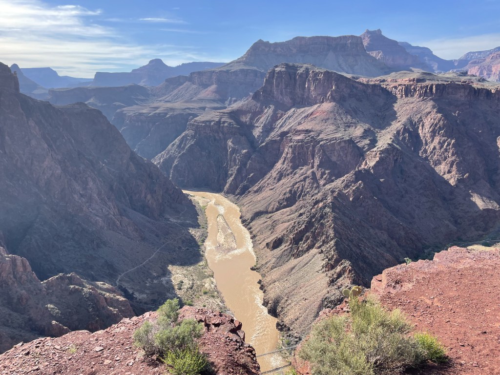
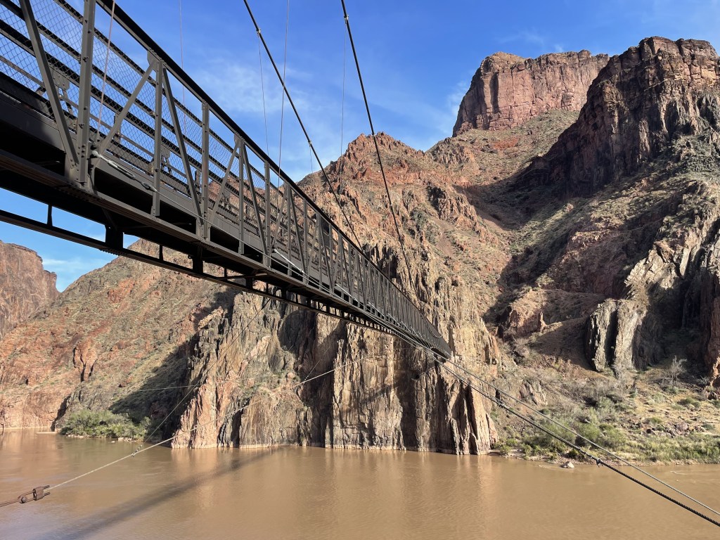
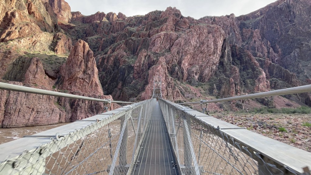
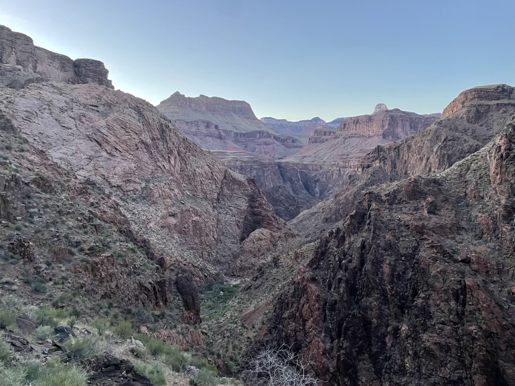
If you are planning to go all the way down to the Colorado River and back up in the same day, I would recommend parking in the village and starting at the South Kaibab trailhead using the orange route shuttle service. From there, it is about 7 miles down, a couple easy miles along the river after crossing Black Bridge and Silver Bridge by Phantom Ranch (a small remote lodge at the base of the canyon that can only be reached by hiking), and a (slightly) less steep climb up the Bright Angel trail, for a total of 17 miles. This not only gives you two different perspectives of the canyon, but also gives you the flexibility of finishing at any time of day (or night) because Bright Angel spits you out directly into the village, so you are not reliant on catching the last shuttle.
After parking my car near the Backcountry Information Office in parking lot D, I started my journey in the afternoon from South Kaibab and completed it after midnight under a very bright moon, taking me a total of 12 hours. Be sure to bring plenty of water and food, and a headlamp if you don’t think you can complete it before the sun goes down. The climb out of the canyon is grueling and time consuming, and definitely not for beginners. I sure had a good time though!
Climbing up to the North Rim Village* (*closed due to wildfires in July 2025) is longer and more strenuous than its southern relative because it resides at a higher elevation, although the vegetation is a bit different and offers more shaded trail. The North Kaibab Trail is really the only trail that will get you to the base of the canyon from that side. If you are backpacking to the north from the South Rim Village, you can access it via the Bright Angel or South Kaibab Trails, and after crossing the river, hike up where they connect behind Phantom Ranch. The journey from South Kaibab TH to North Kaibab TH is 21 miles. The northern rim has other trails but most of them do not go all the way down to the river.
Check out this little brochure about hiking the Grand Canyon from the NPS for more information, and always choose a hike that is appropriate for your skill level. Have fun!
Other stuff you can do around the park
Go fishing. Check rules and regulations on the park website here. It is not a free-for-all and you will need a license, and locations are limited and away from the primary tourist area.
Go whitewater rafting. There are different trips offered depending on the length of the trip (single or multi-day) and your skill level. Check out the rafting options here.
Visit the Skywalk, a walkway constructed over the canyon to the west. It exists on Hualapai Tribal Lands and they collect admission separate from the national park. This area is closer to Kingman, Arizona and Las Vegas, Nevada.
Backpack to the famous Havasupai area. Campsite reservations/permits are required and usually booked long in advance, and are very expensive. This spot is famous for its beautiful blue-green waterfalls.
Other nearby destinations you can add onto a road trip
The Grand Canyon is in a really great location for road trips, and there are a bunch of really great spots you can check out in the area. Here are my top 3 recommended destinations within a 3-hour drive from the South Rim:
- Sedona, Arizona (2 hours to the south), check out my post about Sedona here!
- Horseshoe Bend, Arizona (2.5 hours to the north)
- Petrified Forest National Park (3 hours to the east)
My thoughts
The Grand Canyon is great because it was designed in such a way that welcomes tourists of all kinds, and you can pack a lot of really great views into one day. The active traveler can appreciate the strenuous hikes down into the canyon that offer new perspectives. A non-active traveler can enjoy a bunch incredible outlooks just a short walk from their car. It’s a great destination for families and people with limited mobility. The park has the infrastructure present to support a lot of visitors at once, but for me it honestly kinda takes the “wild” out of the experience a little because it is so developed. While I’m totally okay with more rugged and remote conditions, not everyone is into that. Nonetheless, it still provides some of the most epic views in the country, and I’m here for it.
Have you been to the Grand Canyon? Did you get lost soaking in the views? What was your favorite viewpoint? Leave your recommendations in the comments below!
Happy traveling! 😊
(And always remember to follow #leavenotrace principles!)
🧡
(this post was last edited and updated on June 14, 2024)


Leave a comment