
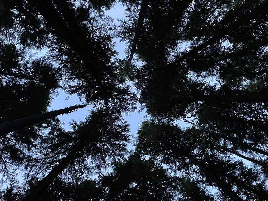
Glacier National Park is an absolute gem, and a true visual of the remote and rugged snow-capped mountains many imagine when they think of the northern wilderness. This park is an absolute dream destination from summer through fall, which is the only time of year the majority of the park’s interior is accessible. One of the greatest and most popular activities is driving through the park on the famous Going-to-the-Sun Road, which offers some of the most incredible views you will ever see from the comfort of your climate-controlled vehicle. Sharing its northern border with another country, Glacier is unique in that it also shares a cause with the neighboring Waterton Lakes National Park of Canada, and the two nations work together to protect our incredibly beautiful north American landscapes.
Although this park sits outside the Top 10 in terms of annual visitation (as of 2023), I think if it were closer to major cities and was accessible for longer of the year, more people would go. With that said, during the few months of the year when there is no snow, this place is PACKED.
Just within the park’s western boundary at Lake McDonald sits the Apgar Village area, which is the most frequently visited region of the park due to its accessibility year-round, but the area itself isn’t necessarily the “best” place to visit inside the park. The village here hosts the Apgar Visitor Center, a very large campground, hotels, a boat launch, a restaurant, ranger station, gift shops, and more. On the eastern side of the park are several smaller village areas, but they are not visited as often.
Reception is poor or nonexistent in most of the park, although there is a reliable signal around the west entrance’s Apgar visitor center. The remaining areas are spotty and unreliable. Wifi is available at the Apgar and St. Mary visitor centers. Carrying a park map (offered complimentary with your entrance fee) is absolutely recommended. If you go without a specific plan, head to any visitor center (there are 3 total) during operating hours and talk to a park ranger about your options. They are there to help you make your adventure the best they can, but be mindful as to not take up too much of their time so they can do their jobs and help other people, too!

When to go and how long
The majority of the park can only be accessed after the snow melts off, which ends up beginning at some point during the month of June and through the fall, until some time October, at which Going-to-the-Sun Road would no longer be an option. During the colder off-season, you will only be able to explore the perimeter areas of the park near the entrances and a few miles of road beyond it, but these areas all have beautiful scenery.
Winters are cold and harsh, and the park resides at a high elevation and annually sees a lot of snow. In fact, the entire spring season is practically just an extension of winter. The area has plenty of wildflowers that can’t really be seen until the snow melts off in the summer, but they hang around for a while. Summer is crowded and reservations for just about everything are necessary in advance, but it’s really the only time the entire park is open and accessible. Beware of lots of bloodthirsty mosquitos in warm seasons.
Some forested areas of the park have beautiful golden tones during the peak of the fall season; which, per the seasons page on the Glacier National Park Conservancy website, the west side is best during the second half of September, and east is best first half of October.
If you are going at any point during the summer through the fall, you could easily spend several days to a week here checking out the different areas in the park, depending on your activity level, and you might as well spend more time there because it was quite the commute to get all the way out there. If you are not fond of or capable of physical activity, you could enjoy a full day or two just driving around the park and checking out the viewpoints. A weekend would be a great amount of time to spend here (although a more active person could easily spend much more time in the region).
During the cold seasons, a lot of the park is not accessible and you will have to drive around the southern tip to get from the east side to west side, so you would be breaking your trip up differently. Driving around takes at least a couple hours.
Where to stay
There are a lot of options, take your pick and book it ASAP!
Lodges inside the park + other official park lodging:
- Apgar/Lake McDonald village areas: Lake McDonald Lodge, Apgar Village Lodge, Motel Lake McDonald, Belton Chalet (located just outside the West Entrance)
- Saint Mary/Rising Sun village areas: Rising Sun Motor Inn
- Many Glacier village area: Many Glacier Hotel, Swiftcurrent Motor Inn
- Other: Sperry Chalet (near Lake McDonald) and Granite Park Chalet (just north of Logan Pass) are in the backcountry and can only be accessed by hiking.
Some nearby cities you can stay outside the park include:
- WEST ENTRANCES: cities of Whitefish and Kalispell, Montana, both are only about 30-45 minutes outside the park boundary, and the community of West Glacier sits just outside the Apgar/Lake McDonald area entrance
- EAST ENTRANCES: city of Browning, Montana is about 30-45 minutes from entrances at St. Mary and Many Glacier, and the community of East Glacier Park sits right at the Two Medicine entrance
- SOUTH: along the US Route 2 which follows the southern boundary of the park, there are some smaller hotels and more camping options
Lots of campgrounds in the park:
- Apgar/Lake McDonald area: Fish Creek Campground has 177 sites, Sprague Creek Campground has 30 sites, Avalanche Campground has 90 sites, Apgar Group Campground has 5 group sites (designed to host up to 24 people)
- Saint Mary/Rising Sun area: St. Mary Campground has 141 sites
- Many Glacier area: Many Glacier Campground has 103 sites
- East Glacier Park area: Two Medicine Campground has 96 sites
- backcountry sites are everywhere, but *wilderness permits are required to camp in the park’s backcountry*
- there are loads more campsites in the surrounding national forests outside the park boundaries, permits are usually not necessary, but reservations are highly recommended where available
Reservations, regardless of where, are highly recommended as everything around here will likely be booked in advance during the peak season. Activities and tours will also usually sell out ahead of time, and even the parking lots fill up by mid-morning, as you will find during your visit.
How to get around
You are best off renting a car or driving your own.
Linked here is the official park map of Glacier NP. I recommend having this open on another tab so you can reference it at any point throughout this post as you read along.
The closest commercial airport to the west entrance is the Glacier Park International Airport (FCA) which sits less than 45 minutes southwest of the park’s West Glacier entrance in the city of Kalispell, Montana. There is also an airport a couple additional hours south in Missoula, Montana (MSO).
From any of the park’s three entrances on the east side, Great Falls International Airport (GTF) is about 2-3 hours away. Rental cars are available near any of these airports (reservations are recommended).
You will pretty much need a car to explore the park simply because there is no public transportation that will get you into the park’s interior, but once you arrive you can use the park shuttle to get around. Parking can be competitive and complicated and lots usually fills up by mid-morning during the peak of the season. To drive all the way through the park’s interior on Going-to-the-Sun Road may require reservations depending on the season and time of day (more on this in the next section). Using the free park shuttle reduces congestion on this single lane road that runs through the park while also ensuring access to those who could not obtain a reservation.
The FREE SHUTTLE SERVICE operated by the park runs two routes: the West Side Shuttle which runs from Apgar to Logan Pass (includes a transfer @ Avalanche Creek), and the East Side Shuttle which runs from Logan Pass to Saint Mary (includes a transfer @ Sun Point). Centrally located at Logan Pass in the middle of Going-to-the-Sun Road is the transfer between the two shuttle routes where there is a visitor center and restrooms available. Both shuttle lines make stops at several lookouts and trailheads along their routes. To ride the shuttle from the east or west side of the park to the opposite side requires 4 total transfers (Apgar -> Avalanche Creek -> Logan Pass -> Sun Point -> St. Mary). Check the shuttle schedule and route maps before your trip, it is only in operation during the summer into early fall. Always be aware of the time of the final shuttle and aim to be there early, or you risk getting stranded somewhere in the middle of the park!
It is logistically very complicated to get to Glacier without a car because there is little to no public transportation available in the surrounding cities. Here’s all the information I was able to gather…
Whitefish, West Glacier, Essex, and East Glacier Park are all stops on the Amtrak (train). Rental cars are available at Whitefish and West Glacier. Taking the Amtrak is a considerable option if someone is picking you up locally or if you are planning a backpacking trip (some more notes on backpacking later in this guide). There are no ride shares nor taxis except for in the immediate towns near the airports. Expect wait times and high prices. Some hotels may provide private transportation, but you would have to inquire in advance and they may charge a fee. Glacier National Park Lodges offers a shuttle in the summer season for a fee (reservation required) which operates in the West Glacier area.

Things you should know about Going-to-the-Sun Road
Going-to-the-Sun Road is about 50 miles of engineering mastery that connects West Glacier to Saint Mary on the eastern boundary of the park. This is the only road that provides through-access from one side to the other, and for the majority of the summer and fall seasons, requires a timed-entry reservation. If you’re able to land one of these reservations, make sure you have enough gas in your tank before you enter, as there are exactly zero fueling stations inside the park (although there are stations immediately outside the entrances on either end). The single lane road is windy and slow moving and takes about 2 hours from end to end, but offers guests a way to see loads of incredible views. Always check the NPS website concerning current road conditions in advance regarding road closures due to weather and construction improvements.
If you aren’t able to secure a reservation on Going-to-the-Sun Road, you totally still have options and this shouldn’t stop you from visiting. During the hours the shuttle is running, you can enjoy this drive without having to worry about reservations or trying to find parking for your car at each of the limited trailhead parking lots and outlooks (although you will have to find a parking spot at the Apgar or St. Mary visitor centers).
The timed reservation system helps to alleviate some of the congestion and there are still options to drive through the park if you show up without one. Outside the operating hours of the reservation system (which ends up being around sunrise and sunset), you are allowed to pass through the park in your own car. If you leave at any point during the day that falls during the timed-entry system, you will not be allowed reentry to this road.
If you would like to get from one side of the park to the other during these blocked-off times without a reservation, you can do so by driving on the US Route 2 which wraps around the southern tip of the park and passes through Essex. This route takes about the same amount of time, is less crowded, and is also usually accessible during any time of the year, although there are always exceptions. Always check road conditions in advance for closures.
Going-to-the-Sun Road is also used by bicyclists, so be aware and share the road! If you are a bicyclist, please familiarize yourself with the rules of the road on the NPS website before your trip.
Food and money
Glacier is in a very remote area, but there are food options around the perimeter of the park as well as in the villages. Food prices are reasonable, maybe a little on the high end but nothing out of the ordinary. Packing a lunch will help you make the most of your trip so you don’t have to exit and reenter the park or migrate to the villages during the middle of the day. If you are planning on camping, it is recommended that you bring all your groceries with you as dining options near campgrounds and the park’s general stores have limited selections.
Huckleberries, elk (burgers and steaks), and trout are a few local foods you can try while you’re up in this remote region of Montana. These items may or not be served at the restaurants in the park, but are available around the region.
It is more expensive to stay inside the park’s lodges than the nearby areas. Hotels are above average during the peak season (which usually lasts from late June to September), and campsites are also more expensive than average during this time of year, but still a great way to save money. With that said, prices do fluctuate greatly depending on the season. Prices are generally average for the other parts of the year.
Day trip tours (such as rafting or horseback riding) can be very expensive and are often $100+ per person, but there are some less expensive options for individuals and families on a more restricted budget. Alternatives include boat rides and watercraft rentals on certain lakes (prices vary, more on that later) and riding on the Going-to-the-Sun Road Shuttle all the way through the park and back ($ free, included with park admission).
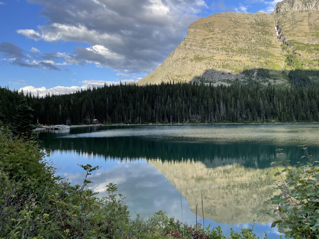
Apgar + Lake McDonald area (southwest)
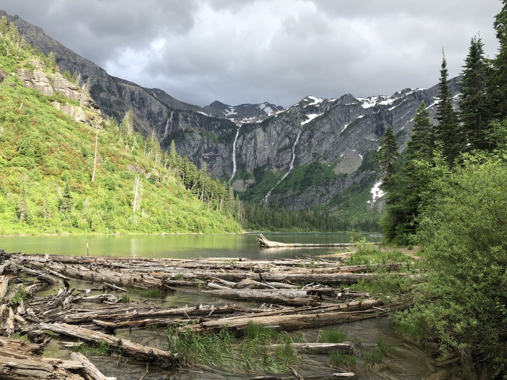
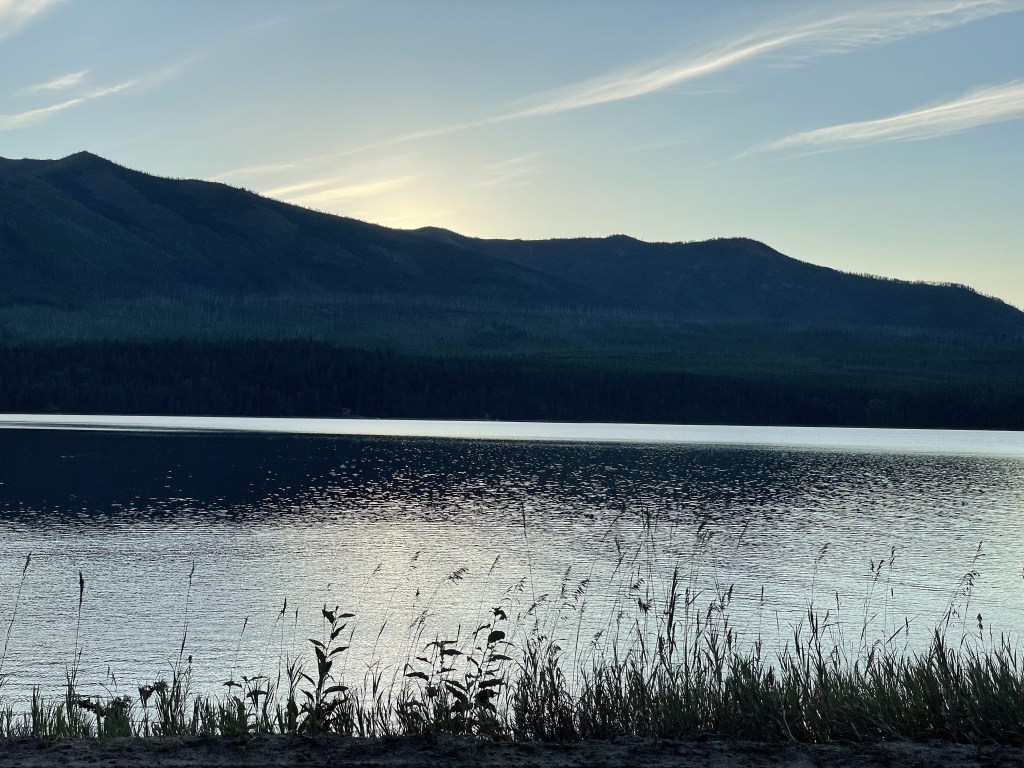
This is one of the most frequently visited regions of the park because for the most part, the Apgar area is accessible year-round, has the largest number of services available to guests, and is nearest to the international airport in Kalispell. Lake McDonald is famous for the rainbow colored rocks present in its shallow waters, although these rocks are not exclusive to this lake and are a common theme in many of the other lakes and creeks around the park. The hike to Avalanche Lake is absolutely stunning and was one of my favorite hikes when I first visited the park back in 2019.
Services: Apgar Visitor Center, Apgar Backcountry Permit Office, Apgar Ranger Station, Apgar Public Boat Launch, Gift Shops, Eddie’s Restaurant, Lake McDonald Lodge Boat Launch, Lake McDonald Coffee Shop, Lake McDonald General Store, Lake McDonald Post Office, Lake McDonald Ranger Station, Fish Creek Ranger Station, West Route Park Shuttle, additional non-park services are located just outside the park entrance in the city of West Glacier
Attractions include (but are not limited to): Lake McDonald, Avalanche Lake, Mt. Brown Fire Lookout, Snyder Lakes, Huckleberry Mountain, Huckleberry Fire Lookout, McGee Meadow, Apgar Fire Lookout, Loneman Fire Lookout, McDonald Falls
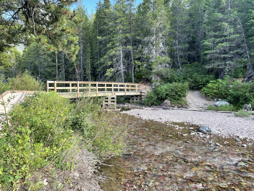
Trailheads: Huckleberry Lookout, Nyack Creek, Apgar Lookout, Boundary, Camas Road, Lake McDonald, Howe Ridge, Lincoln Lake, Sperry Trail, Trout Lake, Upper McDonald Creek, McDonald Creek Horse Bridge, John’s Lake, Avalanche, Trail of the Cedars
Linked here are some options for day-hiking in the Lake McDonald area.


Central Glacier area
This area can only be accessed when Going-to-the-Sun Road is open. Many incredible views are visible directly from the road, but there are also several lookouts and hiking trailheads (many of which connect to trails that lead to other areas of the park). The transfer between the East and West Shuttle Routes occurs here at the Logan Pass Visitor Center.
Services: Logan Pass Visitor Center, West Route Park Shuttle, East Route Park Shuttle
Attractions include (but are not limited to): Bird Woman Falls Overlook, Road Camp Overlook, Hanging Valley Weeping Wall, Triple Arches, Hidden Lake, Lunch Creek, Jackson Glacier Overlook
Trailheads: Flattop Mountain, Granite Park, Hidden Lake, Highline, Siyeh Bend, Piegan Pass
Linked here are some options for day-hiking in the St. Mary/Logan Pass areas.
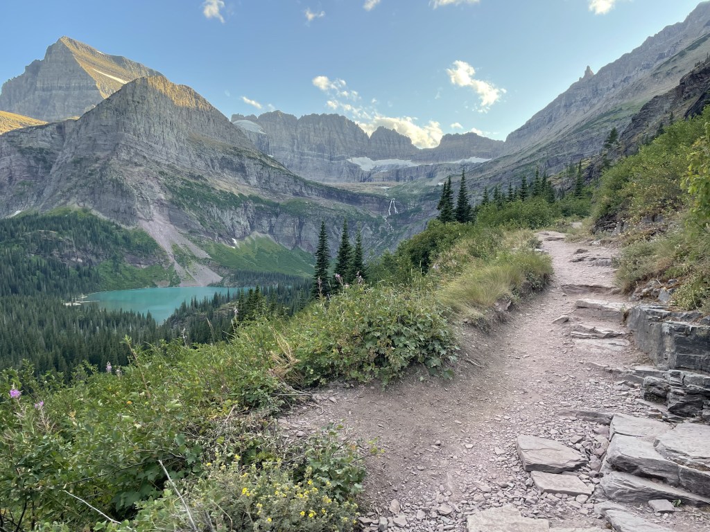
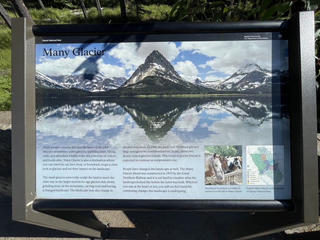
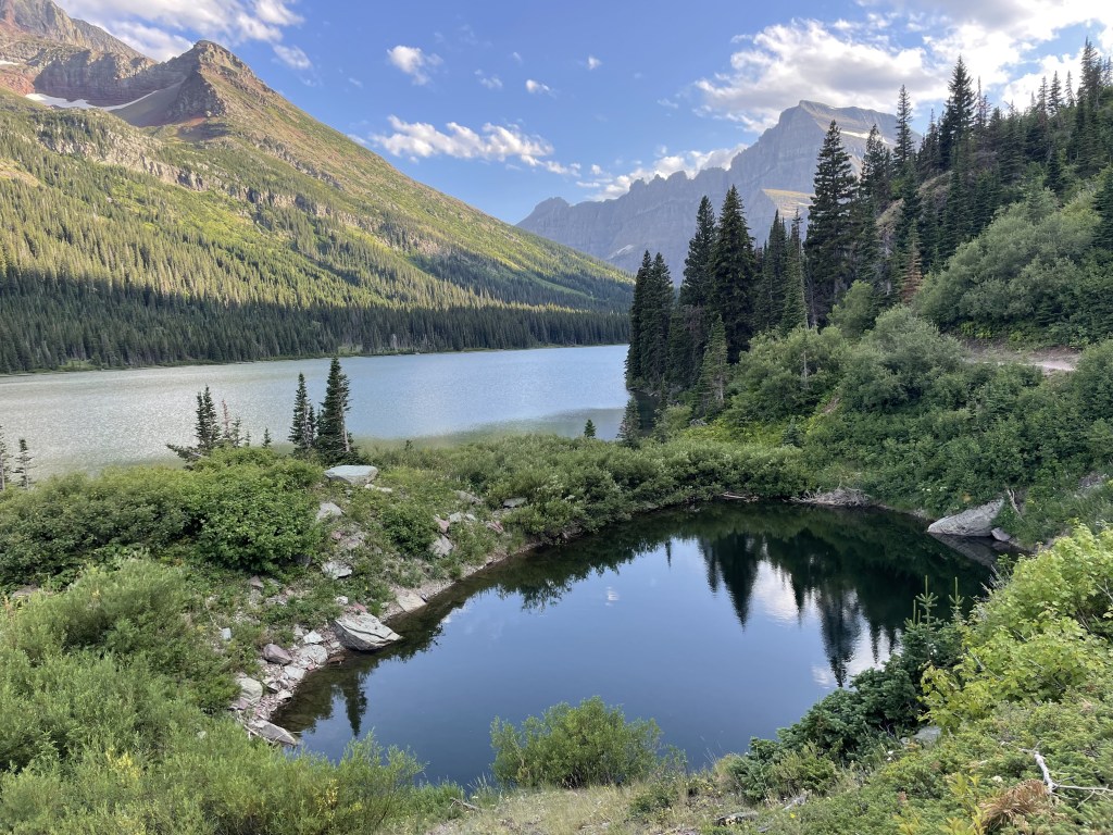
Many Glaciers area (northeast)
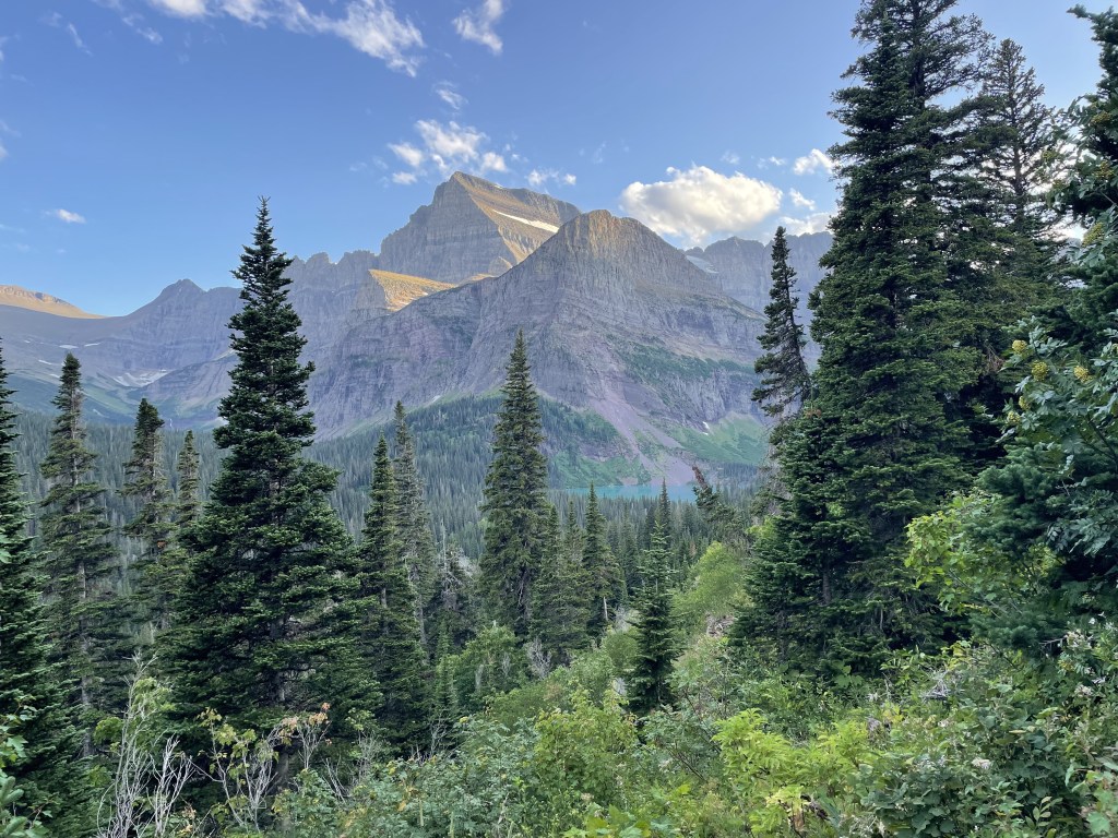
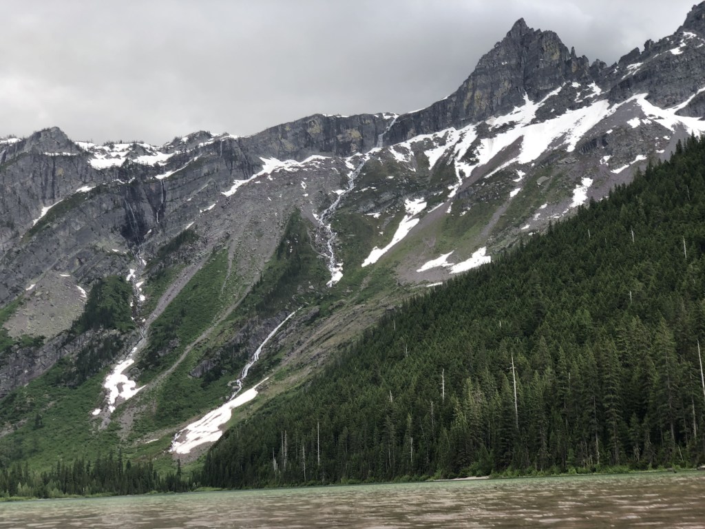
Many people have argued that this is the most beautiful region of the park, and while I haven’t seen enough of this place to agree, I can at the very least admit that the views are absolutely incredible. The hike to Grinnell Lake/Glacier is absolutely breathtaking and surreal, and I look forward to returning to this area someday. However, many of the glaciers are melting rapidly (both here and in other areas of the park) and it is unclear how long they will remain, or if new ones will form in the future, as it is all in the unpredictable hands of nature.
The drive into this region from the east is absolutely beautiful as the road parallels the northern shoreline of Lake Sherburne. No shuttle operates in this region and it can only be reached by personal vehicle or on foot. The historic Many Glacier Hotel is a famous landmark as well as a potential lodging option.
Services: Swiftcurrent Camp Restaurant and General Store, Swiftcurrent Boat Ramp, Many Glacier Ranger Station
Attractions include (but are not limited to): Lake Sherburne, Apikuni Falls, Swiftcurrent Glacier, Swiftcurrent Fire Lookout, Swiftcurrent Lake, Grinnell Lake, Grinnell Glacier, Salamander Glacier, Cracker Lake, Siyeh Glacier, Governor Pond
Trailheads: Sherburne (at Many Glacier entrance), Red Gap, Iceberg Lake, Cracker Lake, Piegan Pass x2 (north and south), South Shore Josephine, Swiftcurrent Lake, Swiftcurrent Picnic Area, Swiftcurrent Pass, Ptarmigan
Linked here are some options for day-hiking in the Many Glacier area.
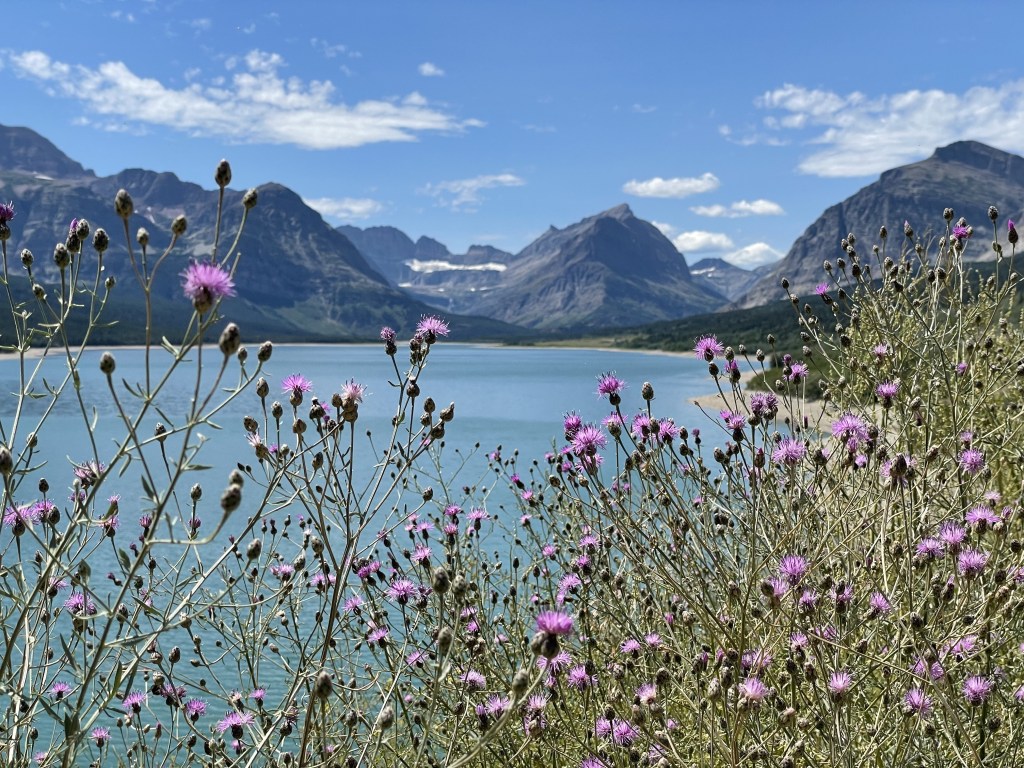
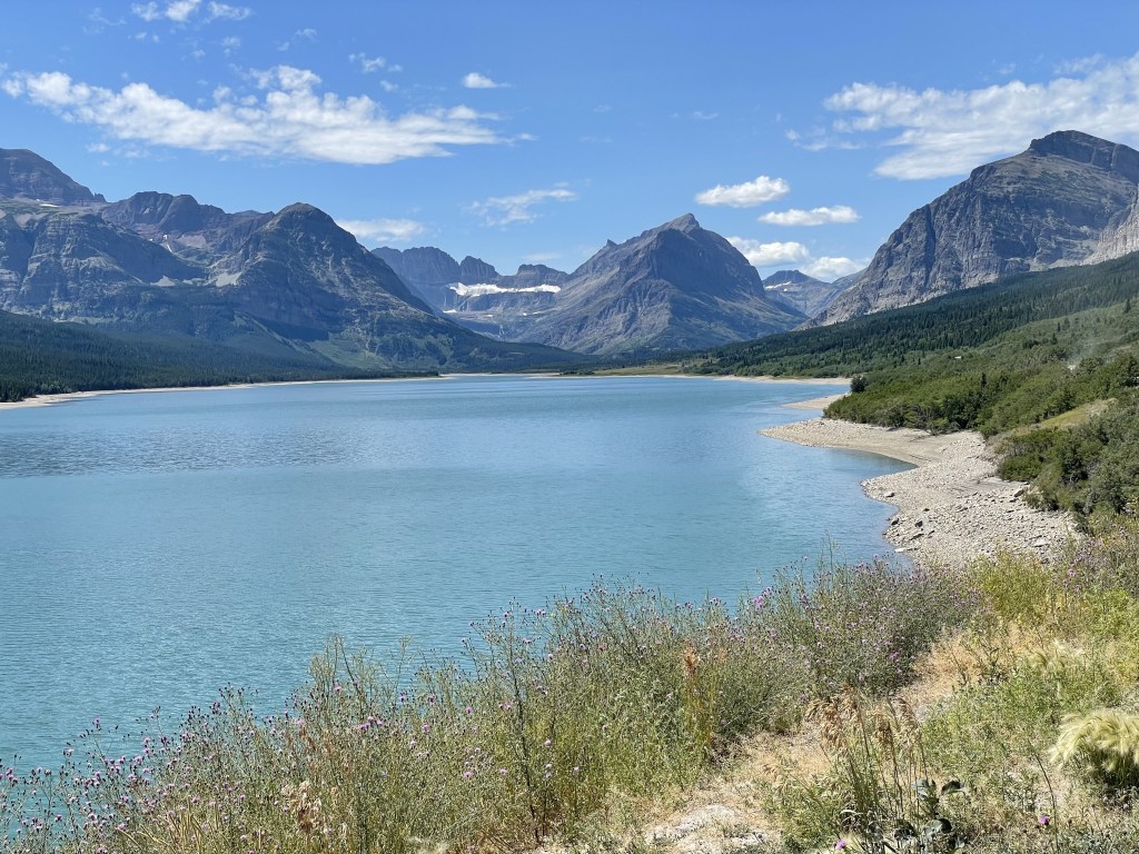
Rising Sun + Saint Mary area (central east)
This area on the eastern side of the park is popular for many of the same reasons as the Apgar area. These lakes provide beautiful views and opportunities for floating out on the water for an hour or an afternoon.
Services: Rising Sun Camp Store, Rising Sun Restaurant, Rising Sun Boat Ramp, St. Mary Visitor Center, St. Mary Ranger Station, 1913 Ranger Station, East Route Park Shuttle, Fueling Station (immediately outside the park boundary)
Attractions include (but are not limited to): Saint Mary Lake, St. Mary Falls, Virginia Falls, Goat Lake, Wild Goose Island Overlook, Golden Staircase Overlook, Sunrift Gorge, Two Dog Flats (prairies), Beaver Pond
Trailheads: Beaver Pond Loop, Rose Creek, Otokomi Lake, Rising Sun (Boat Ramp to Picnic Area), Sun Point, Piegan Pass, Baring Creek, Baring Falls, St. Mary Falls, Gunsight Pass
Linked here are some options for day-hiking in the St. Mary/Logan Pass areas.
Two Medicine area (southeast)
Two Medicine is the closest area to the community of East Glacier Park. It is accessible from the town by road as well as by hiking trail. This area may be slightly less crowded due to being further away from most of the park’s major areas. No shuttle operates in this region and it can only be reached by personal vehicle or on foot.
Services: Two Medicine General Store (includes some food options and coffee), Two Medicine Boat Launch (watercraft rentals and boat tours available), Two Medicine Ranger Station, additional non-park services are located about 14 miles east in the city of East Glacier Park
Attractions include (but are not limited to): Two Medicine Lakes (Upper, Middle, + Lower), Running Eagle Falls and Natural Bridge, Pray Lake, No Name Lake, Cobalt Lake
Trailheads: Autumn Creek East (from East Glacier), Mt. Henry (TH in East Glacier connects to TH near Two Medicine), Dry Fork (near Two Medicine entrance), Running Eagle Falls, Pray Lake, Two Medicine South Shore
Linked here are some options for day-hiking in the Two Medicine area.
Essex area (central south)
If you are unable to land a permit for Going-to-the-Sun Road, you can drive around the southernmost tip of the park to get to the other side. Most visitors don’t spend any time here, but there are some pullouts, camping spots, and trailheads for anyone interested. Drive slow and enjoy the ride. The overlooks are always worth the quick pitstop if you have the time.
Services: Walton Ranger Station
Attractions include (but are not limited to): Goat Lick Overlook, Scalplock Mountain Fire Lookout, Silver Staircase Waterfall, Maria’s Pass Obelisk
Trailheads: Coal Creek, Walton, Fielding/Coal Creek, Autumn Creek West, Summit, Lubec
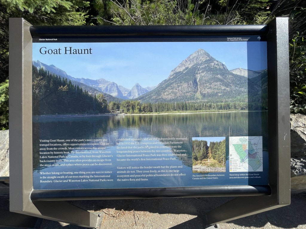
Polebridge + Goat Haunt area (north)
Polebridge sits in the northwest corner of the park and is primarily visited in the summer and early fall. It is one of the more remote areas of the park and has two access points (Polebridge is furthest north and Camas Creek is nearer to Lake McDonald). The north region is fantastic for animal watching and getting a little extra solitude as there aren’t any major developed campgrounds and only minimal guest services. This is a great destination for backpacking in the warmer seasons and snowshoe related activities during the wintertime.
The Goat Haunt area is located in the center of the park’s border with Canada and is only accessible by hiking trails as well as by boat from Waterton Lakes National Park of Canada. Chief Mountain Highway cuts through the northeast corner of the park and leads into the park’s Canadian sibling.
Services: Polebridge Ranger Station, Logging Ranger Station, Bowman Ranger Station, Kintla Ranger Station, Goat Haunt Ranger Station, Belly River Ranger Station
Attractions include (but are not limited to): Quartz Creek, Winona Lake, Hidden Meadows, Logging Creek, Bowman Lake, Akokala Lake, Numa Fire Lookout, Bowman Lake, Kintla Lake, Goat Haunt Lake, Waterton Lake, Porcupine Fire Lookout, Slide Lake, Cosley Lake, Glenns Lake, Elizabeth Lake, Helen Lake, and lots of smaller glaciers (Old Sun, Ahern, Chaney, and Shepard, just to name a few)
Trailheads: Dutch Creek, Logging Lake, Quartz Creek, Hidden Meadows, Bowman Lake, Quartz Lake Loop, Akokala Creek, Kishenehn South, Boulder Pass, Lee Ridge, Chief Mountain, Waterton Lake, Slide Lake, Boundary (on Canadian border)
Linked here are some options for day-hiking in the North Fork/Goat Haunt areas.
Canadian border + Waterton Lakes National Park (at north boundary)
In the southwestern corner of the Alberta Canadian province is a sibling of Glacier National Park. You will be required to present your passport at the border if you are driving across the border on Chief Mountain Road, which is only accessible during the summer season until about mid-fall, or until the first major winter storm occurs. *It is illegal to cross the border via any hiking trail without acquiring a permit in advance.*
The Prince of Wales Hotel and Waterton Lake are a couple famous landmarks in this region.
*I will update these sections ^ as I return to visit the various regions and/or hear about any official park updates.*

Backpacking and longer hikes around Glacier
There are three spots that are ideal for backpacker access from Amtrak train stations, which is the only local public transportation available in the region:
- From West Glacier Park, it is about a 2.5-mile walk to reach the Apgar Visitor Center (where you can catch a shuttle to the interior of the park, if necessary). There are many trailheads you will be able to reach in this region.
- The train station in East Glacier Park is about 14 miles down the road from the Two Medicine park entrance. However, choosing this option does not require a long road walk or sticking your thumb out for a hitch, although those are always viable options. The Autumn Creek East TH (heads south towards Essex) and Mt. Henry TH (heads north towards Two Medicine) are both access points along the Continental Divide Trail which lead into the park.
- The train station in Essex sits almost exactly at the park boundary, and accessing the trailhead is basically as simple as crossing the road and river to the park’s Walton Ranger Station which sits at a trailhead that connects with the web of trails that runs through the part.
Many trails connect the different regions of the park to each other. You can choose your own adventure and map it out to reach whichever attractions you feel drawn to. Wilderness permits are required for camping in the backcountry and can either be obtained in person at the Apgar Backcountry Permit Office, or in advance by reservations using the park’s Recreation.gov web page. You are required to obtain these prior to your adventure.
Linked here is the park’s hiking trail conditions page which can be a useful tool for planning your route and where you would like to camp during your adventure. This may also be helpful for day hikes.
Store any food and other scented items in an animal-proof container. It is important that you take proper precautions when it comes to the wildlife as you are at risk of having your lunch stolen by a variety of animals, as well as being dinner for others. It is useful to know how to handle wildlife encounters before they happen.
There are plenty of natural water sources inside the park and filtering it before consumption is recommended (…but this is probably some of the purest water around, and in an emergency you would *probably* be fine without doing so).
Other activities
Whitewater rafting and the more calm “scenic floats” are available from these park-approved concessioners. If you are participating in any of these raft tours, you will be spending around $80-150 per person, depending on type and length of the journey.
If you hate getting wet and/or are visiting on a tighter budget, the park does have boat rides available in the major regions from the park-approved concessioner Glacier Park Boat Company. Lake McDonald, St. Mary, Many Glacier, and Two Medicine all have offerings that will take you on a ride around the lake. The company also offers watercraft rentals (like boats, canoes, and kayaks). St. Mary area does not offer rentals.
Go fishing. Glacier is a really popular park for this, and to my understanding you are not required to have a license nor a permit unless you are taking out a private boat. Check in advance to see the rules and regulations regarding exactly which bodies of water you can fish in and which fish you are allowed to keep versus which ones you are required to release.
Going horseback riding is a popular activity in the Many Glacier and Lake McDonald/Apgar areas from the park-approved Swan Mountain Outfitters. These tours only operate during the summer and cost from $100-400 per person, depending on tour length. They also offer packing services for those who want to camp in the backcountry but can’t or don’t want to carry their own equipment. Private stock is also allowed, but you are responsible for knowing the rules and regulations before your trip, such as which trails you are allowed to use.
Cross country skiing and snowshoeing are popular activities in the wintertime. You will get to witness the park blanketed in snow, and avoid the crowds! Conditions will vary, and every year is different. Check out the NPS website page linked above to find out where exactly you can wander and any additional information you might need to know ahead of your trip.
Glacier Park Red Bus Tours have guided tours that have several pick up and drop off points on both the east and west sides. While the tours are pricy, the experiences do have a good reputation.
Check in at the visitor centers or this page on the NPS website regarding ranger-led tours. They offer a variety of options such as guided hikes and ranger talks that will provide you with context concerning the different components of the park.
For anyone interested in the indigenous history of this region of the Americas, just outside the eastern boundary of the park less than an hour’s drive to the east is the Museum of the Plains Indian in the city of Browning.
Other things you should know before visiting
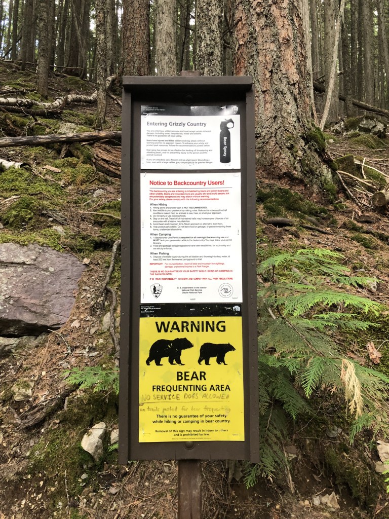
BE BEAR AWARE! They will *probably* not bother you personally, but they may try to take your food. Follow the park’s recommendations as to how you can protect yourself and the wildlife. This is a very popular destination for bear sightings.
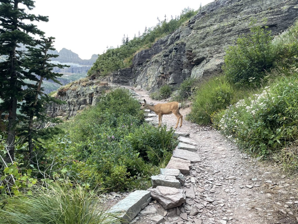
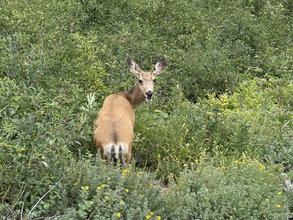
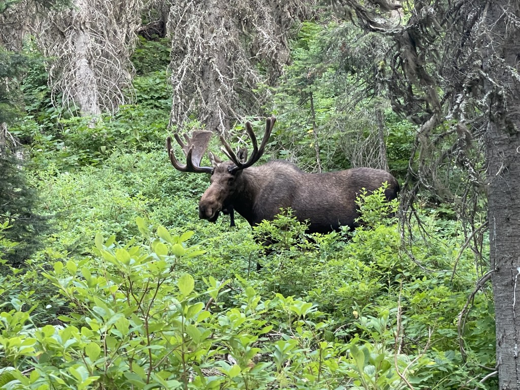
Elk, moose, and other large animal encounters are also common around here. Please, let them live their lives in peace, do not try to feed them and DO NOT approach them for any reason!!! They will charge at you if they feel threatened, I have watched tourists try to get the perfect photo with an elk only to be chased by one instead. Other animals like squirrels and marmots also hang out around here, and should be treated the same. Leave them alone, use zoom and take your photos from a distance. Animals are most active around the hours of sunrise and sunset. It is also important to be alert and watch for wildlife while driving and follow the speed limits, especially after the sun goes down. Keep nature wild.
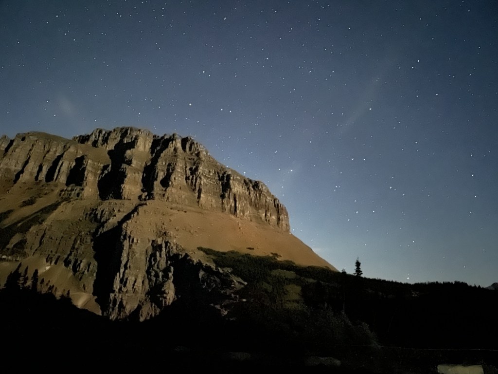
The timed-entry system does not effect astro-enthusiasts who would like to get into the park after hours to stargaze, and although extremely rare, there are occasionally opportunities to catch glimpses of the Northern Lights (forecast from University of Alaska Fairbanks linked here). Forecasts are not always accurate, much like how they are with the regular weather forecast.
Overcrowding is a real possibility and may unfortunately force you to adjust your plans during peak season, so it is very important to have a back-up plan and to remain flexible. Linked here are some tips from the NPS for how you can handle it. I would suggest starting before sunrise, or going at the very beginning or end of the open season.
Other nearby destinations you can add onto a longer road trip
This park is tucked up so far away from everything else, getting to many other destinations is going to have you in your car for hours. Montana is a massive state and there is a lot to do, it’s just all far apart. Here are some other destination ideas you can add onto a longer road trip, depending which direction you came from or are heading to next:
- SOUTH of Apgar: Yellowstone National Park (about 8 hours), Bozeman and Lewis & Clark Caverns State Park (both are about 5 hours), Flathead Lake (about 45 minutes)
- WEST of Apgar: North Cascades National Park, Washington (about 9 hours), pitstop either in one of the Idaho Panhandle National Forests OR Spokane, Washington (both are about 5 hours)
- EAST of the 3 east entrances: Upper Missouri River Breaks National Monument (east) and Billings (southeast), both are about 6.5 hours
- NORTH of the Canadian border: Waterton National Park of Canada (just over an hour), Banff National Park of Canada (about 5 hours), and Jasper National Park of Canada (about 7 hours), *must cross border into Canada, passport required!*
My thoughts
All I can really say is, WOW. There is a reason this place is so popular. It doesn’t surprise me at all why people rave about it, as well as why it gets crowded in the way that it does. Driving through the park alone is incredible but traveling by foot is one of the best ways to experience most of it (if you have the means to).
Writing this post took me a lot longer than I thought it would because there is so much here. I learned about a lot of spots during the research phase of creating this post that I now would like to check out. The view from the Scalplock Mountain Fire Lookout hike in the Essex region looks stunning (about 10 miles round-trip) and is on my list for next time, along with several others.
Have you visited Glacier National Park before? What was your favorite area? Or favorite hiking trail? Did you see a moose or a bear? Let me know in the comments below!
Happy traveling! 😊
(And always remember to follow #leavenotrace principles!)
💜


Leave a comment