
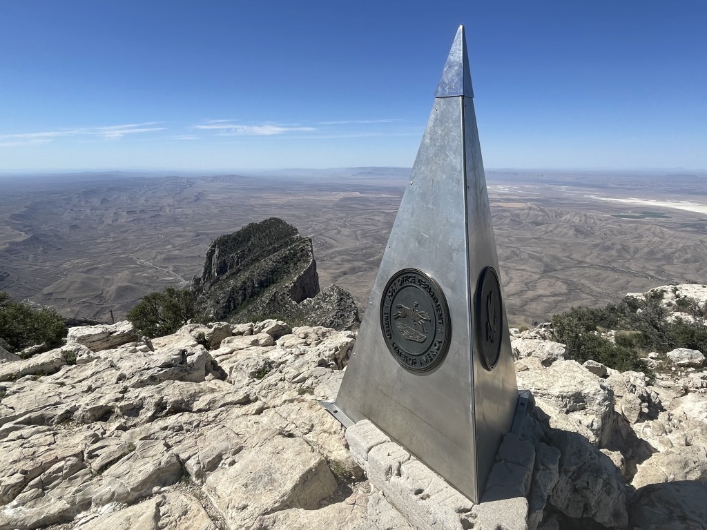
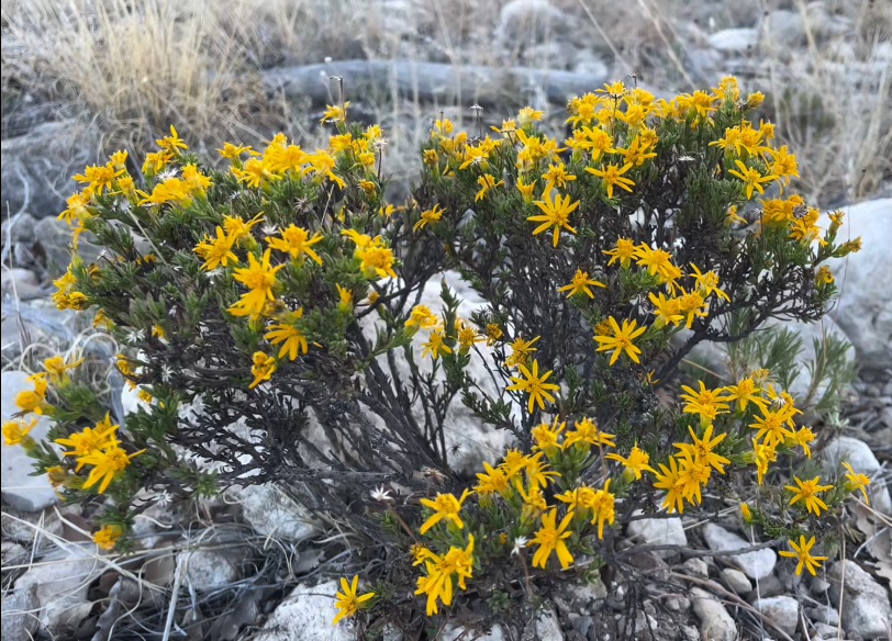
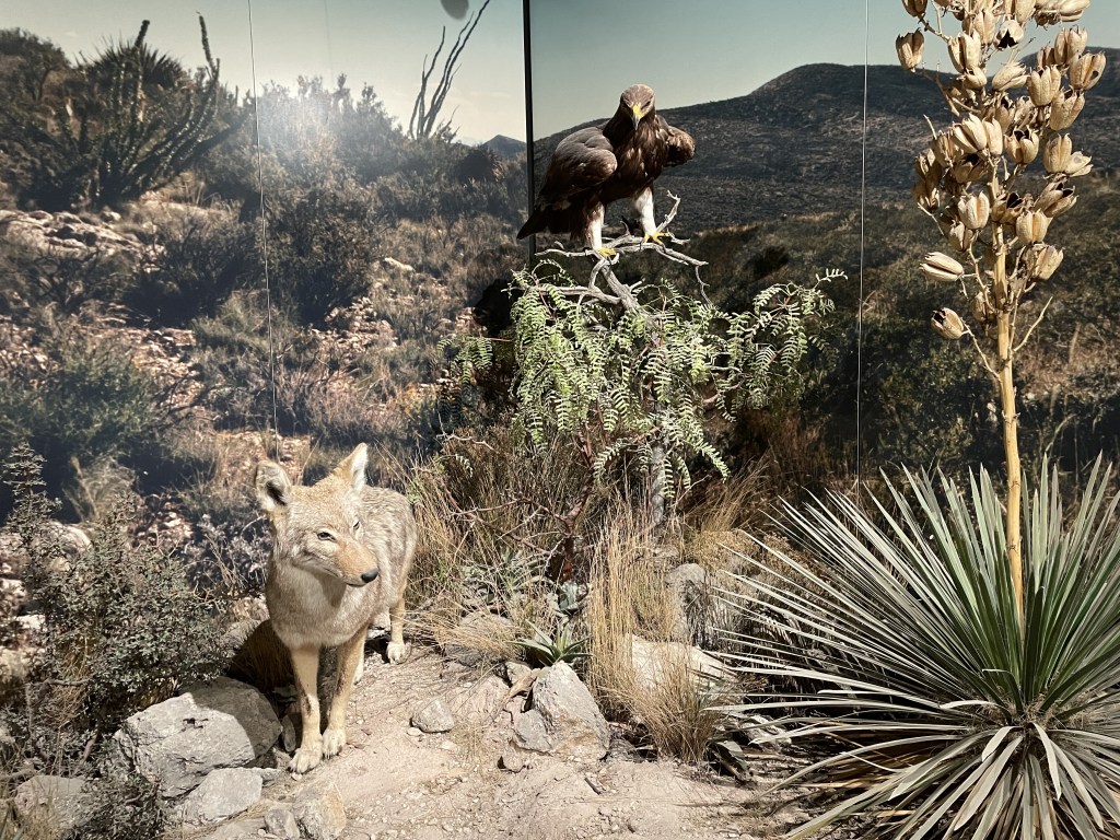
They say everything is bigger in Texas, and their highest peak is right here in this park. Sitting at an estimated 8751 feet above sea level, Guadalupe Peak may not be the biggest of all-time, but it certainly does not disappoint with its incredible sweeping views of the endless desert below. This mountain range spans across southern New Mexico and ends here at the edge of the state border in Texas. Remains of several old ranches and other structures are preserved from the early western settlers who eventually pushed out the Mescalero Apaches that survived off this land before them but were not successful in competing with them for resources. People were able to thrive here despite the desert heat with the help of a few small natural springs and a diverse ecosystem. The mountains support a wide variety of flora and fauna at the different elevations, which include species like bears, bobcats, and mountain lions.
Guadalupe Mountains National Park is one of the least visited national parks, nearly in the bottom 10 in terms of annual visitation. It is very hot in the summer (because desert) and the park is primarily enjoyed by hiking lovers during the spring and fall seasons. There are trails of varying difficulty all over the park, and backpacking is very popular.
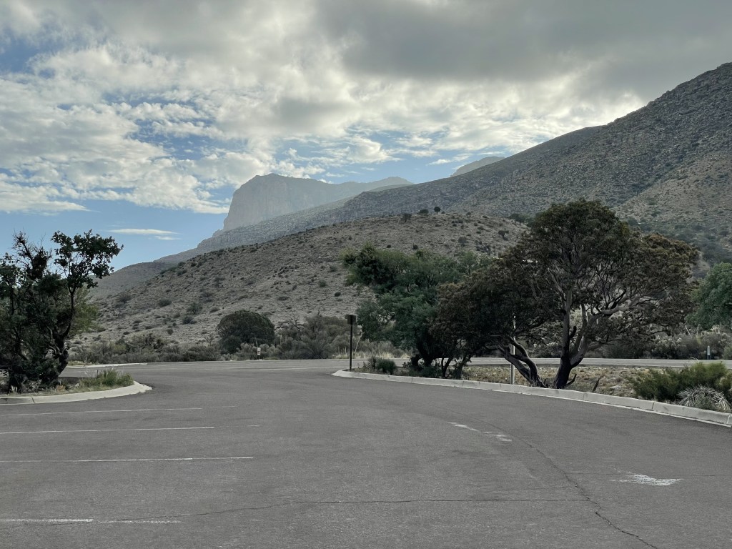
The Pine Springs region is home to the park’s largest visitor center, a small gift shop, a campground, and many major trailheads. This area is very remote and services are limited. Other regions within the park have similar but fewer services.
Reception is pretty spotty out here; however, you can typically get a signal around Pine Springs and Frijole Ranch. Wifi is also available at the Pine Springs Visitor Center and Dog Canyon Ranger Station. Carrying a park map (offered complimentary at any of the visitor centers) is recommended. If you go without a specific plan, head to any visitor center during operating hours and talk to a park ranger about your options. They are there to help you make your adventure the best they can, but be mindful as to not take up too much of their time so they can do their jobs and help other people, too!
When to go and how long
The Texas desert is hot and dry, and this place is no exception. With that said, hikers will find that the weather in the mountains can be a bit cooler as you increase in elevation.
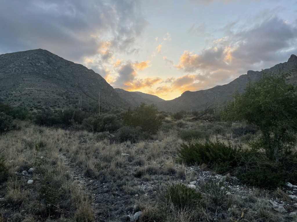
Summers are HOT, and rangers told me this place is practically empty for several months, and rain is common. Spring and fall are apparently the best and have more mild weather. Everything is green and lush in the springtime, and during the fall the park sees golden foliage in some regions. Winters are windy, and snow and ice at high elevations is common.
A few days in the region would be great for those who enjoy hiking. For those wanting only to see the outlooks and stop at the museums, a day would be plenty.
Where to stay
Nearby cities include:
- Carlsbad, New Mexico (1-hour drive to the northeast)
- Roswell, New Mexico (2-hour drive to the northeast) *regional airport
- Van Horn, Texas (1-hour drive to the south)
- El Paso, Texas (2-hour drive to the west) *nearest international airport
There are 2 major campgrounds inside the park: Dog Canyon (13 total sites, primitive) and Pine Springs (35 total sites, mostly primitive)
There is also a separate equestrian campground for individuals visiting with horses or stock animals: Frijole Horse Corral
Carlsbad, New Mexico is the closest major city and is about 50 minutes drive northeast of the Pine Springs region of the park, or a 1.5 hour drive from the Dog Canyon area, which is a more remote part of the park.
White’s City, New Mexico has one inn and an RV park, and is 30 minutes from the Pine Springs area at the entrance to Carlsbad Caverns National Park.
How to get around
You will need a personal vehicle to explore this national park, as there is absolutely no public transportation in this region and nothing is offered by the park either. It doesn’t really get enough visitation to warrant that. Make sure you have enough gas in your tank, the closest fueling station is in White’s City.
U.S. Highway 62 runs along the park’s eastern boundary and up to Carlsbad. The Dog Canyon area is on the other side of the park and is most easily accessed from the north by Queens Highway (NM 137 North). The Salt Dunes are also on the other side but are accessible from the 62 using East Williams Road and Ranch Road 1576.
Once you’re there, you’re probably hiking. This park is perfect for that. There are a handful of really good shorter and longer day hikes for individuals wanting to explore the area up close, and many of the trails web together so it could potentially be turned into a backpacking trip. For those interested in options for backpacking through the Guadalupe Mountains, the NPS offers some sample itineraries here.
Horseback is also an option, but not all trails are approved for this type of travel. Know where you are allowed to trek before you go.
I couldn’t find any useful information about biking on the Guadalupe Mountains NPS website which leads me to believe they aren’t allowed on the trails. You could potentially road-bike up and down the highways, although it might be a little sketchy. I have seen bikers out there before on the main roads.


Food and money
There is no food available for sale anywhere inside the park, and the closest restaurant is the one outside the park entrance of Carlsbad Caverns in White’s City which is about 30 minutes away. It is recommended that you bring all your own meals and snacks regardless of the duration of your adventure. The closest cities would be Carlsbad, New Mexico and Van Horn, Texas, which are both about 1 hour drive from the Pine Springs visitor center.
Restaurants and food prices in this region are nothing out of the ordinary for a city.
Camping prices inside the park are average. There are plenty of other options that range from free camping in the backcountry to somewhat pricy, depending what kind of adventure you are having and whether or not you need amenities like bathrooms or RV hookups.
Lodging prices in the nearby cities seem to be mostly average. There are cheap motels as well as nice hotels, and you get what you pay for.
What to do
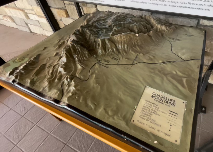
There are five major regions of the park:
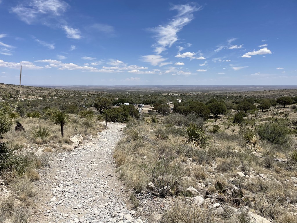
Start here: The PINE SPRINGS area is the most frequented and it is also home to the park’s largest visitor center and a small gift shop. The Pinery Trail begins at the visitor center and is mostly flat. It brings visitors to some ruins and offers views of the incredible mountain peaks as a backdrop. This popular trail takes about 20-30 minutes and is the only trail in the park you can walk with your pet.
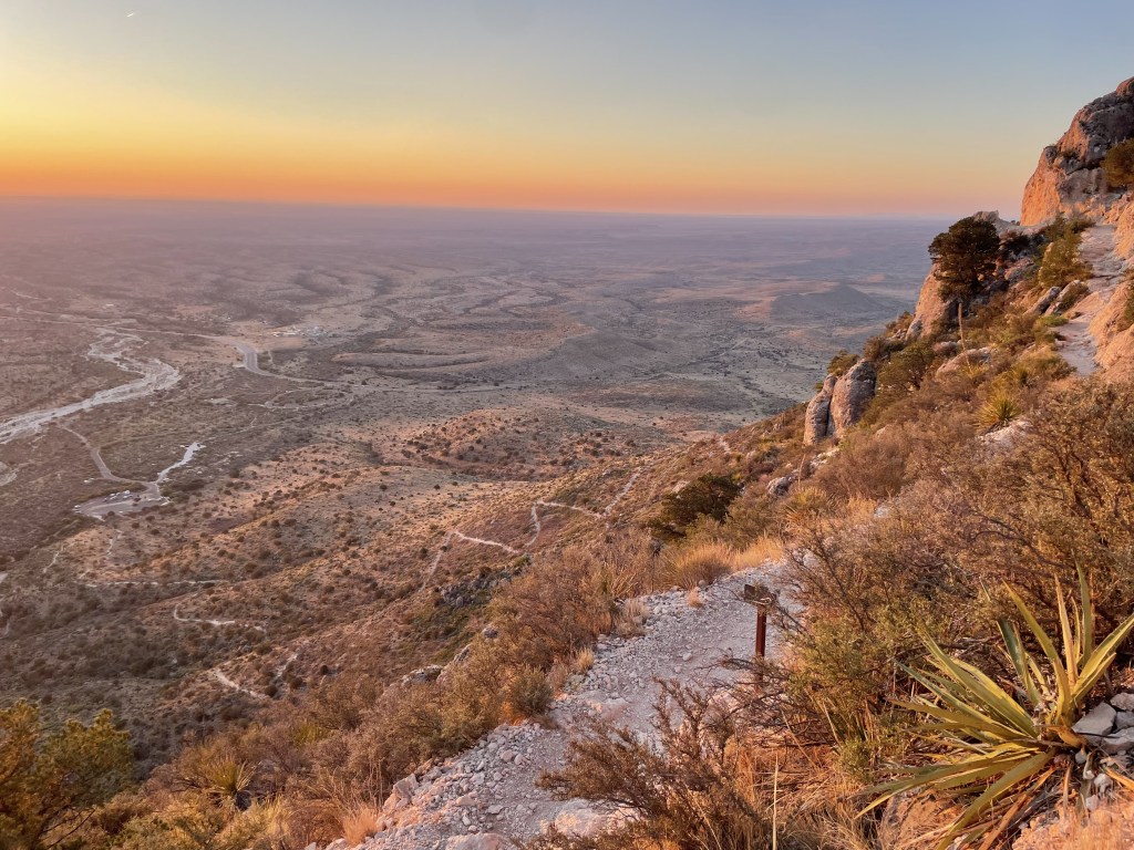
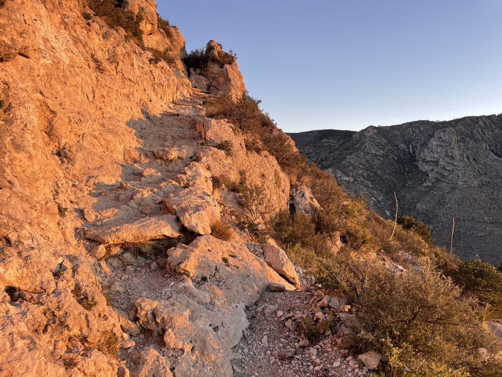
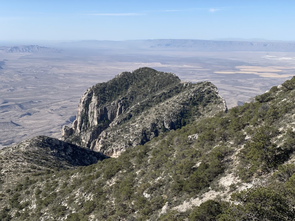
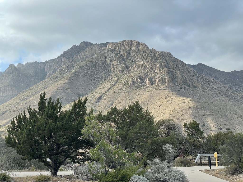
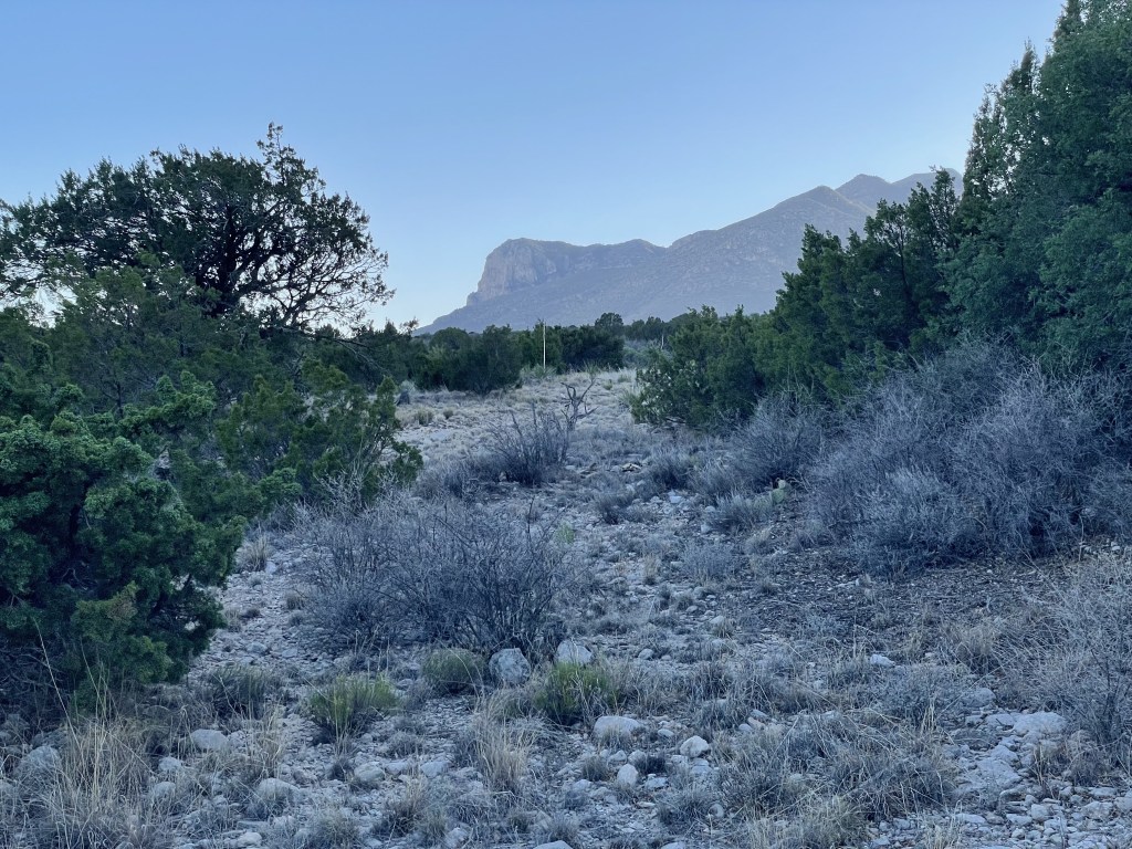
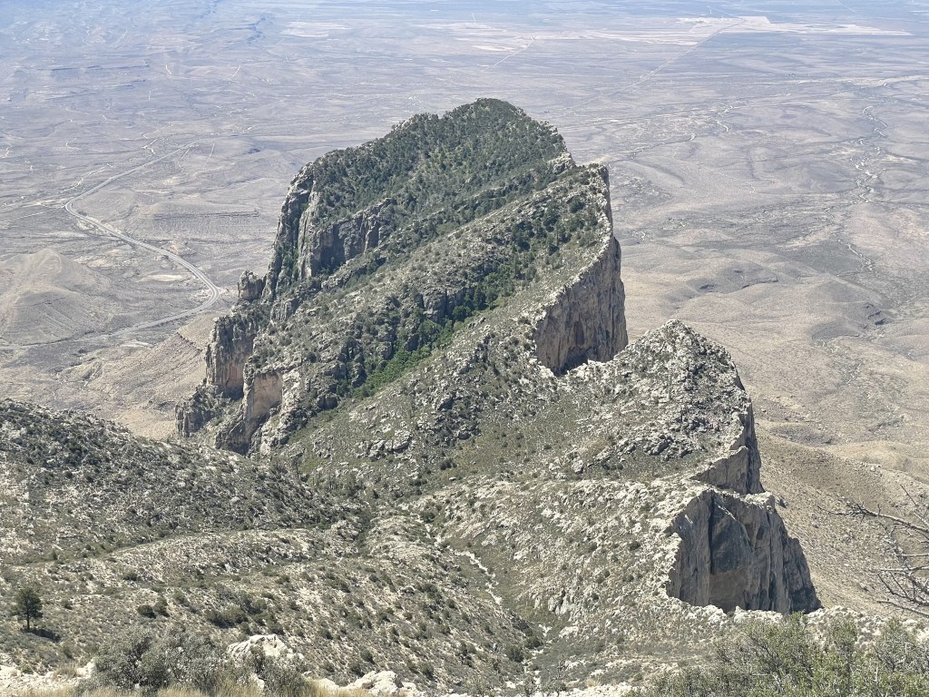
From just past the visitor center at the Pine Springs campground is the trailhead that you can take up to Guadalupe Peak (about 4 miles one-way), the most famous attraction in the park and the highest point in the state of Texas, as well as Devil’s Hall (about 2 miles one-way). From here you can also access another longer trail that loops around the base of El Capitan, a monumentally cool looking rock you may drive past if you are ever coming or going through the southernmost tip of the park, which also connects to the old Williams Ranch.
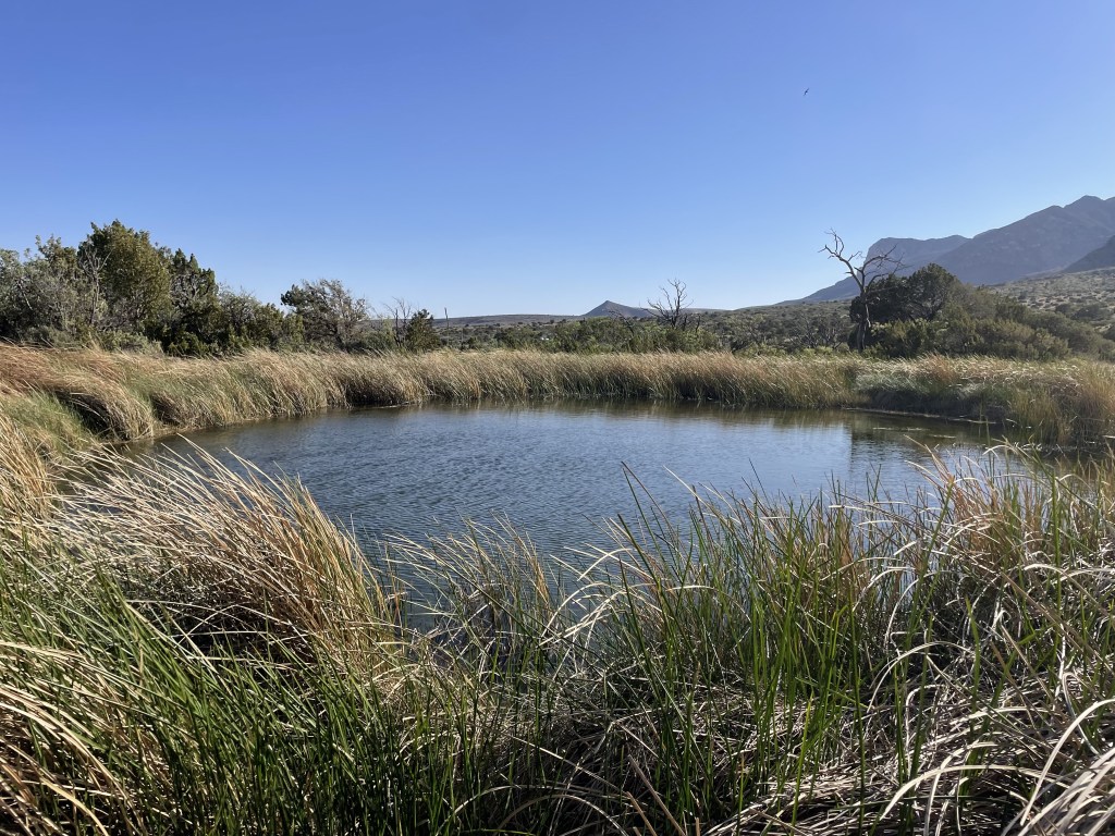
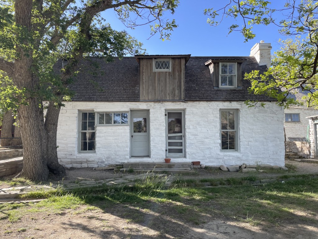
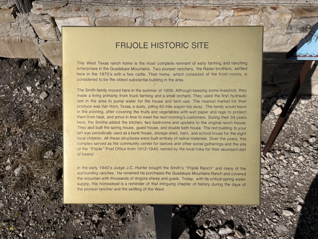
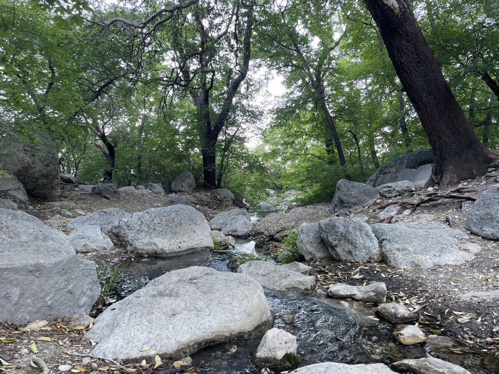
A few minutes up the road on U.S. Highway 62 is the FRIJOLE RANCH area, where you will have to briefly drive on a well-maintained dirt road to get to the parking area. Visitors can then walk less than 5 minutes on a mostly paved and flat trail to get to the Frijole Ranch Museum from the parking area. There is also a loop trail (about 3 miles) to get to two natural springs (Spring and Manzanita) from which the ranch was able to thrive. A few other trailheads here provide access to longer trails that reach other areas of the park and connect to the Pine Springs and McKittrick Canyon areas.
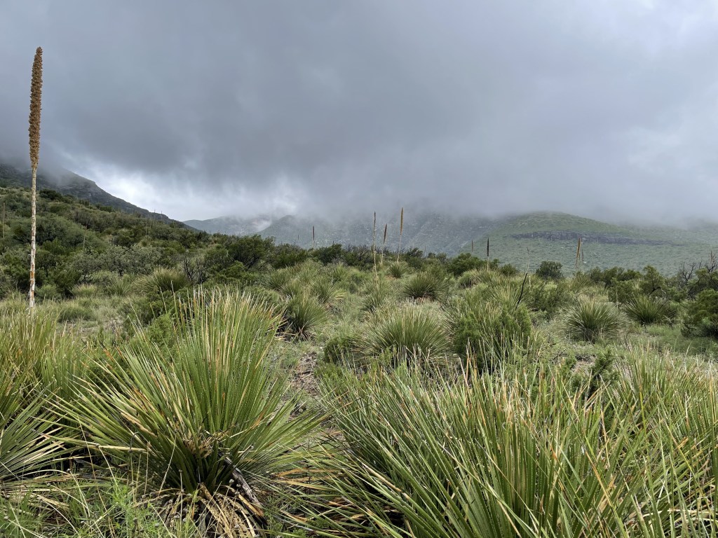
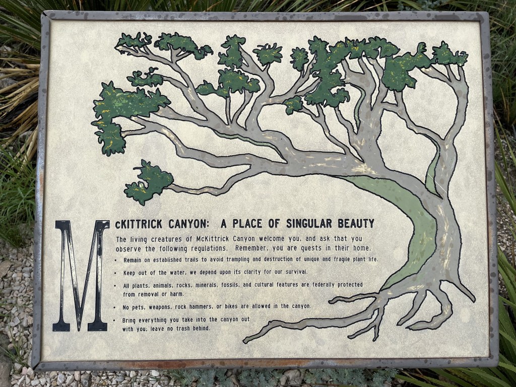
About 5 additional minutes up the road is the MCKITTRICK CANYON area. Once you turn off the U.S. Highway 62, it is a 10-minute drive down another maintained dirt road to access. There is another, smaller visitor welcome center here, only offering basic information and restrooms, and more hiking trails. The two rangers I spoke with both highly recommended this area. I have only been here when it is overcast. Hiking access leads up to McKittrick Ridge, which includes some of the other highest peaks in the park and is supposed to be another one of the most difficult (and rewarding) hikes in the state of Texas. Apparently this area is absolutely beautiful in the fall when the foliage changes color. The hiking trails in this region are generally longer and more difficult, but I hear it’s worth the extra effort.
DOG CANYON is over an hour away from everything and seems to be similar to the McKittrick Canyon area. There is only a ranger station and a campground in this region of the park. Again, these hikes are longer and more strenuous, and may offer some really nice fall foliage, and water is available at the campground. This area is very remote and recommended for those who enjoy solitude and off-grid camping. Trails here also connect to McKittrick Ridge.
The southern part of the park consists of SALT BASIN DUNES. The salt basin and sand dunes are pretty far away from everything else in the park. The main trailhead for the salt basin overlook isn’t currently accessible due to construction (there is nowhere to park along the busy highway), but if this still interests you, it can be reached from the El Capitan trailhead in Pine Springs. The Salt Basin Dune trail is one of the only ways to see the dunes at this time and it takes about an hour to drive to the trailhead from the Pine Springs area. The 2-mile one-way walk to the dunes is mostly flat through sandy terrain and the road to get there is said to be rough (but still accessible with a regular passenger vehicle). Although there are many sand dunes in this region of North America, these ones are especially unique due to the backdrop of the beautiful El Capitan, and came highly recommended as a sunset destination as it appears to glow when the sun goes down.
Other stuff you might want to know about the park
Trekking poles may improve your hiking experience. Not only do they assist with your balance, but it also helps to distribute the work your body has to do (your upper half can alleviate some of the work your legs have to do).
Apparently this is a good place for bird watching, if you’re into that.
There are a lot of different animals that call this place home. Be aware of your surroundings and do not approach the wildlife. Know how to handle animal encounters before you go out there.
Having a cat or dog with you will limit your opportunities during your visit as they are basically not allowed anywhere other than paved surfaces. Check the park’s rules here for all information regarding pets and service animals here. Visitors do also have the option to take advantage of the kennel services available at the Carlsbad Caverns visitor center about 45 minutes drive north up the U.S. Highway 62.
My thoughts
Guadalupe Peak was one of the coolest hikes I’ve done in this region of the country. From up there, El Capitan (the big peak/cliff in the front) looked like the state of Michigan and now I can’t unsee it. The walk up was mostly a consistently gradual grade and the views were spectacular the entire time; and despite being out in the middle of the desert, some of it was even shaded. I also really enjoyed the walk to the Smith Spring. The trail was easier coming/going from the east side, and sitting around listening to the creek crackling by was extremely soothing. This park does a good job maintaining their trails.
This is a more remote destination, and it’s probably not a good place to visit for individuals who aren’t interested in hiking, which is definitely the most popular activity here. I absolutely loved it. I look forward to returning at some point during the fall because I heard a lot of good things about the foliage in the McKittrick and Dog Canyon areas.
Have you been to Guadalupe Mountains National Park before? Did you have a favorite hike? What would you consider to be a must-see? Let me know in the comments below!
Happy traveling! 😊
(And always remember to follow #leavenotrace principles!)
💚


Leave a comment