
The Trans-Catalina Trail, often also referred to as the Catalina Backbone Trail, is a beautifully strenuous 38.5 mile multi-day hiking trail that traverses across the entirety of Santa Catalina Island. As you soak up the sun and breath in the whimsical sea breeze, you will wander past private coves, and maybe even a bison (or a whole herd of them!). Once owned by the Wrigley family (the bubble gum people), this island is now primarily under the ownership of the Catalina Island Conservancy, a trust that was established to protect the land and ensure its access for generations to come.
The Channel Islands archipelago consists of 8 total islands. Five of them are protected by the National Park Service (my post on Channel Islands National Park is linked here). The other 3 are excluded for different reasons: San Clemente and San Nicolas Islands are still owned and used by the US Navy (they tested bombs and trained troops on the islands during WWII), and lastly, Santa Catalina Island is a popular tourist destination known for its resident herd of bison who ended up here as a result of a silent film in the mid-1920’s, although it is unclear exactly which film that was.
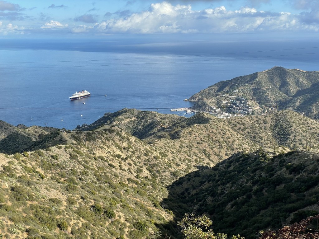
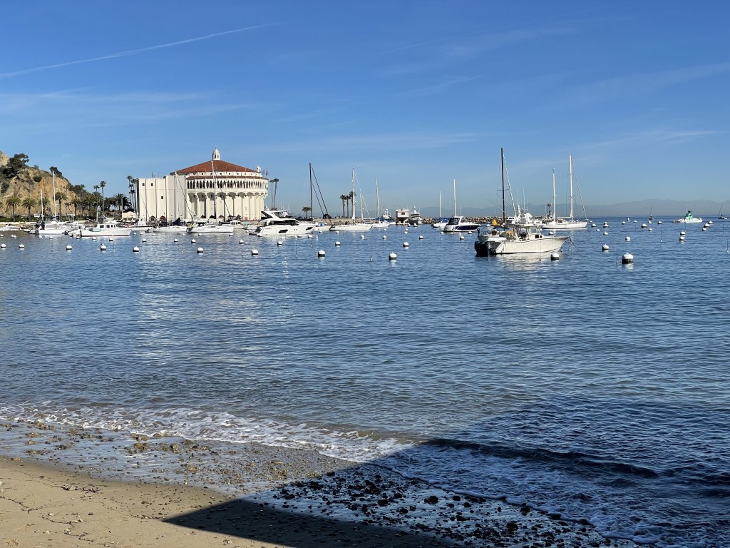
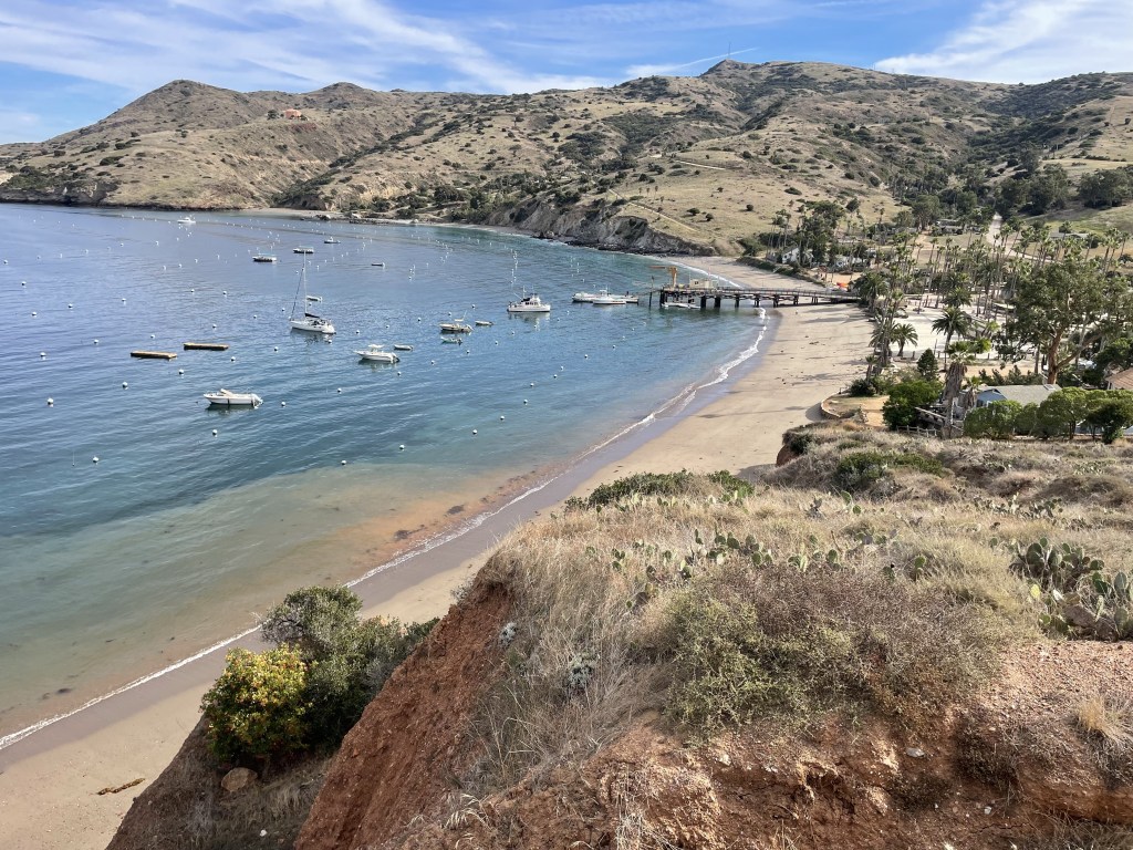
Santa Catalina Island has two notable communities: Avalon and Two Harbors. Avalon is a major city with lots of hotels, shopping, and restaurants, and Two Harbors is much smaller with minimal services available. The TCT begins from Avalon Harbor and walks along the ridgeline, or backbone, of the island for about 26 miles until it reaches Two Harbors. At Two Harbors, the trail has an additional 13-mile loop that includes an intense climb up another ridge and down into the private cove at Parson’s Landing, then back to the harbor along the northeastern facing cliffs.
Reception is not great on the island likely because it’s out in the middle of the ocean; however, you can typically get a signal from the higher elevated spots on the trail and from the city areas. Bringing a map with you is recommended, as there are some forks in the road where it is unclear which direction you need to take. Downloading the map on your phone using your favorite outdoor app may significantly help you as well, as this is what I typically do when I’m hiking a new trail.
When to go and how long
The greatest thing about the TCT is that you can pretty much hike this trail at any point during the year and it will be enjoyable. Because of the “mediterranean” weather patterns, temperatures are mild and generally fluctuate in the winter with highs reaching 60 F and lows around 40 F (~15.5/4.5 C). Summer days are generally around 75/80 F (~25 C), but it can get much warmer, and nights cool down to the 50s F (10 C). It sure feels a lot hotter up on that ridgeline when the sun is directly above you in the middle of the day. Fall and spring land somewhere in between. It remains breezy year-round, but it is significantly more windy during the cooler times of the year.
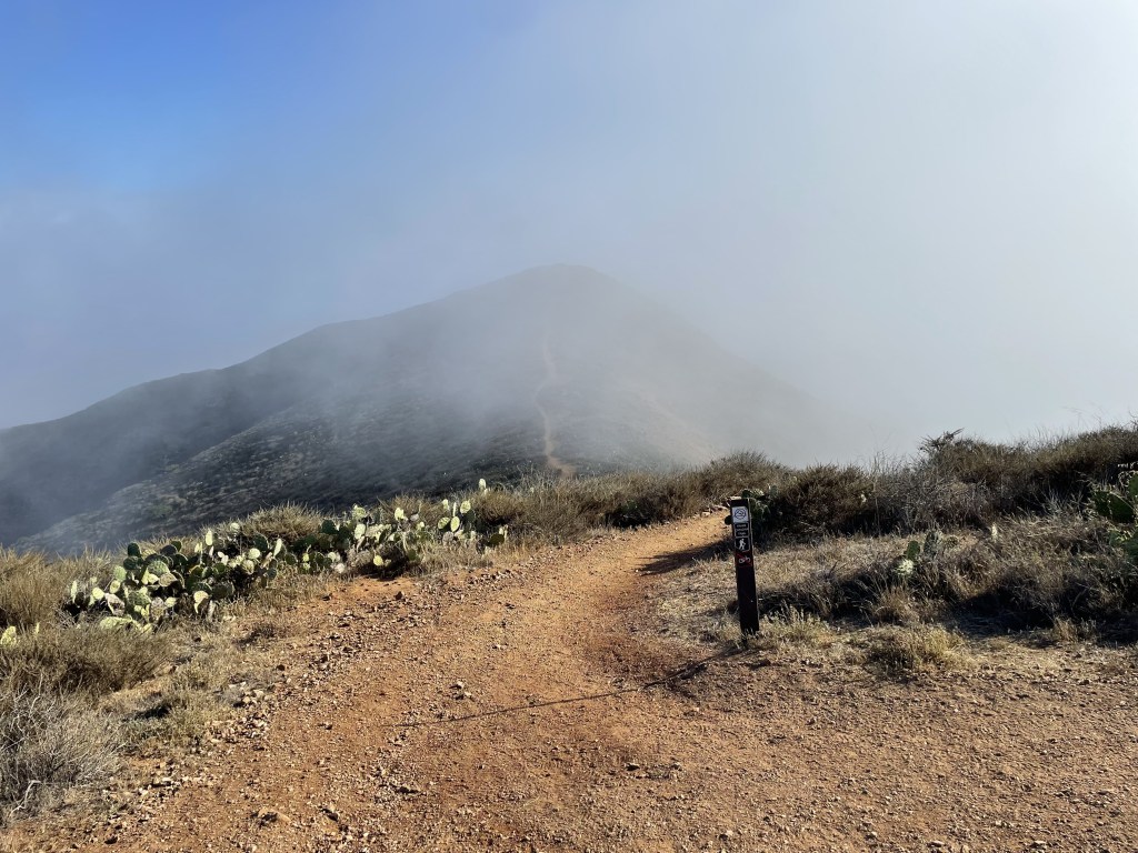
The hills are covered in lush green meadows in the spring, beginning from late winter through early summer, then turn to brown and stay that way for the rest of the year into the next rainy season. There are lots of colorful little wildflowers all over the place in spring/summer. Harsh winds result in the island being pretty dry for the majority of the year, but the severity varies by season, being more extreme in the cold months. Fog is common year round, especially in the mornings until the marine layer burns off.
There are very few trees on this island and you will be fully exposed to the sun for the majority of the trail. Pack a hat and sunscreen especially if you are planning to make the trek in the summertime, and never underestimate the benefits of a sun umbrella (iykyk).
Always check the weather before you go!
People usually hike the TCT in 3 to 5 days, depending on their experience and skill level. A 3-day hike would require hiking an average of 13 miles per day, a 4-day hike would be an average of about 10 miles per day, and a 5-day hike would be an average of about 7 miles per day. However, as a hiker, your journey will be limited by the campsite locations as you can only camp in the designated campgrounds, so every day will require different mileage.

Where to stay
You may not camp on the island without advance reservations, which simultaneously exist as your permit to hike the TCT. There are a total of 5 campgrounds at the following mile markers:
- Mile 1.5: Hermit Gulch Campground
- Mile 10.7: Blackjack Campground
- Mile 18.9: Little Harbor/Shark Harbor
- Mile 24.2: Two Harbors
- Mile 30.8: Parsons Landing
- Mile 38.5: Two Harbors (again)
In the city of Avalon, there are dozens of hotels you can stay at. Unless you are hiking during summer season, you probably wouldn’t have any trouble walking in to a hotel and getting a room on the spot. Reservations are recommended.
Two Harbors has limited options, offering only a couple hotels for guests. Availability is limited and making reservations in advance is highly recommended.

How to get to and from the trail
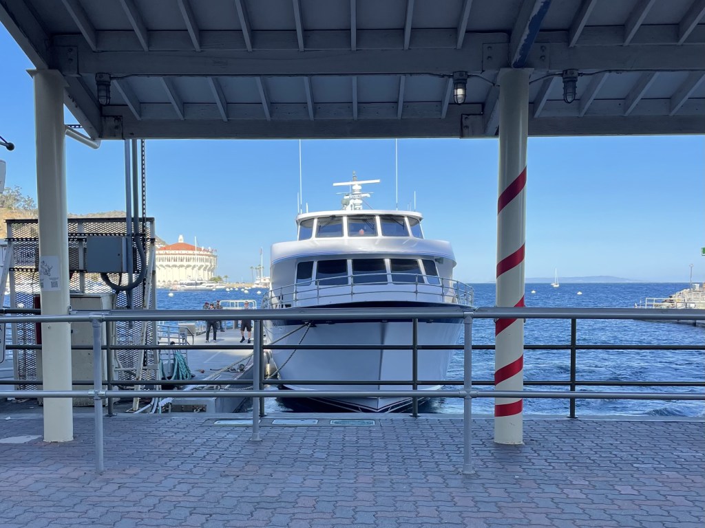
The Catalina Express is the public ferry that runs to and from the island. It does not run every day (depends on the season), so it is important to refer back to their website to make sure it runs on the day you are planning to go. Check the schedule here.
From either the port in Long Beach or San Pedro, California, travelers can choose to arrive to/depart from both Avalon and Two Harbors. There is also a port in San Diego at Dana Point and another in Newport Beach that have offerings to Avalon only. Ticket prices vary depending on traveler age and departure location. Open ended tickets are issued but it might save you a few bucks $ to book your return ticket at the same time. There is no additional charge for carrying your backpacking gear with you if it is your only bag. Overnight and multi-day parking is available at the ports for a fee.
There is another ferry provider that brings passengers between Avalon and Newport only. The Catalina Flyer page on schedules and fares is linked here.
Once you arrive on the island, the TCT basically begins and ends directly at the shoreline where you arrive at the pier. There is no public transportation on the island and everything in the city areas is walkable. You do also have the option to rent a golf cart and drive around for a day in Avalon. Most residents don’t drive cars and golf carts are the preferred method of transportation around town. To my understanding, many roads outside the city are not open to the public (and are only open to locals and island rangers or tours and other staff).
Food and money
This is a rather pricy destination all-around, and definitely one of the more expensive backpacking trips you can take. Every aspect of the trip costs money: parking at the mainland ports, the ferry to the island, each individual campsite reservation, and any purchased meals (optional). Hotels are also on the expensive side if you are planning to stay for an extra night to relax on the island during the warmer seasons.
The pricing of the campsites is somewhat outrageous. Going with a group of people doesn’t save you any money, as when you make your campsite reservations, you have to enter the number of people staying there and the charges are per person, not per site, as it also exists as your individual permits. Most sites can accommodate up to 8 people.
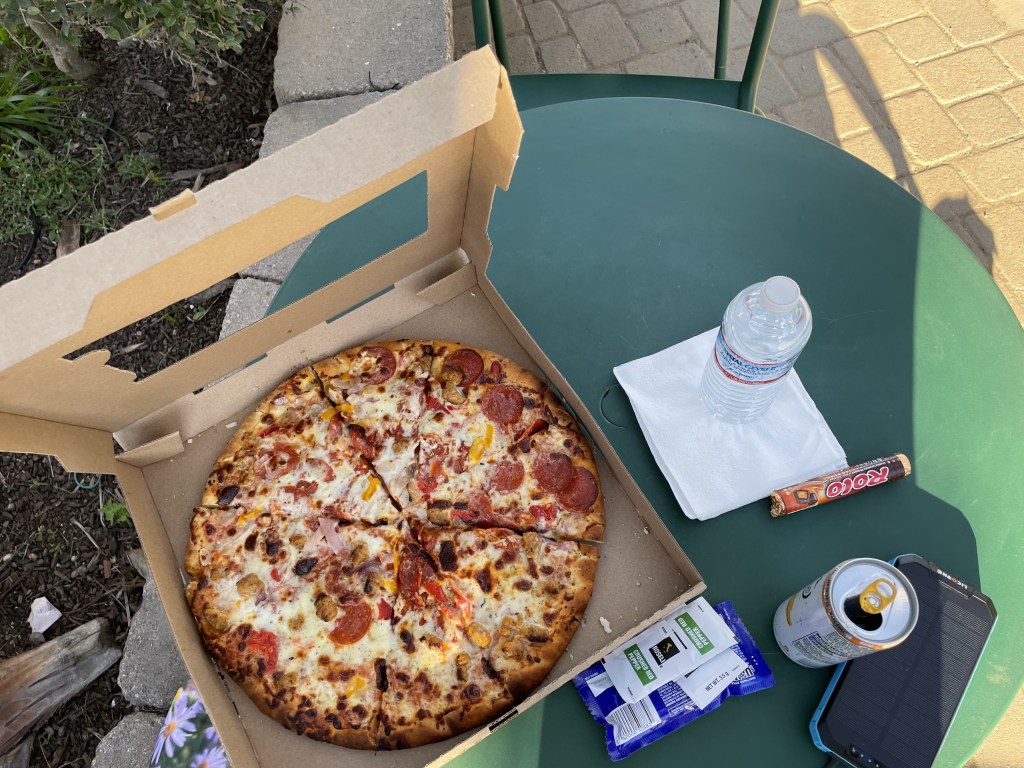
Because you are backpacking, it is customary to bring all your food with you already, BUT there are several opportunities to buy your meals on the island if you choose:
- Avalon (mile 0): dozens of restaurants and grocery stores, prices vary, but expect to spend slightly more than you would pay on the mainland
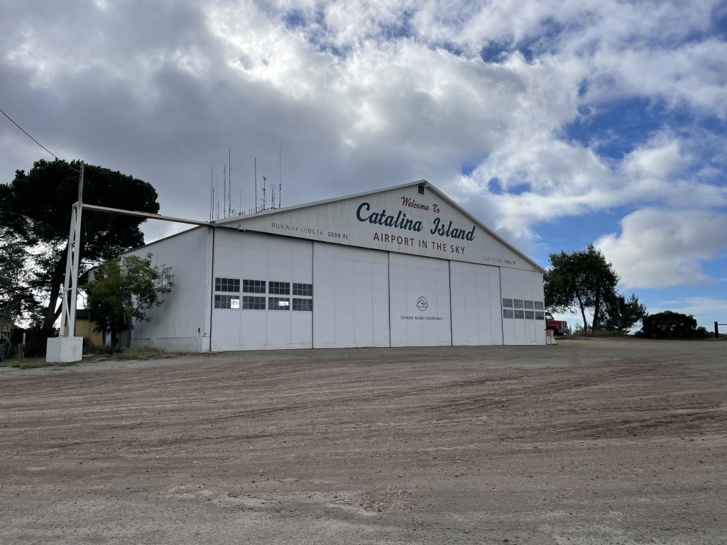
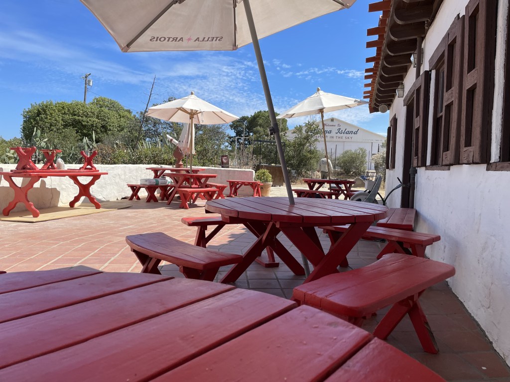
- Airport in the Sky Restaurant (mile 12.75): full restaurant service and a small gift shop, prices are as high as you are up here
- Two Harbors (mile 24.2 and mile 38.5): small general store has some food options available and a microwave for cooking items (if necessary), they also sell full-size pizzas, there is also one restaurant with limited operating hours, expect to spend slightly more than you would pay on the mainland
The locations of these restaurants also technically make it possible to buy all your meals and not pack any food at all depending how you break up your hike. The choice is yours!
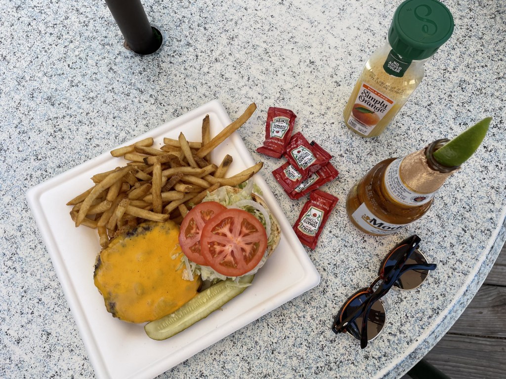
Bison burgers and seafood dishes are popular.
Overnight parking at Long Beach Harbor is about $25/day and San Pedro Harbor is $20/day.

Trail breakdown, by section
(NOTE: "mm" stands for "mile marker")*Avalon (mm 0) to Blackjack (mm 10.7)*
The trail begins in the city streets of Avalon. You will walk in the road alongside the locals golf carts until you reach the Hermit Gulch Campground, which sits at about 1.5 miles into the trail. This campground is the most developed of all the campgrounds on the island, with restrooms and showers, and is close enough in proximity to the city of Avalon that it is possible to explore the area while you camp here. Staying at this campground is a good option for individuals completing the trail in reverse or for those who prefer a full day to tackle the climb up to Blackjack (instead of embarking in the late morning/early afternoon after your arrival by ferry). To my understanding, dogs are not allowed at this camping area.
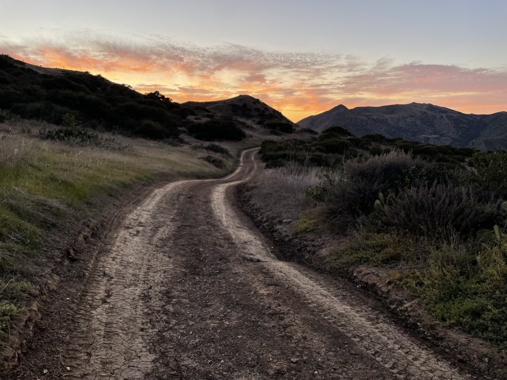
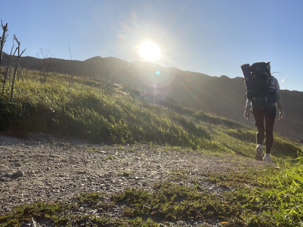
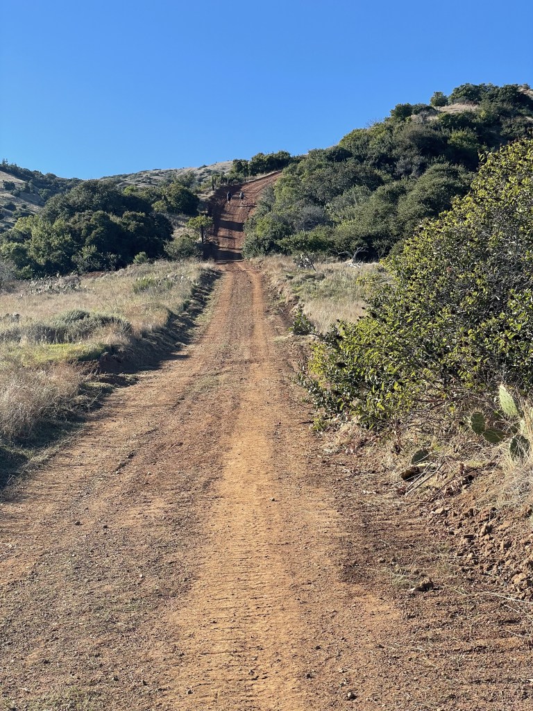
Your hiking journey begins by taking you up onto the ridgeline, or backbone, of the island which fluctuates between 1200 feet and 1600 feet above sea level.
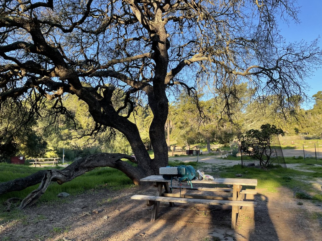
Haypress Recreation Area is a small picnic area with restrooms and water available about 5.6 miles into the hike. There is no camping allowed here, but it is a nice spot to break after your ascent out of Avalon, or if you are going in reverse, a fantastic spot to break before your final descent.
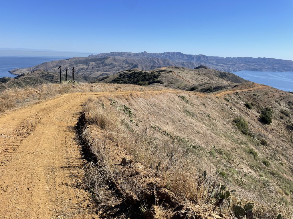
The trail fluctuates between regular hiking trails and road walking along well-maintained dirt roads once you reach the ridge.
I had cell reception for the majority of this section, including at the Blackjack campground.
Optional side quest: If you manage to reach the campground with time to spare, you can summit the tallest peak on the island by embarking on a journey up to the top of Mount Orizaba. The round-trip adventure will add about 3 miles to your day.


*Blackjack (mm 10.7) to Little Harbor/Shark Harbor (mm 18.9)*
This section brings you down about 1600 feet of elevation back to sea level.
The Airport in the Sky resides at mile 12.75 on the TCT. Here you can take a long break and enjoy a hot breakfast or lunch from their restaurant menu. Check the operating hours before you go to make sure you pace yourself accordingly so you can get there in time! From Blackjack it is about 2 miles of steep ups and downs before you arrive, and if you are doing the trail in reverse it is a tough and exposed 6 miles uphill from Little Harbor. Be sure to check out the information regarding the area’s history at the museum-like displays, wander around the airport’s gift shop, and spend a few minutes watching the planes take off. This is one of the highest points on the island, which is probably how this place got its name. You cannot camp here, but in the event of an emergency it is possible to find transportation back to Avalon.
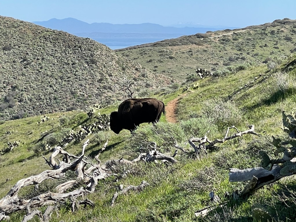
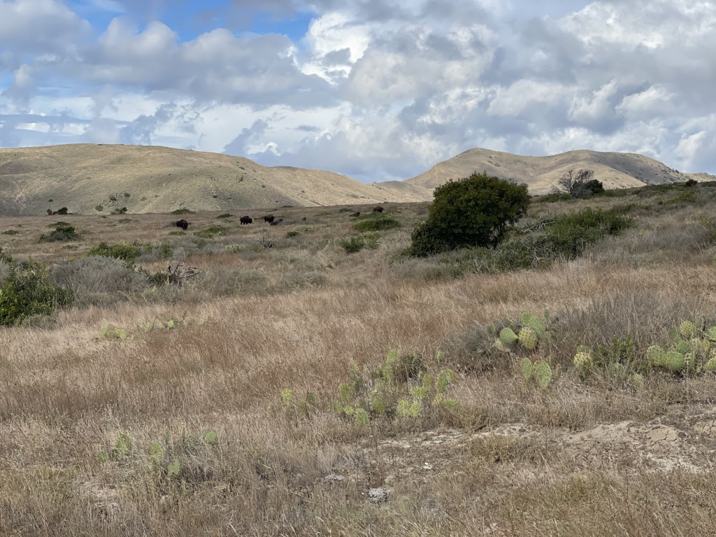
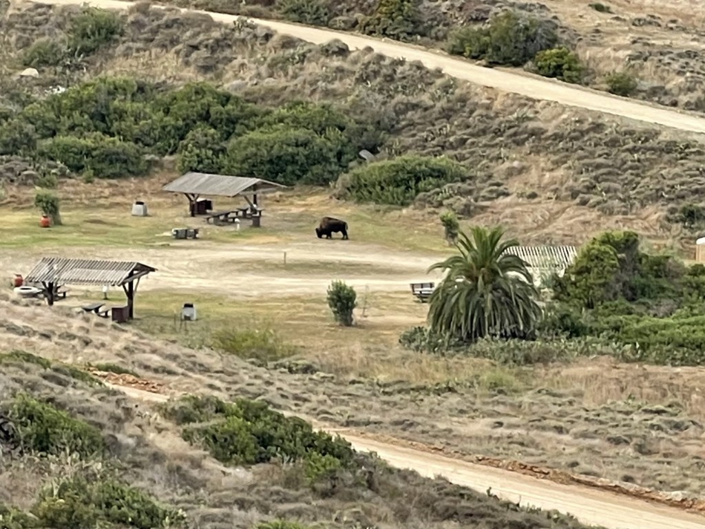
Between the airport and Little Harbor is the only area where I have seen bison. They seem to hang around the Little Harbor area the most, but to my understanding they are able to freely range the majority of this part of the island.
I had cell reception for most of this section, but it was weak in some areas and there was some places I had nothing. Reception was nonexistent at the Little Harbor campground, but I was able to find it relatively quickly after climbing out of the beach cove area.


*Little Harbor/Shark Harbor (mm 18.9) to Two Harbors (mm 24.2)*
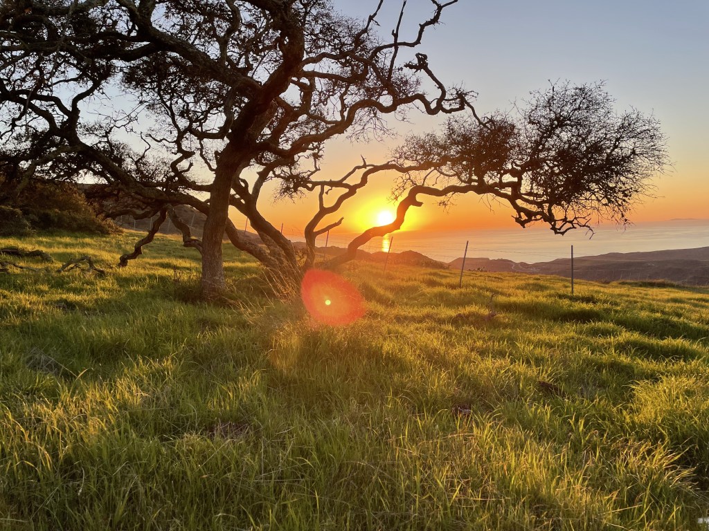
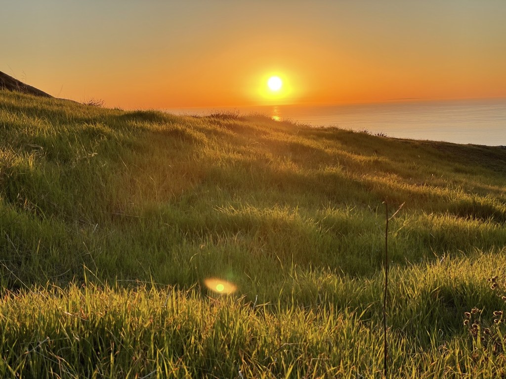
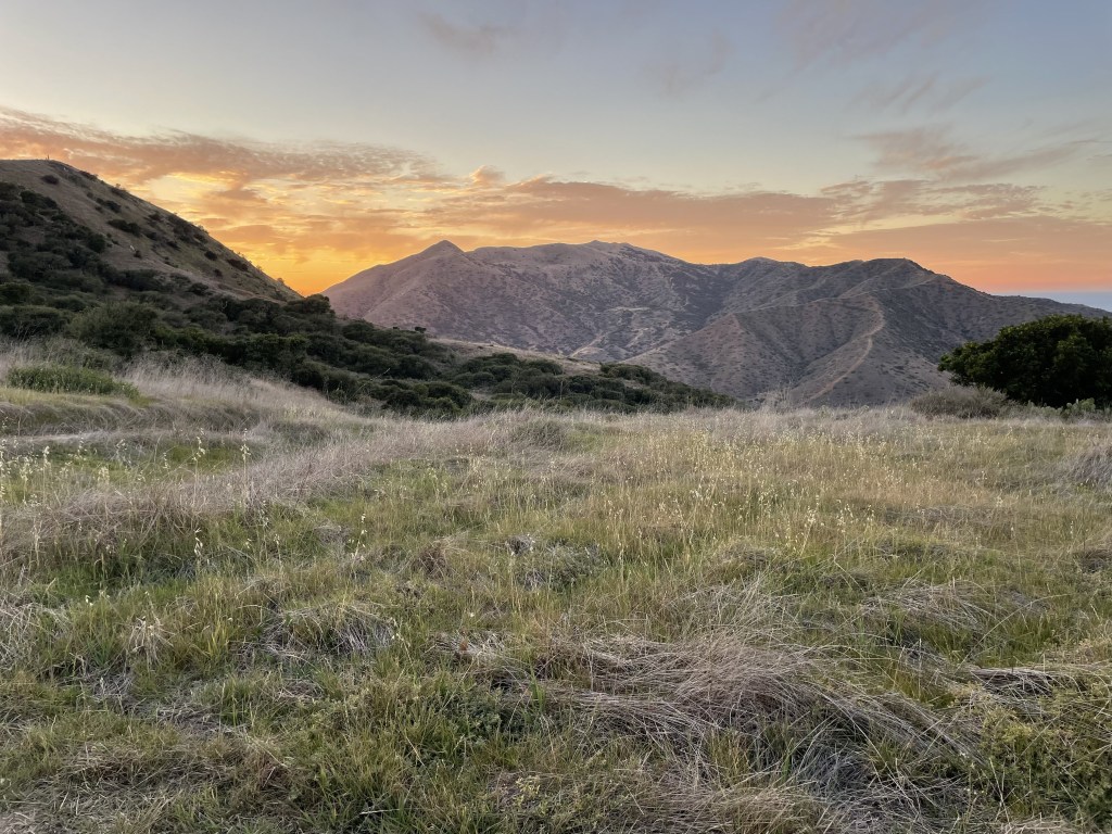
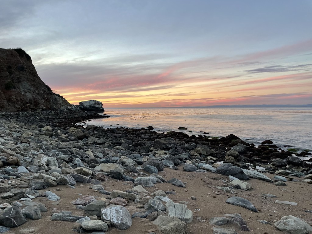
This section includes about 1200ft of elevation change (from harbor at sea level to the highest point, and back down to sea level) and offers some of the most beautiful views of the northern coastline. Up at a higher elevation on this section of trail is a great place to be for sunset because you have sweeping views of the ocean looking west. This is a challenging climb but the next one is tougher.
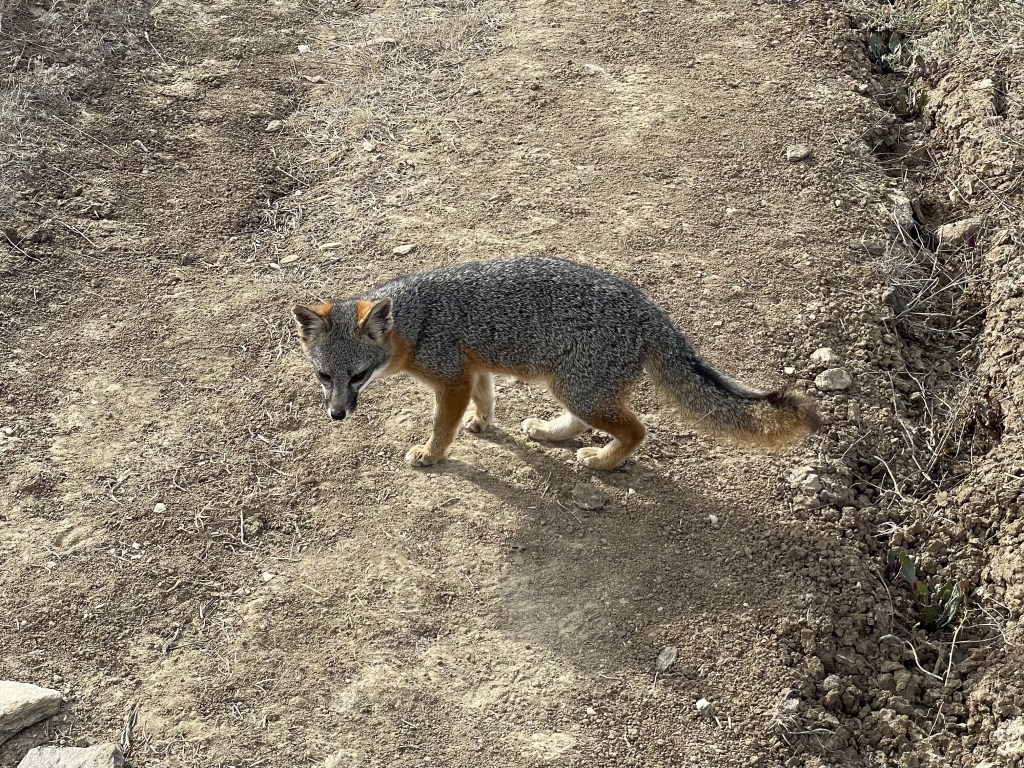
I have not personally seen bison here, but I have seen their tracks. In all my expeditions to the island, this is where I have seen the most island foxes.
I had cell phone reception often in this section, although it was weak in some parts and it did cut out in some areas occasionally. Two Harbors has good signal.
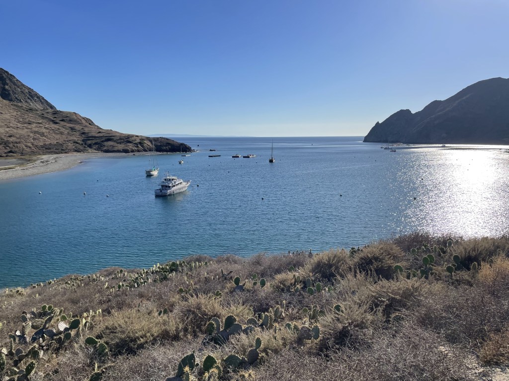
The campground at Two Harbors is developed much like the one in Avalon and is a short walk from the main part of town. In Two Harbors, there are a couple restaurants with limited hours and a general store that has everything from groceries to basic camping equipment, and a microwave you can use to cook anything you buy in the store.
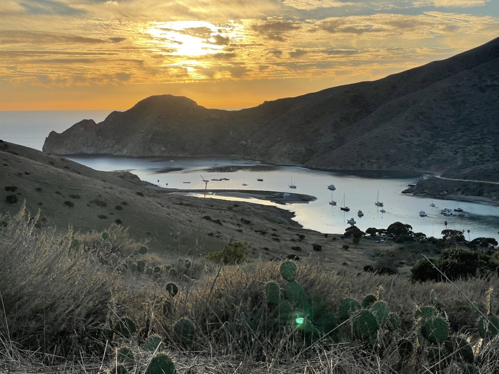
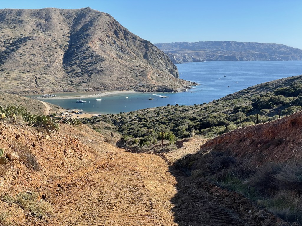
*Two Harbors (mm 24.2) to Parsons Landing (mm 30.8)*
Whether you’re doing the trail in the intended direction or in reverse, this is probably the most difficult section of the entire 38.5 mile journey. You will climb up nearly 1800ft in less than 3 miles. The terrain is steep and the sun will be beating down on you as there is no escaping the direct sunlight. Once you reach the high point from either end, there is a shaded picnic table you can take a break at and enjoy the views from up on the ridge. Take your time, drink lots of water, and break when you need to.
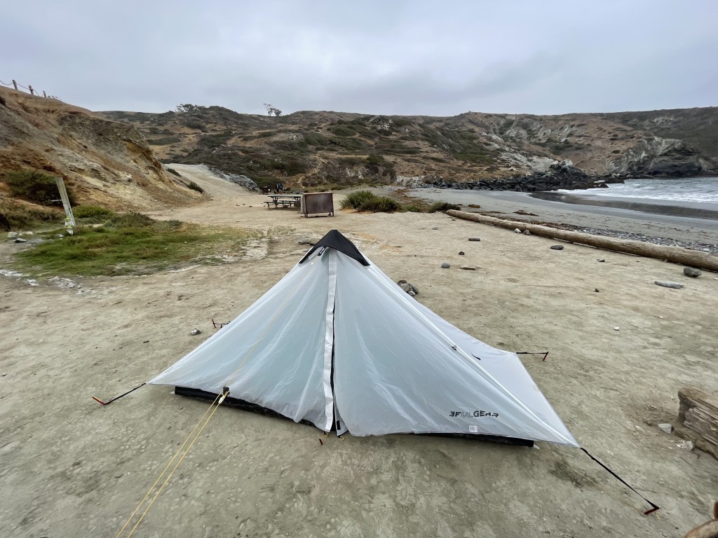
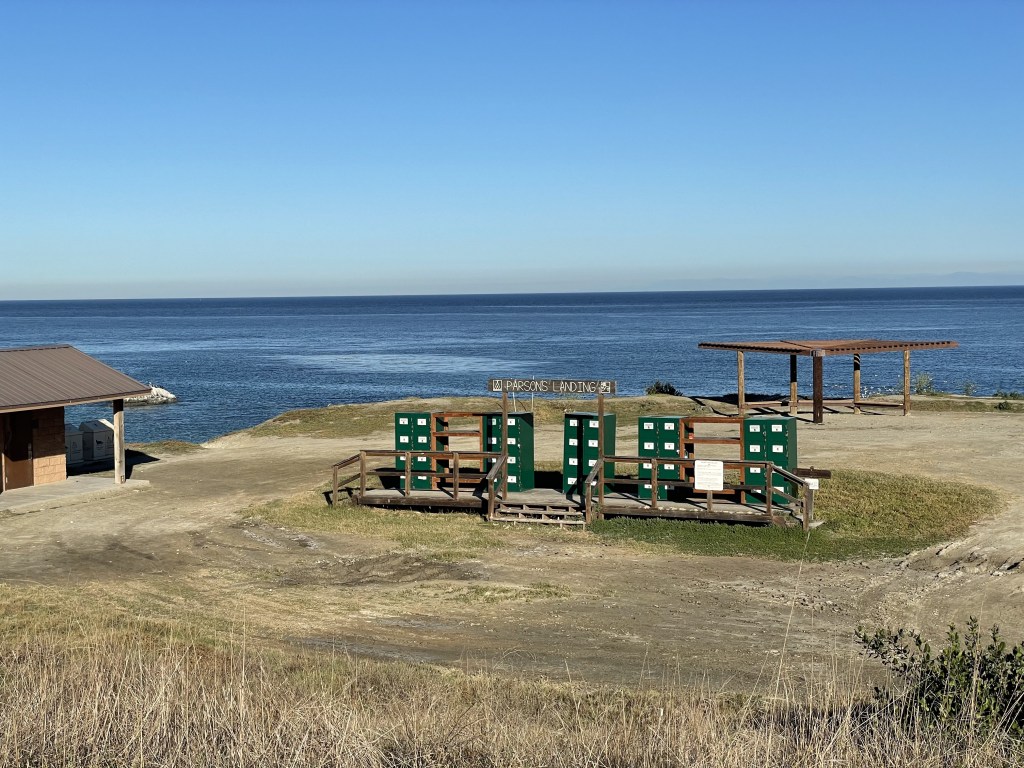
The Parsons Landing Campground is one of the most remote campgrounds on the trek, and it is extremely competitive and difficult to get a reservation here. With that said, it is also one of the most secluded and gorgeous places on the island to spend an evening. There is no water available and you must carry your liquids with you, or *add water* to your reservation (they will leave it for you at the lockers in the campsite).
There aren’t usually bison west of Two Harbors. I’m not sure if this is by choice of the bison or if they are literally unable to access this area. I have never seen them over here.
Cell reception here was inconsistent for me. Absolutely no signal at Parsons Landing.
Optional side quest: Starlight Beach *apparently* used to be a stop on the trail which was also originally over 40 miles in total length, but has since been excluded from the official trail. You can still hike here from Parsons Landing, and this round-trip journey adds about 8 miles to your total mileage. While I have not yet been, I have heard good things.


*Parsons Landing (mm 30.8) to Two Harbors (mm 38.5)*
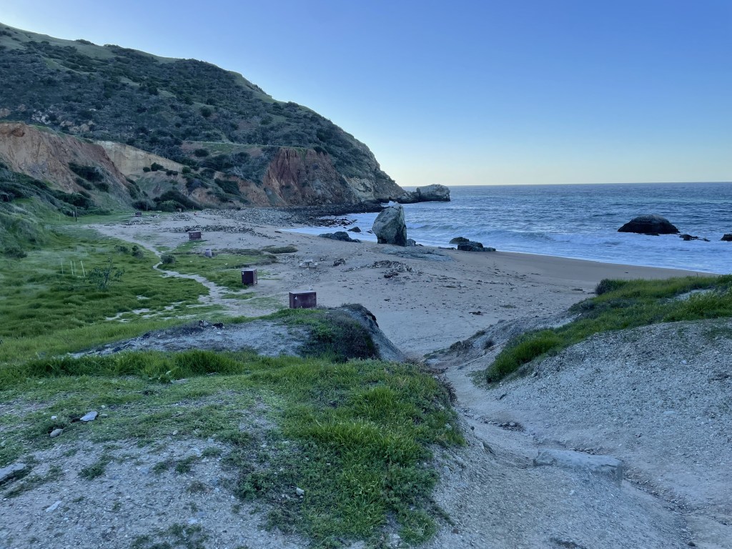
This is the section of trail with the least change in elevation, and the walk is nearly flat for the duration of the 7.7 miles. You will pass by several coves, some of which are occupied by private parties, and others that are mostly untouched. If you listen closely, you may be able to hear some sea lions barking down on the rocky shorelines below…
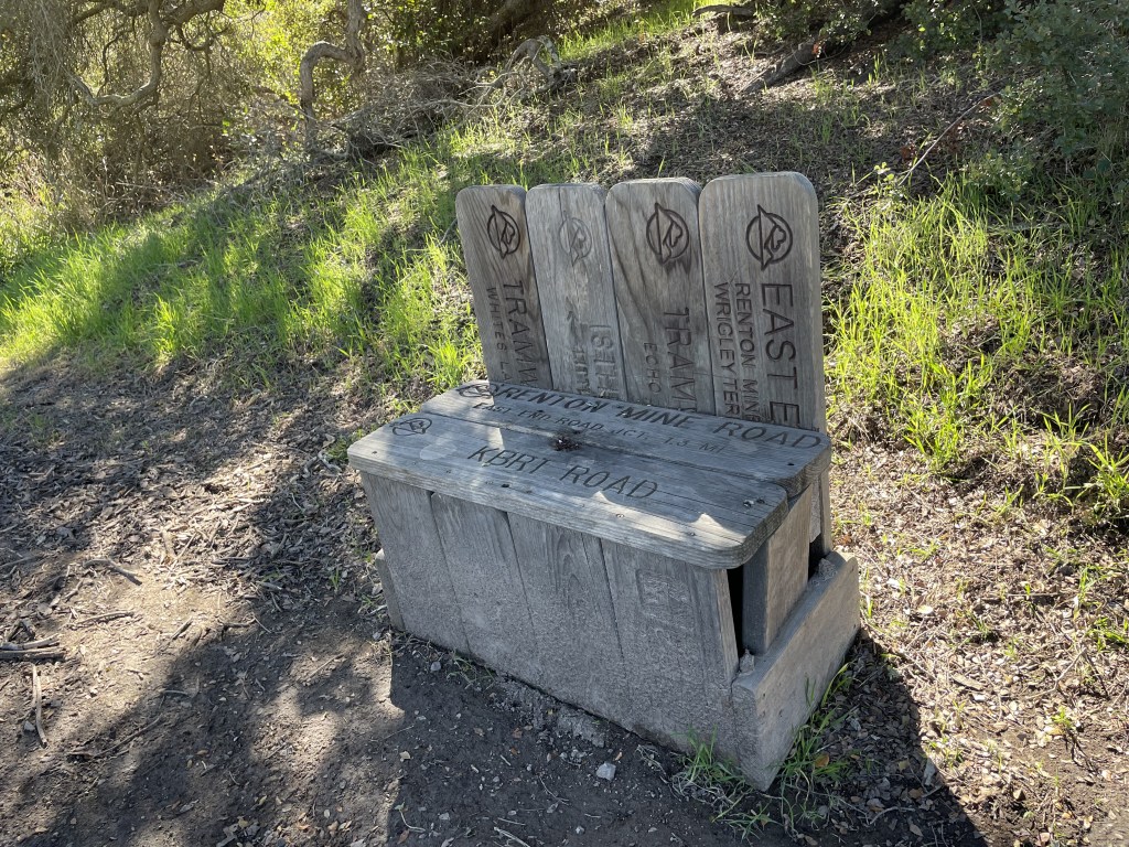
Lion’s Head is a viewpoint at mile marker 35.6. There is a toilet here, a trash can and a bench, but it can be rather windy and exposed. This is one of the spots nearest to Parsons Landing I always get good cell reception in this section of trail.
Enjoy this final part of the trail! Or if you’re just starting here, its all uphill after this…
This section of trail had unreliable signal. The closer to Parsons Landing, the less service I had.

Other things you should know about backpacking the TCT
If you are planning to cook your meals, you will have to buy your fuel for your camping stove on the island from one of the general stores in Avalon or Two Harbors. Propane and butane canisters are not allowed on the Catalina Express, no exceptions.
This trail is dog-approved! So yes, bring along your *experienced* adventure pup and share this epic journey with them. DO NOT bring a dog that is not accustomed to long-distance outdoor walks; rangers have to repeatedly rescue unexperienced animals. Booties are recommended as the ground can get very hot and the trail has lots of rocky jagged edges. This is not the place for training as getting medical attention in the event of injury will be extremely delayed.
Bison are cute and fluffy, and we all have fantasies about cuddling with one, but they are not your friends. We are visitors in their home! Please treat them with respect, give them the space they need to live their life in peace, and DO NOT approach them for any reason. They are not afraid of humans, and often hang out right in the Little Harbor Campground. They will charge at you, and they have attacked visitors in the past, but they will probably leave you alone unless you are acting like a fool. Keep nature wild.
Beware of island foxes and ravens. Foxes are cute but they will eat all your food if you walk away from it. Ravens are so smart they literally know how to unzip zippers. I lost my bread to these thieves on one of my trips and couldn’t make my avocado toast for breakfast. Keep all your belongings on you at all times, or store them in the animal-proof lock boxes located at every campsite.
Hammock camping is pretty much impossible. There really aren’t many forested areas on the island, but you could potentially set up a hammock at some of the sites that include covered picnic tables like Little Harbor and Two Harbors. I wouldn’t recommend it. Stick to tent camping for this trip.
Bring trekking poles. The inclines are intensely steep climbing in and out of Two Harbors and Parsons Landing. I used to think trekking poles were dumb and now I would never go backpacking without them, they are beneficial for both distributing some of the work to the upper half of your body as well as useful for maintaining your balance.
Make sure there is decent tread on the bottom of your shoes. The steep and rocky trails are easier to maneuver when your feet aren’t sliding around.
This is a difficult trail and I would not recommend it for individuals who are not in decent physical shape. Although rather short for a long-distance hike, the steep grades and consistent elevation change make this a major challenge, especially with all your belongings strapped to your back!
Remember that you are on an island in the middle of the ocean and it will be a while before you receive help in any kind of emergency. There is a hospital in Avalon, but getting there will take a while. Park rangers are available to help orchestrate a rescue but keep in mind that reception is spotty and it will take time for them to find you. Carrying a GPS locator device is always recommended for individuals traveling in backcountry scenarios. Stay alert, careful, and cautious.


My thoughts
This is one of my favorite spots to get away from the hustle and bustle of Los Angeles. It is quiet, it is clean, it is beautiful. The views are incredible, especially at sunset from just about anywhere up on the ridge. I love that there are bison here, it is so random and fun that these beasts have adapted to thrive in the middle of the ocean. I’ve hiked this trail several times now, and I prefer to do it in reverse (starting from Two Harbors and ending in Avalon). I like to break my hike up into the following sections:
- Day 1: Boat ride to Two Harbors, walk the easy miles along the cliffs of the shoreline to Parsons Landing (total of 7.7 miles)
- Day 2: Parsons to Two Harbors, break for lunch, Two Harbors to Little Harbor, this is the most difficult day (total of 11.9 miles)
- Day 3: Little Harbor to Airport in the Sky, break for lunch, AITS to Blackjack (total of 8.2 miles)
- Day 4: Descend from Blackjack into Avalon, night at a hotel to celebrate! (10.7 miles)
- Day 5: Early boat ride back to mainland
This gives me 4 days of hiking and a night to rest and clean up before getting back on the boat full of people without smelling like a sweaty mess. 😅 This trail is exhausting and doing it in reverse makes it more difficult. The people who designed this trail barely incorporated any switchbacks so it’s just straight up and straight down. The climbs are tough.
My only real complaint about this trail is the price and availability of the campgrounds, which end up costing more than the boat ride to the island, and sites are always booked up long in advance. It would be nice to see some additional sites or even a second campground near Parsons Landing and Blackjack, or even something near the Airport in the Sky.
I made a vlog series about the TCT on YouTube, linked here: hike across Catalina Island with me (Nov. 2023)
Have you backpacked the Trans-Catalina Trail before? What was your favorite section? Do you have any other tips for future hikers? Leave your notes in the comments below!
Happy hiking! 🤩
(And always remember to follow #leavenotrace principles!)
💚


Leave a comment