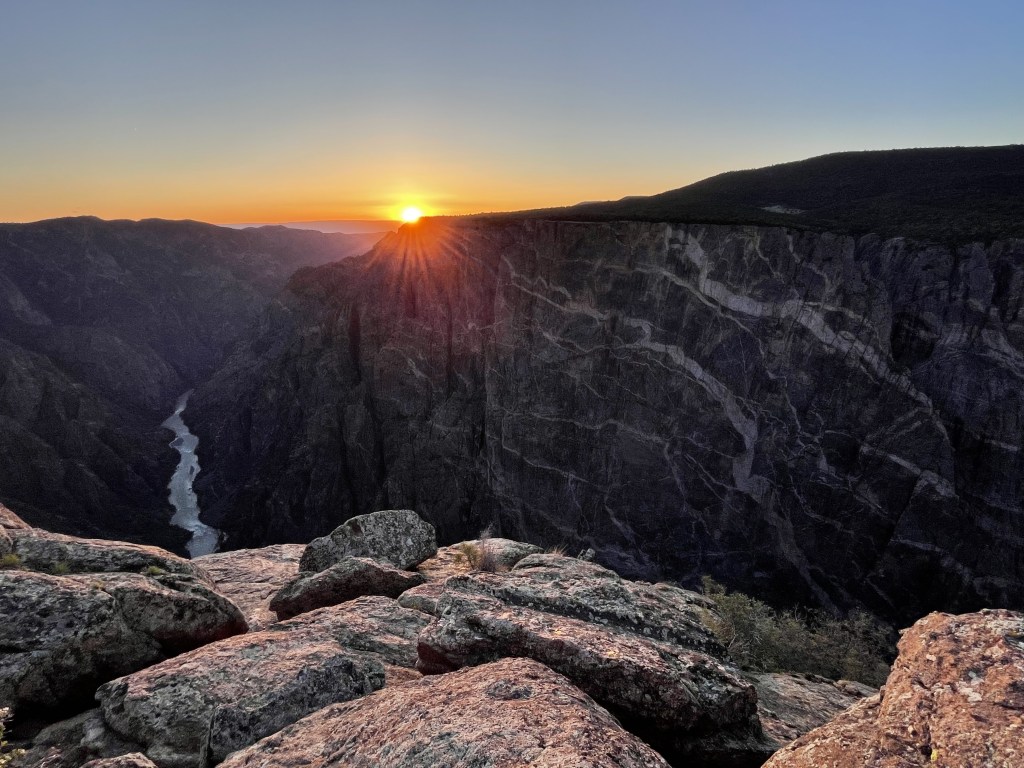
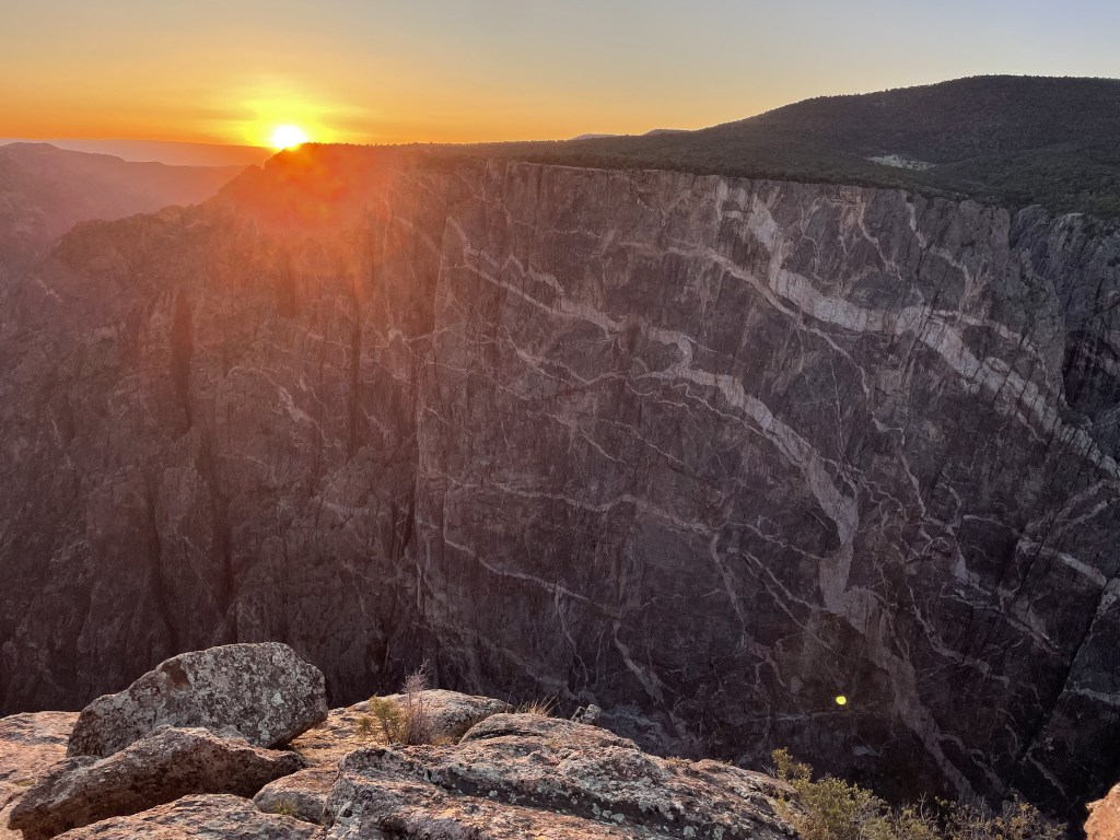
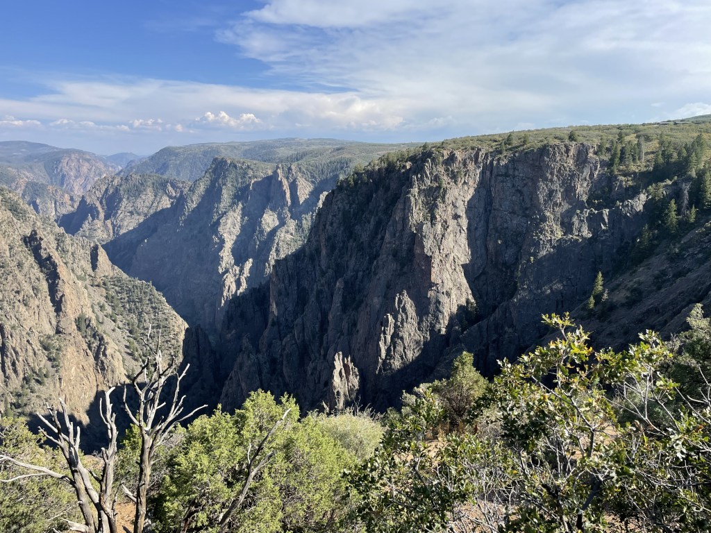
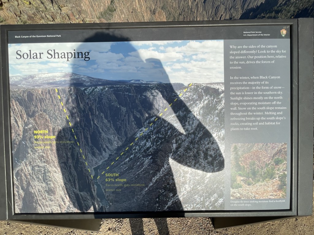
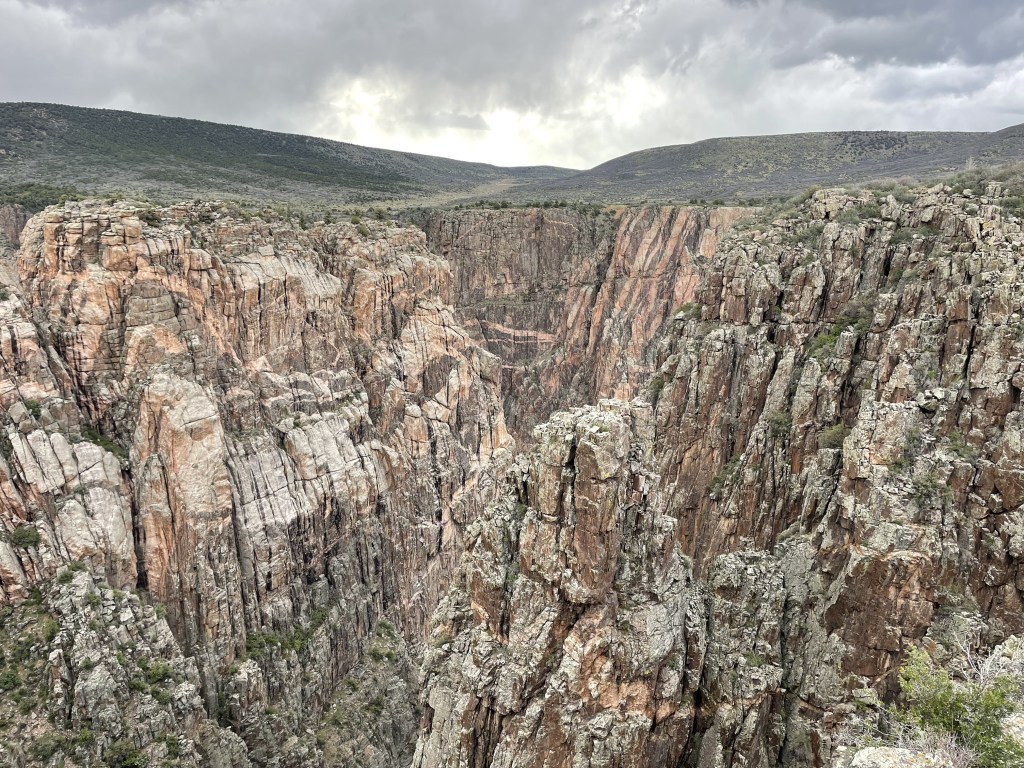
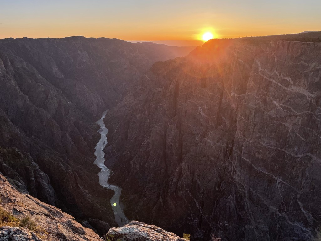
If you’re seeking to lose yourself in a grand canyon but in a completely different climate, Colorado’s Black Canyon of the Gunnison offers some uniquely beautiful views without all the red hot heat of Arizona. This deep slice through our planet’s surface was carved out by the Gunnison River, exposing the metamorphic and igneous rock layers that formed while this land was once under water over a billion years ago. This seasonal destination offers stunning outlooks both with and without hiking, and provides some epic spots to watch a sunrise or sunset.
Black Canyon of the Gunnison has little human history down by the river area, as most human evidence suggests activity up on the rim only. Navigating the river is extremely difficult and only recommended for highly-skilled kayakers, and even the hikes to reach the river from the rim include intense elevation change with loose, jagged rocks and take many hours to complete, which might explain why there isn’t much information about the inner canyon. For centuries, people both old and new, indigenous or just passing through, looked at the canyon and just said, “Nope!”
There are two notable regions in the park: the South Rim and the North Rim. The South Rim is probably the best option for people with limited mobility and individuals interested in shorter walking trails, although there are some strenuous options. The North Rim is better for more experienced hikers, but is only accessible for a little more than half of the year.
Reception is not great anywhere in the park because it’s out in the middle of the Colorado mountains; however, you can typically get a signal from some of the higher elevated spots to the west. Unfortunately there is no public Wifi available. Bringing a map with you is highly recommended, but you probably won’t get lost as the park is mostly just one long road lined with outlooks on either of the rims. Downloading the map on your phone using the official NPS app may significantly help you navigate the specific parts of this park.

When to go and how long
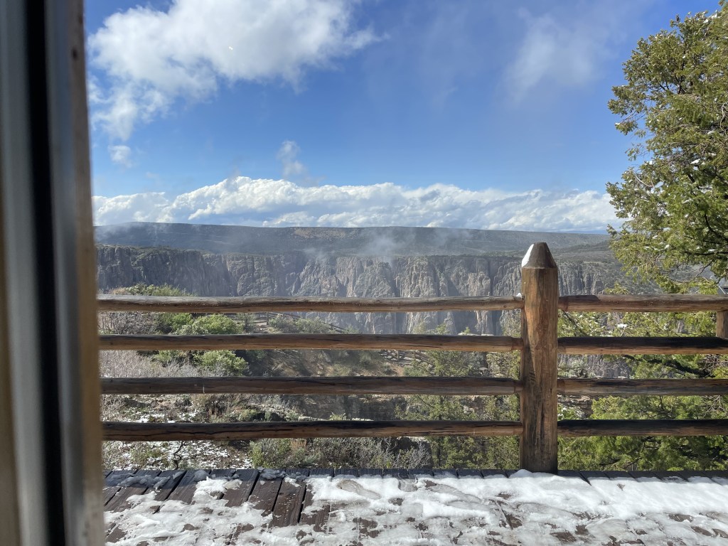
Winter around here sees so much snow, most of this park is simply not accessible. For the majority of the cold season, the only thing open is the visitor center and parking area on the south rim. Roads to the north rim are closed. Early spring is an extension of winter, but by mid- to late-spring, the road that follows the south rim opens back up and remains open until the freezing temps and snow return later on in the year, some time in the late fall or early winter. In the winter, roads and trails are icy, and snow equipment (like snow shoes for your feet and chains for your tires) may be necessary.
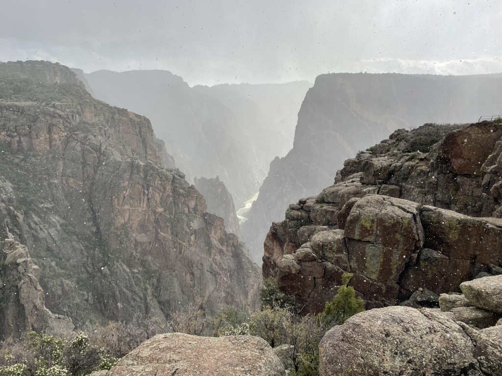
With that said, from the mid-spring to mid-fall, weather around here can be wildly unpredictable. Lots of wind, rain, random periods of hail or snow, pop-up storms with thunder and lightning, heat waves, and so on. The forecast is definitely not always accurate.
Late spring through early fall are the best times for visiting. Perhaps because this place is so far away from any major cities, it doesn’t usually get too crowded, but there would significant inconveniences if it did. Parking is minimal at some of the outlooks and trailheads, and the road is curvy and you can’t really pass people who are driving slow or stopped to wait for a spot. With that said, most people aren’t parked in any one spot for long.
If you just want to check out the viewpoints with minimal hiking and walking, a half- to full-day will be plenty of time. If you want to do other types of activities, give yourself a day or two to explore. (More on your activity options at the end of this post.)
The north and south rim are about a 2-hour drive apart. If you wish to visit both, plan for at least a half-day at each. While many of the views are similar, the two sides offer very different opportunities for visitors. There is a greater variety of hiking opportunities on the north rim.
Where to stay
The closest city to the southern rim is Montrose, about 30-minute drive to the southwest. Here you will find a handful of various hotels, restaurants and stores, as well as basic city stuff. This town is also home to a long-standing family-owned drive-in theater with daily showings that looks pretty cool (called the Star Drive-In Theater).
The community nearest to the northern rim is Crawford, about 30-minute drive to the north. It is much smaller and offers minimal services, and there are only a few hotels, restaurants, and stores. It is also home to Crawford State Park, a beautiful lake with stellar views of snow-capped mountains in the distance, as well as more camping options.
Grand Junction is the closest major city and the largest city on the western side of Colorado, about a 1.5- to 2-hour drive from either rim of the canyon to the northwest. You will be able to find anything and everything you need here, and you will have plenty of options to choose from. In the backyard of Grand Junction is Colorado National Monument, a beautiful display of red rock canyons near the border of Utah. There is a regional airport here that does flights to/from several other major cities, like Denver and Dallas, Texas. Eventually I will write an entire post about Grand Junction because there is a lot to do around this area.
Camping options are plentiful around the park, and there are two park-official campgrounds: South Rim Campground (reservations highly recommended, some sites include electric hookups) and North Rim Campground (only open in winter, north rim sites are first-come, first-served). The East Rim Portal Campground is technically just outside the park boundary down by the river, and the 15 campsites are first come, first-served only. One backcountry campground at Red Rock Canyon is a popular spot for backpackers who enjoy fishing. There are some other backcountry camping spots inside the park and you are required to obtain a wilderness permit in advance from the visitor center on the south rim or the ranger station on the north rim.
Many other campgrounds are scattered around the surrounding areas and state parks, and free dispersed camping may be available in nearby national forests.

How to get there
You will need a car. There is absolutely no public transportation to and from this park, nor is there any kind of park shuttle once you get there. If you are coming here on a road trip already, you will have no issues. If you are flying into Denver or Grand Junction, you will need to rent a car.
Getting around the park is easy, and the drive between the north and south rims takes about two hours (you have to drive all the way around the canyon).
The South Rim Road parallels the edge of the canyon for about 7 total miles from the campground and visitor center at the east side to the end of the road at High Point Overlook on the far west side.
The North Rim Road parallels the edge on the north side, stretching about 5-miles from the campground and ranger station on the west side to Kneeling Camel Overlook to the east.
Food and money
Prices for gas seem to be slightly higher than average in the area around this national park. The two nearby cities, Montrose to the south and Crawford to the north, both have some dining and service options, although Crawford is a much smaller town and those options are very limited. Food prices in general seem to be nothing out of the ordinary.
Absolutely no food is for sale inside the park. Bring your own lunch and snacks, depending how long you plan to visit. Bring everything you need if you are camping unless you plan to drive back to the nearby communities of Montrose or Crawford.
Campsite prices are pretty average. Hotel prices are also competitive and you can find options on either end of the general price range.
The only items for purchase inside the park are at the gift shop at the south rim.
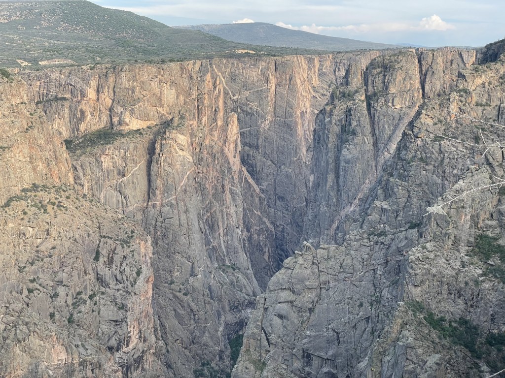
What to see on the South Rim
This is the most popular region of the park. It has more total overlooks and is technically accessible for the majority of the year, although during the winter, guests have very limited options. The type of overlooks vary–a few of them are just off the side of the road (and are accessible to those with limited mobility), but many require a little walking on maintained dirt trails to reach the designated viewpoint. The longest mini-trail is a few hundred yards. There aren’t many hiking options on the south rim, but there are a few trails, and most of them are a couple miles or less. Hikes down into the canyon to the river are extremely difficult and require a permit (an entire section on this later).
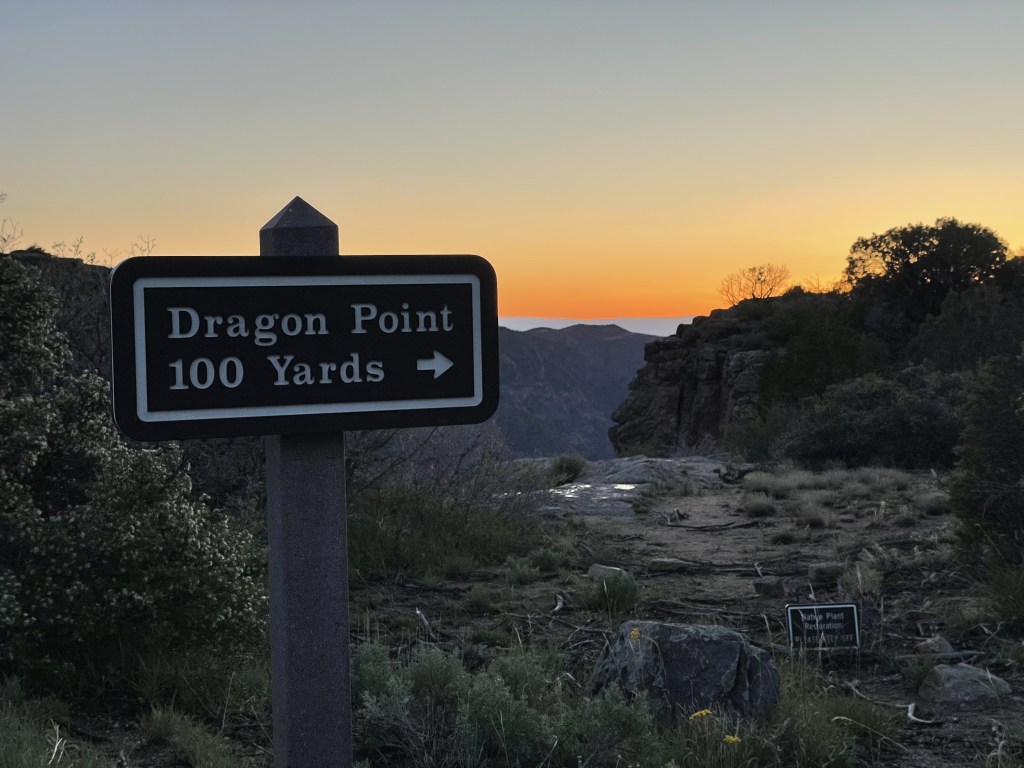
There are 12 total overlooks along the 7-mile South Rim Road. From the furthest east to west, these overlooks include: Tomichi, Gunnison Point, Pulpit Rock, Cross Fissures, Rock Point, Devil’s Lookout, Chasm View, Painted Wall, Cedar Point, Dragon Point, Sunset View, High Point
Easy and moderate hiking options on the south rim include:
- Oak Flat Trail starts and ends at the visitor center (about 1.5 miles for full lollipop-shaped loop)
- Uplands Trail connects the Oak Flat Trail to the Rim Rock Trail (just under a mile one-way)
- Rim Rock Trail runs along the rim between the campground and the visitor center (just under a mile one-way)
- High Point Overlook to Warner Point (1.5 miles round-trip)
What to see on the North Rim
This side of the park is primarily a summer destination since the access roads are closed during the majority of the year when it’s covered in snow. The road is made of loose gravel and not paved, and therefore it may be difficult to maneuver when wet as well, but to my understanding a high-clearance vehicle is not necessary. This looks like the better rim for hiking (in my opinion), as the hiking trails seem to offer more variety than those on the south side. River access is about the same as the south rim, and in the next section, I will share further details about these challenging journeys.
There are a total of 6 overlooks along the 5-mile North Rim Road, listed here from furthest west to easternmost: Chasm View, The Narrows, Balanced Rock, Big Island, Island Peaks View, Kneeling Camel View
Easy and moderate hiking options on the south rim include:
- Chasm View Nature Trail from campground (1/2 mile loop)
- Exclamation Point from ranger station by North Vista Trail (1.5 mile, one-way)
- Green Mountain Peak by North Vista Trail (just over 3 miles one-way, 1.2k feet of elevation change)
- Deadhorse Loop Trail from Kneeling Camel Outlook area (4 mile lollipop loop)
- Deadhorse Trail from Kneeling Camel Outlook area (about 2.5 miles one-way)

If you are considering hiking down to the Gunnison River from either rim…
From both sides of the rim, there are three different “wilderness routes” that will take you down to the river, but there are **technically** no official trails. Each journey, regardless of route, includes a lot of elevation change and rock scrambling, and it is common to lose the trail and then need to find your way back.
Obtaining a permit is required and can be done at the visitor center on the south side and the ranger station on the north. They only allow a small number of hikers to attempt this trek each day, and all routes are said to be highly difficult due to the intense change in elevation. The specific distances below may not be accurate due to the fact that these routes are not often repeated perfectly since they are mostly unmarked (my online research was revealing different numbers depending where I looked). The numbers below are based off the official NPS website.
- South Rim routes:
- Gunnison – this is the most popular route; it is supposed to be the shortest and least difficult all around, and is the only route that includes a chain rope to accompany the elevation change for some portion of the trail (3 miles, estimated 4.5 hours round-trip)
- Tomichi – considered the steepest on the south rim (2 miles, estimated 6 hours round-trip)
- Warner – best for backpackers and those interested in fishing, has the most elevation change and is the longest of the southern routes (5.5 miles, estimated 6.5 hours round-trip)
- North Rim routes:
- Pinyon Draw – while still extremely difficult, this is argued to be the easiest option on the north rim, beware of excessive poison ivy (3.5 miles, estimated 5 hours round-trip)
- Long Draw – shortest north rim option, must be able to climb around some cliff edges, goes through narrow canyon and mostly shaded during the day, lots of poison ivy (2 miles, estimated 4.5 hours round-trip)
- Side Draw – steepest and most dangerous, route has shade most of the day (2 miles, estimated 5.5 hours round-trip)
Carry lots of water, and wear long pants and sleeves if you can to protect yourself from the bounty of poison ivy that lines both the routes and the river itself, especially if you are taking on this challenge from the northern rim where it appears to be worse.
Most routes are only a few miles in total distance and essentially just go straight down, then back up. The routes are covered in scree (loose gravel and rocks) which makes both the ascent and descent extremely complicated and exhausting. I would highly recommend trekking poles for both balance and climbing assistance.
Regardless of which route you choose, the trek down and back will likely take at least half a day even for the most experienced hikers, especially if you spend some time down on the river bank when you get there. Don’t forget to pack a lunch!

Other things you might want to know before visiting
Snow exploring opportunities, like snowshoeing and cross-country skiing, are unique and plentiful in the winter. However, because most of the roads are closed, you are limited to your trailhead being the south rim campground and visitor center area, but you might get this place all to yourself since not many people come here when it’s that cold. The nearly vertical black cliff faces look super cool when accented with pristine white snow. The park also has guided snow walks (snowshoeing) in the peak of winter.
Go rock climbing, if that’s your thing, because there are some super cool spots here for that. There are almost 150 unique routes in the inner canyon according to the NPS.
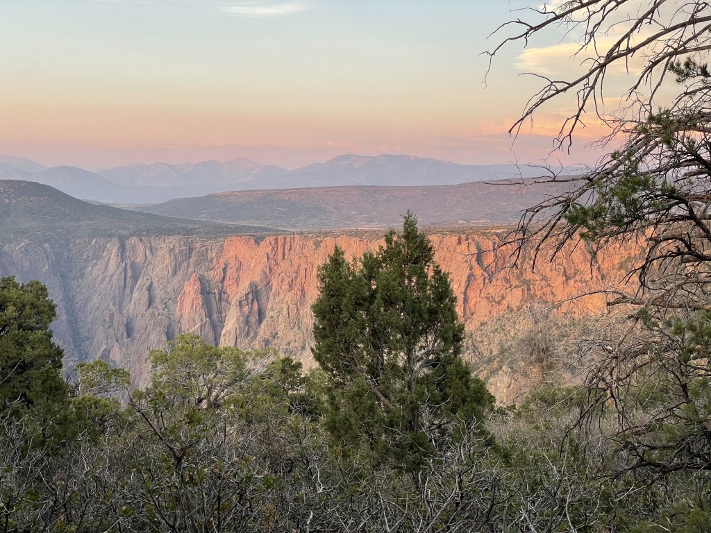
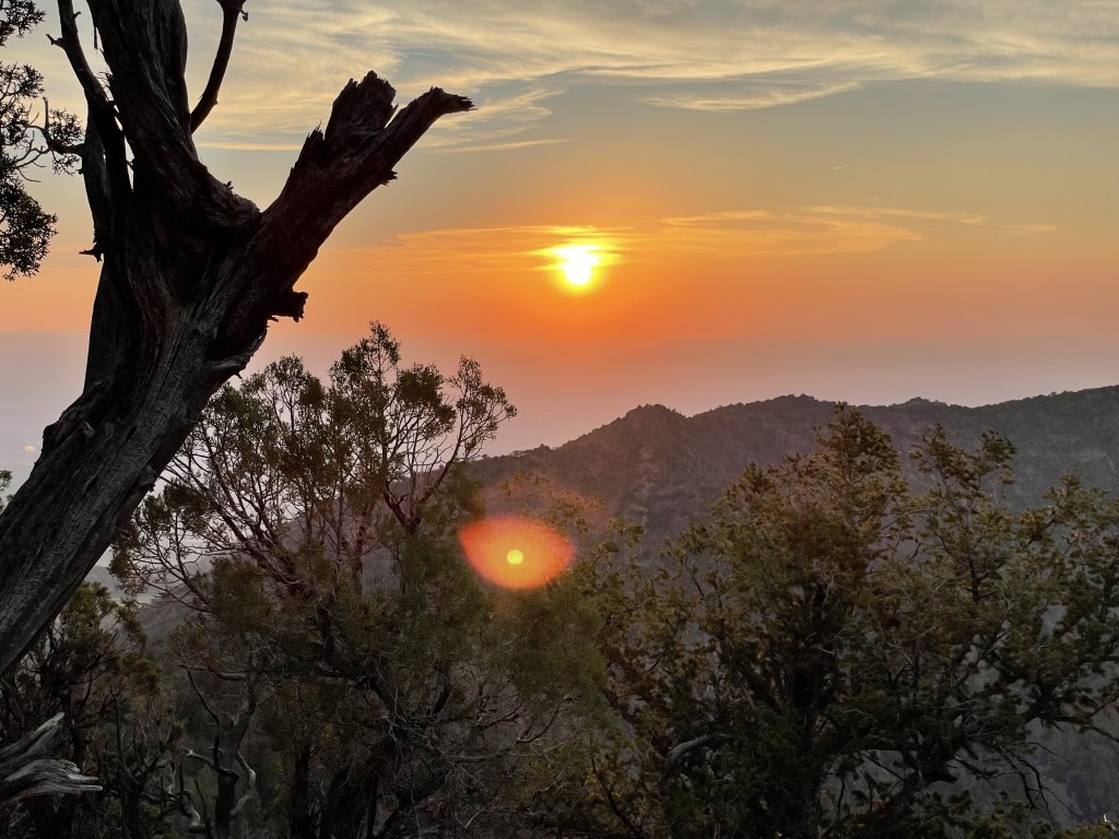
Get in touch with your creative side and practice your photography. Depending on the time and the weather, the entire place can look totally different. You may notice different things depending how the light hits the cliff faces.
This is also a fantastic spot for astrophotography and stargazing, and they hold an Astronomy Festival annually in early September. Black Canyon of the Gunnison NP is recognized as an International Dark Sky Park and they take significant steps to reduce light pollution.
River activities are a popular option for experienced water lovers, but this will occur away from the north and south rim areas in an entirely different section of the park. Off to the east towards Curecanti National Recreation Area is a third campground (called the East Portal Campground), where visitors can stay down by the river. Kayaks can be launched but this river is NOT for beginners. No motored-boats.
Fishing is also extremely popular here, and you will need a Colorado Fishing License. Check here for more specifics about fishing around this region.
Horseback riding options are limited and they are not allowed on the south rim at all. Check prior to your trip to see where you can explore. Trail rides are available from private parties in the surrounding areas but I didn’t find anything like that within the park.
It is recommended that you don’t bring your pet unless you are just planning to check out the overlooks. They probably won’t have a good time because they’ll have to stay in the car, but you won’t be away for too long at any given overlook. Unfortunately they are not really allowed to go hiking with you (except for on the southern Rim Rock Trail and north rim Chasm Nature Trail), and they are limited mostly to paved areas.

Other nearby stuff you might want to check out
There are several mountain towns between this national park and the city of Denver (such as Aspen, Breckenridge, and Vial) with ski resorts that make fantastic options for snow activities like skiing and snowboarding. Keep in mind that this is an expensive region for participating in these activities.
Curecanti National Recreation Area is popular for various water activities, camping and hiking. This park sits right up against the eastern boundary of Black Canyon of the Gunnison and takes about 1.5 hour to drive there.
Colorado National Monument is an awesome display of the red rocks typically associated with the American southwest, and it’s basically in the backyard of Grand Junction. (In my opinion, this could totally be a national park!) The scenic drive is one of the best parts and it only takes about 30 minutes to get there from Grand Junction, or 2- to 2.5-hours from Black Canyon of the Gunnison.
For more red rock stuff, Moab is about a 3-hour drive to the west in Utah. Check out my post about the city of Moab here; there’s tons of stuff to do and two major national parks (follow these links for my posts on Canyonlands NP and Arches NP).
If you’re into scenic drives, there are tons of great options around Colorado. Consider the commutes on nearby highways 50 and/or 92. Both of these will take a few hours of your time and leave you speechless.
If you would like to learn more about the history of the indigenous communities that were once-upon-a-time the only people roaming these lands, Mesa Verde National Park and Canyons of the Ancients National Monument are some great options for viewing ancient ruins. Both are 3- to 4- hours southwest near the city of Cortez, Colorado.
My thoughts
This park is extremely underrated in my opinion, and maybe that’s just because of the weather situation, with much of the surrounding area inaccessible for a portion of the year which results in extremely limited options for viewing the canyon. Unless you’re a snow-activity enthusiast or photographer, I would probably advise against it. Aside from that, it’s not super far from Denver (5 hour drive) or Grand Junction (1.5 to 2 hour drive), it offers strikingly beautiful and unique canyon outlooks, and the weather is otherwise pretty enjoyable for the remainder of the year.
While I haven’t hiked down to the river yet, the very strenuous trek is high on my list for a future visit to this area, although I’m not yet sure which route I’d like to tackle (maybe Gunnison from the south, and Side Draw sounds pretty fun on the north rim). My first priority for my next visit is to check out the north rim during the proper season, and currently I look forward to the Exclamation Point and Green Mountain hike via the North Vista Trail. And for anyone wondering, I think Dragon Point is my favorite lookout on the south rim (it’s a great place to be at sunset, especially if Sunset Point is too busy!).
Have you already visited the Black Canyon of the Gunnison? What were your favorite outlooks? Do you have any tips for future hikers? Leave your notes in the comments below!
Happy traveling! 😄
(And always remember to follow #leavenotrace principles!)
🖤


Leave a comment