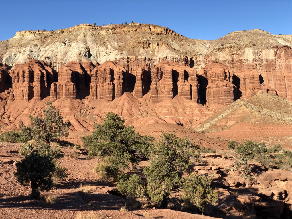
From natural bridges to red canyon views, centuries-old rock markings to otherworldly geologic wonders, apple picking to horseback rides, Capitol Reef National Park is nothing short of unique. It is comprised of the land surrounding the Waterpocket Fold, a geologic masterpiece where older rock layers are exposed at the surface, providing some of the most diverse landscapes in the area. The park protects old reminders of the Native American presence in the area as well as some historic buildings from a former pioneer community, and the flourishing fruit orchards which continue to thrive and can even be enjoyed by visitors in the harvest seasons.
Of all Utah’s national parks, I hear about this one the least, which is probably because it’s it’s more remote than all the others as it sits smack-dab in the middle of the state, super far away from any major city (a minimum of a 2.5 hour drive) and the closest towns in the area are small and extremely limited. There are three major districts within the park that offer different opportunities to visitors.
The most commonly trafficked area is near Fruita, Utah. Services here are limited to its single Visitor Center, the occasional pit toilets at the trailheads, a seasonal nature center, and the orchards. Reception is spotty or nonexistent in most of the region and carrying a park map (offered complimentary with your entrance fee) is an absolute necessity. If you go without a specific plan, head to the Fruita Visitor Center during operating hours and talk to a park ranger about your options. They are there to help you make your adventure the best they can, but be mindful as to not take up too much of their time so they can do their jobs and help other people, too!
When to go and how long
The desert can be rather warm in the summertime, and I would not recommend strenuous activity (like long hikes) on the hottest days unless you embark before or around sunrise. Always check the weather before you go and plan accordingly. Spring and fall are usually the best times to visit the desert because temps are mild. Winters are cold and dry, although the area also sees snow sometimes.
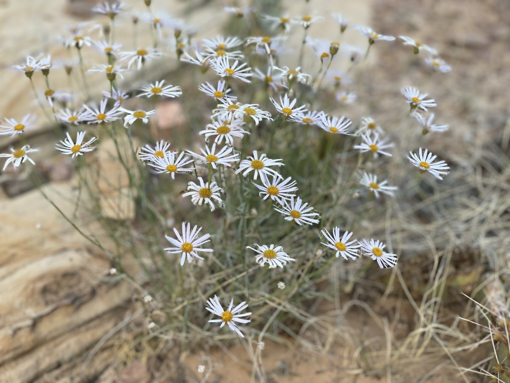
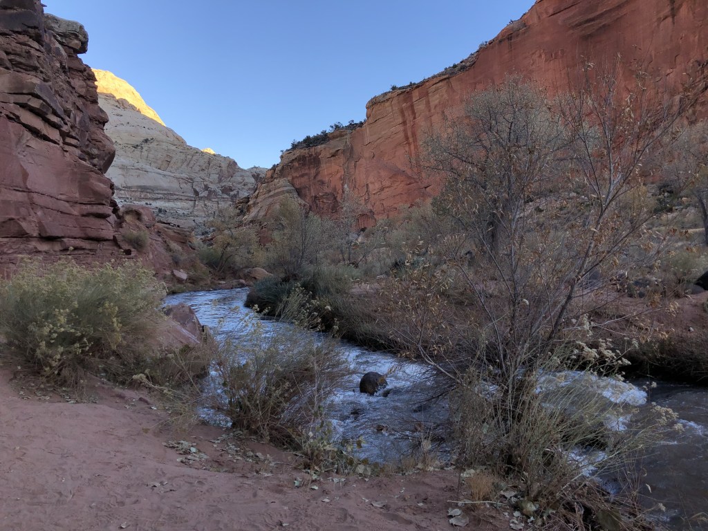
It doesn’t get a lot of precipitation during the majority of the year, but does experience monsoons in the summer. Watch out for flash floods, especially if you are planning to hike through a wash. Seasonal changes to the landscape very obvious in some more lush areas such as near the river, but minimal in most of the desert. There are some small desert wildflowers in the spring and summer, as well as blossoms in the orchards (during the appropriate times of year). Fall brings about some golden foliage around the Fremont River and Sulphur Creek.
Capitol Reef can either be a quick pitstop on your road trip if you are driving through it on Utah’s Highway 24, or a place you stop and spend a few days, depending on how much enjoyment you get from exploring more remote destinations. In a half-day, you could very easily stop at all the viewpoints along the main highway and take a hike, or you could spend a few days camping around in the wilderness, climbing on rocks, off-roading and hiking some of the longer trails.
Where to stay
Within the park, there is only one major campground with facilities, called Fruita Campground, which takes reservations in advance. There is also a large group spot.
There are several small inns and lodges in the city of Torrey, a quick 15-minute drive to the Visitor Center from the west entrance of the park, as well as a motel 45-minutes to the east in the town of Hanksville. Prices may vary by season as they are the only beds anywhere near the park. There are also a few home-rentals in this area that you can find from private parties. The towns of Bicknell (20 minutes from the visitor center to the west) and even Loa (30 minutes) have some lodging, stores and restaurants as well.
Backcountry camping spots are all over the place in this remote part of Utah, but within the park boundary you are limited to the ones already established. For more information on backpacking trails, backcountry camping spots, and permits inside the park, you can check out specific details from the NPS website here.
Capitol Reef National Park is extremely remote and not close to any major cities.
- 2.5 hour drive to the west of Moab
- 3.5 hours to the south of Salt Lake City
If you wanted to add this as a stop on your road trip, it would make a great pitstop on your way to or from any of these landmarks:
- 1 hour north of Grand-Staircase Escalante National Monument
- about 1 hour southwest of Goblin Valley State Park
- about 2.5 hours west of Arches National Park and Canyonlands National Park
- 2.5 hours northeast of Bryce Canyon National Park
- 2.5 hours northwest of Natural Bridges National Monument
- 3 hours northeast of Cedar Breaks National Monument
- 3.5 hours northeast of Zion National Park
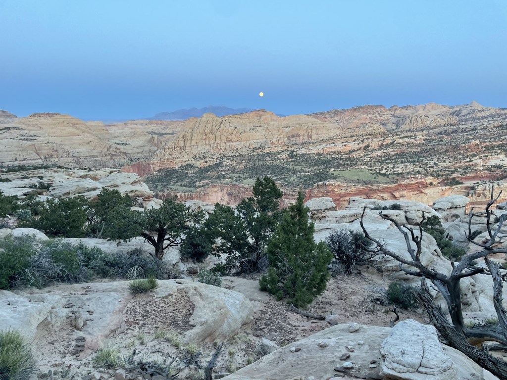
If you are planning to camp anywhere around the park, you are going to have quite a show in the night sky as the stars come out to play. It is so remote there is essentially no light pollution, and Capitol Reef National Park is recognized as an International Dark Sky Park, making it an excellent spot for astrophotography.
How to get around
You are pretty much going to have to drive regardless of where you’re coming from. There is no major airport in the area. The closest regional one is 2.5 hour’s drive in Moab and the nearest international airport is 3.5 hour’s drive in Salt Lake City. If you are flying in, you will have to rent a car. No public transportation will get you to this park, and there is no park-operated shuttle or transportation of any kind.
Having a high-clearance vehicle will give you more access around the park. The Fruita district (most popular area) is accessible with your standard 2WD vehicle. The Waterpocket district (South) can mostly be accessed with a standard vehicle as well, but weather conditions may complicate the journey as its dirt roads get damaged, blocked or washed out. The Cathedral Valley district (North) is 4WD recommended (although technically not required, but try at your own risk). Keep in mind that the majority of the park has little to no cell phone reception and rescues make take days (yes, days, plural).
There are private sellers that offer off-roading and horseback tours for a hefty price if you don’t have the ability to access the rough roads yourself, or simply don’t want to deal with the logistics but just want to enjoy the scenery!
Food and money
Park admission is not collected upon entry but you can pay at the Visitor Center if you do not have an annual pass, backcountry camping permits are mostly free, and established campsites are average in price. There are some locations in the area outside the park with free dispersed camping.
Prices for food and lodging may be on the higher side in this area. No food whatsoever is available for sale inside the park with the exception of seasonal orchard fruits (more on that shortly). Torrey is the closest city and is also home to the closest restaurants and a general store, all of which may be temporarily closed in wintertime (check websites or call for business hours). The nearest reliable year-round groceries are available a 20-minute drive west of Torrey in the city of Loa, but you can always grab generic gas station food in Torrey as a last resort. If you are enjoying the Fruita district, you could potentially drive back to Torrey for lunch or whatever meal you need.
If you are planning to go to the northern (Cathedral Valley) or southern (Waterpocket) districts, I would recommend bringing along all your own food.
Any private tour company will on average charge a couple hundred dollars at a minimum for a half day of touring this area, and close to double that for a full day.
What to do in the Fruita District
The park’s only Visitor Center is located here and is a great place to start your adventure. Just down the road there is also a Nature Center open in the summertime. Once home to a pioneer community, these historical buildings and orchard are now a place visitors can go apple picking (or almonds or peaches, among other things) for no additional cost. Harvest season is generally summer and fall, depending on the specific produce.
According to the park’s website, the rules are that you can pick and eat anything you want in the selected orchards while you’re there (free), but if you want to take anything with you to go, you would pay for that on your way out (you have to buy what you leave with). This area is constantly undergoing rehabilitation projects that may affect produce availability. The orchard trees are mostly visible from the main highway if you aren’t able to or don’t want to stop.
Link: Capitol Reef National Park Orchard Information
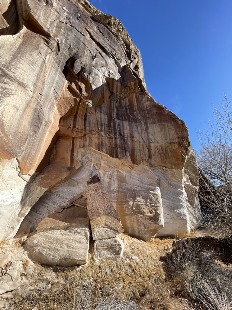
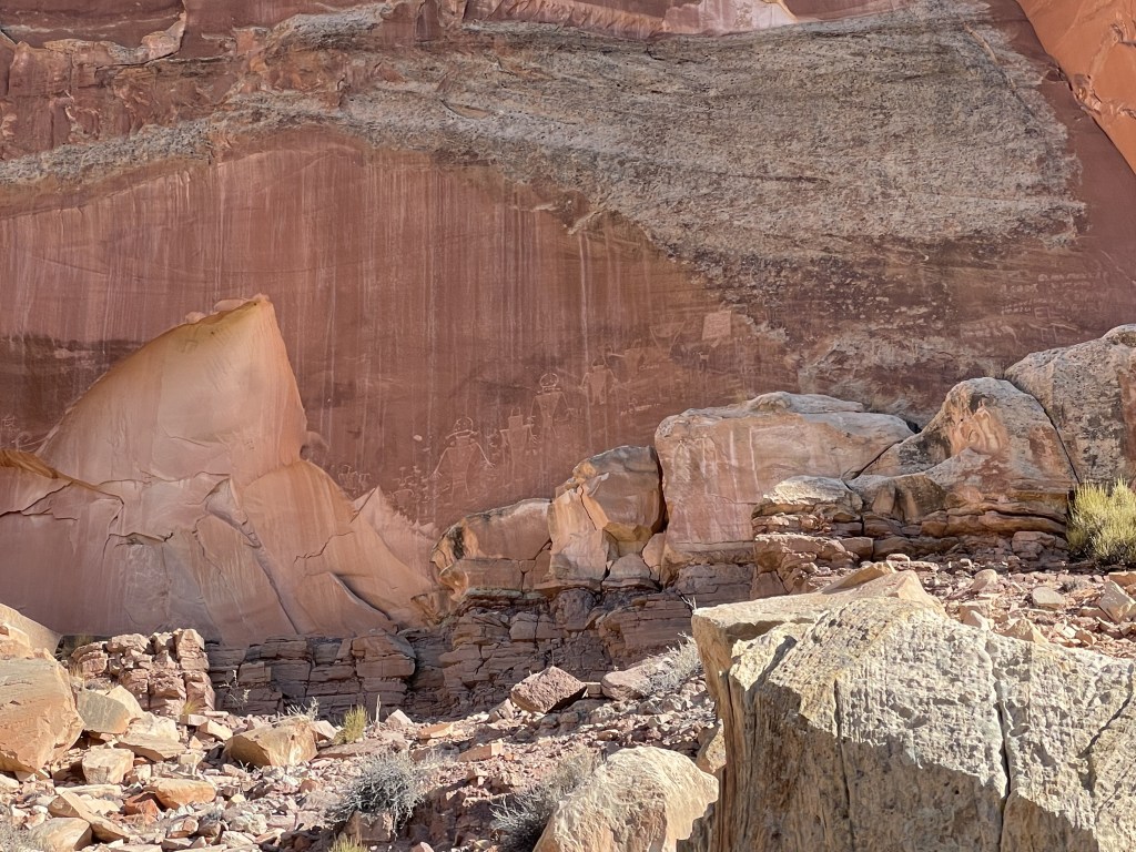
The Petroglyph Panel pullout is a really cool display of some Native American history in this area, and the viewpoint is located on a paved boardwalk down by the river near the visitor center.
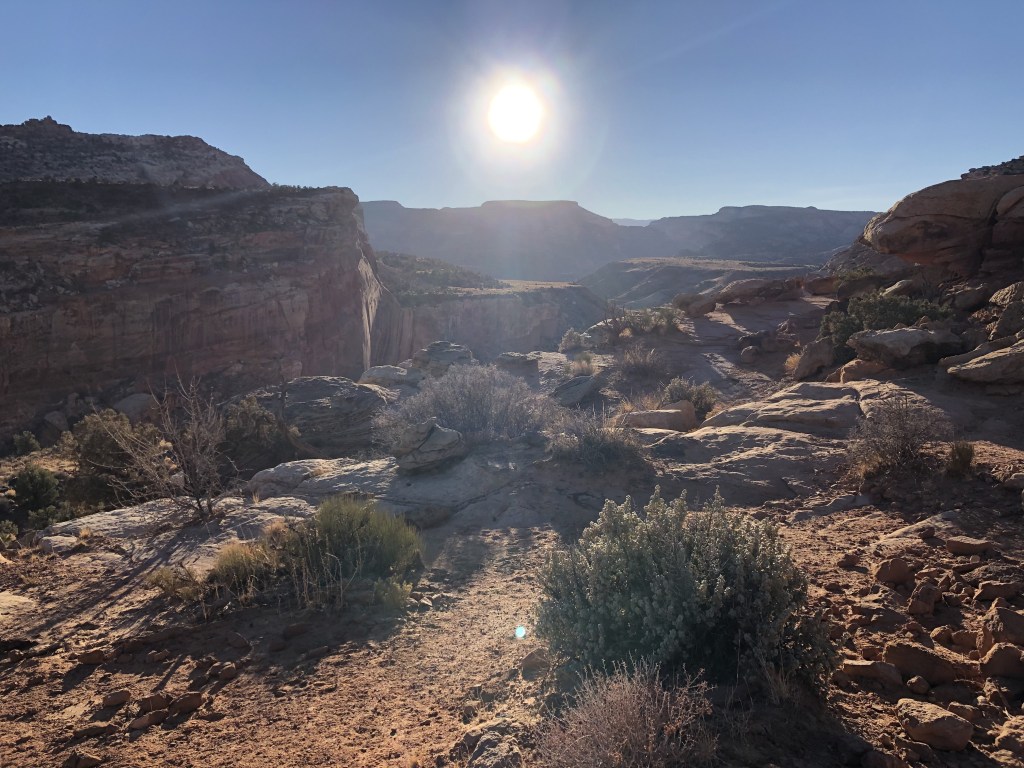
There are quite a few hiking trailheads all over the district that vary in difficulty and distance. If you’re looking for something easy with great views, check out the Grand Wash trail, which is mostly flat (you can make it as short or long as you like, but it goes back for miles).
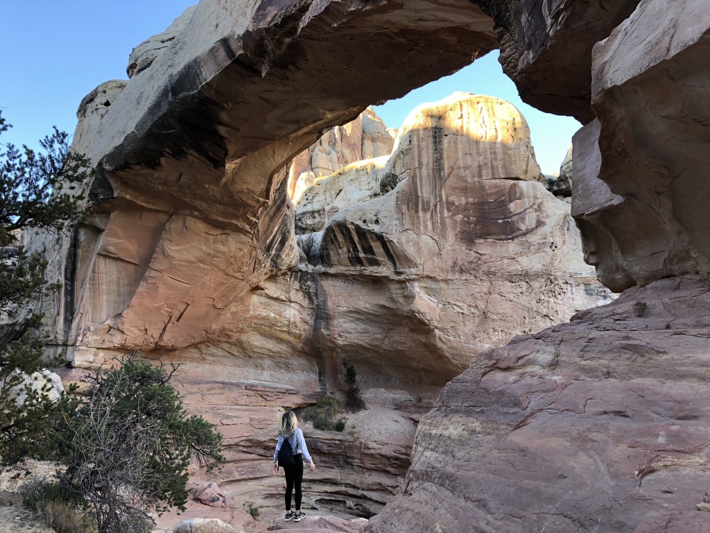
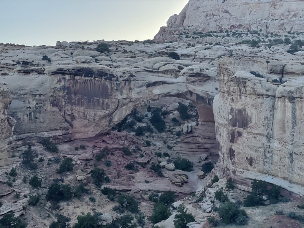
I would also recommend checking out the trail to Hickman Bridge if you are interested in a more moderate-difficulty hike. Some more difficult hikes include the Rim Overlook and Navajo Knobs (all of these are located at the same trailhead, so you can do just one or all three).
As per the NPS website, the 8-mile scenic drive that branches off to the south from the highway was undergoing improvements in 2024, but is expected to reopen to vehicle traffic in early 2025. This road leads to Cassidy Arch, Ferns Nipple (lol), Golden Throne, Capitol Gorge and the Pioneer Register. This area may also be accessed from the 4WD only South Draw Road, which branches off from the Utah Highway 12 (which sits outside of but parallels the park’s western border).
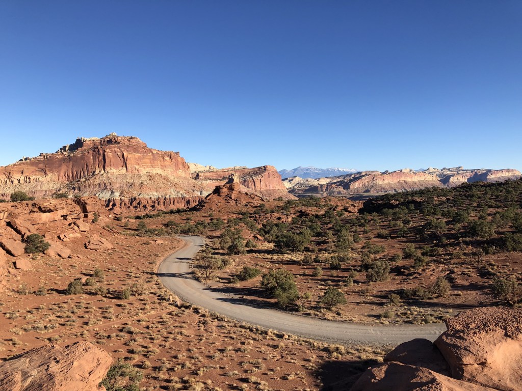
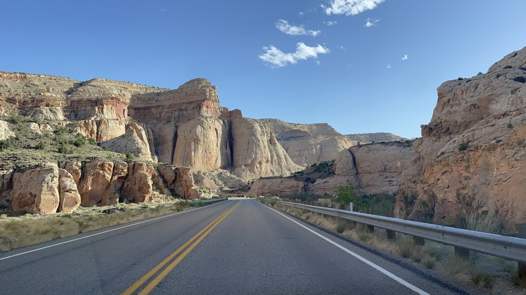
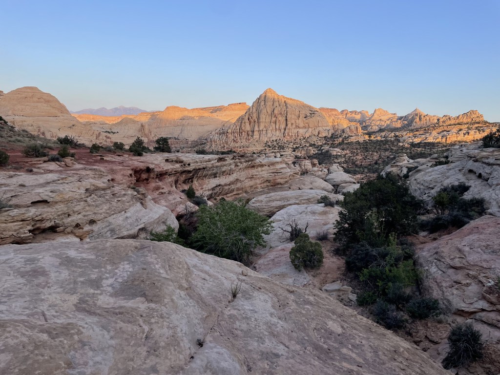
Despite temporary closures to the appropriately named “Scenic Drive,” there is still lots of stuff to see in the Fruita district. The drive along the Utah Highway 24 is also incredibly scenic. On the western side of the park, visitors will stare out their window at the faces of red rock cliffs, which transition into an almost otherworldly canvas of multicolored mounds of dirt and wacky rocks jetting up from the Earth the further east you go. There are occasional pullouts where you can pause to step out of your car for a moment and enjoy the views. Panorama Point pullout was one of my favorites (and the 4WD Goosenecks Road also branches off from here and leads to another outlook).
What to do in the Waterpocket District
Access from Notom-Bullfrog Road which runs along the outside of the park’s eastern border is possible with a regular 2WD vehicle, but road conditions are not consistent. Check before you go. This part of the park can also be accessed from the western side on Burr Trail Road (which branches off from Highway 12), but 4WD is generally necessary over there.
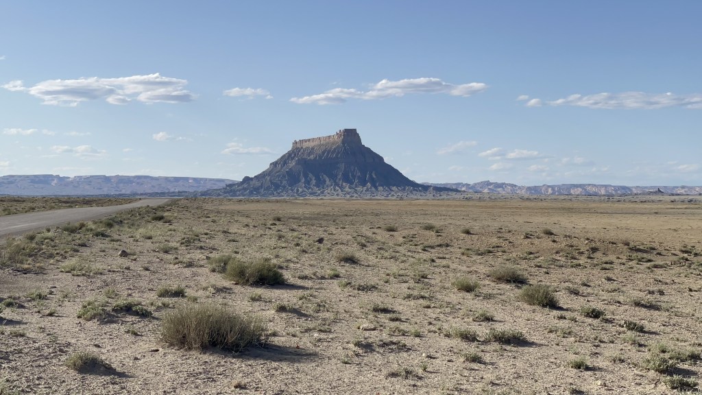
I have not had an opportunity to check this place out yet so I don’t really have much to share, but the NPS website has a great breakdown here: Waterpocket District Information. This district consists of more incredible outlooks and hikes around the fold. At some point, I plan to make my way to the Oyster Shell Reef which is a place you can go to see some fossilized oysters and some other geologic history of this area, which was apparently all underwater at some point. I also recently learned about the Hamburger Rocks which seem to resemble the formations found in the nearby Goblin Valley State Park.
There is one primitive campground in the district called Cedar Mesa which operates on a first come, first served basis.
Link: Cedar Mesa and Cathedral Valley Campground Information
What to do in the Cathedral Valley District
There is also one primitive campground in this area (linked above) located at the northwestern point of the park. I have not had an opportunity to check this place out yet either, but none of the roads to get there are paved and for the most part require a high-clearance with 4WD. One of its two eastern entrances has you literally crossing over the river in your vehicle at Hartnet Road, and the other is further out from the small town of Caineville at Cathedral Road. From the north, you can get here from Baker Ranch Road (branches off from Highway 70) and from the west you can take Polk Creek Road from Highway 72.
As soon as I have the opportunity to go here, I will update this post because this is very high on my list and it looks awesome from the photos I’ve seen. If you are planning to explore here, definitely check out the breakdown directly from the NPS here: Cathedral Valley District Information
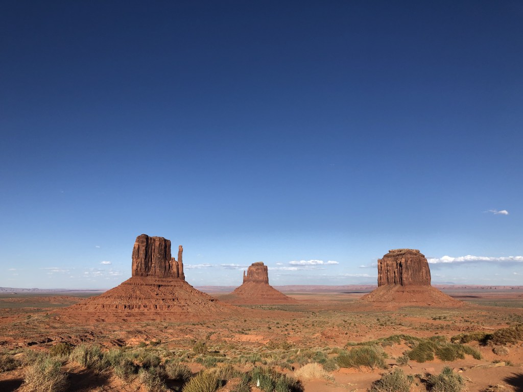
It consists of a bunch of cool rocks that jet up from the Earth (much like those in Monument Valley), the Gypsum Sinkhole, and the Bentonite Hills here are reminiscent of similar ones in Petrified Forest National Park of Arizona and others all over this area of the country. It is famous for its monolithic rock formations, Temple of the Sun and Temple of the Moon.
Other things you can do
In addition to hiking, biking, or riding horses, there are also opportunities for bouldering, rock climbing, and canyoneering throughout the districts (check their website for more specific information about where you can do these activities). Permits may be required and can be obtained in person at the visitor center or requested online by email. Check the Outdoor Activities page to learn more about the specifics of your trip and how to get a permit.


My thoughts
This is another destination where a large chunk of it is off the beaten path, so I will kinda need to wait until I have a high-clearance vehicle. I really want to explore the Cathedral Valley district and go camping in one of the more primitive campgrounds. I would also love to check out the Oyster Shell Reef in the Waterpocket district and find the Hamburger Rocks.
The Fruita district really is cool, though. I think it’s fun that they are preserving and maintaining the orchards once cared for by the travelers that ended up year many years ago, and that many of the specific strains of produce are only found here. Unfortunately I haven’t timed it right for myself to enjoy this park perk yet! It remains on my bucket list for some other time… I find it difficult to desire to go to this part of the country in the blistering heat of the summertime.
Have you been to Capitol Reef National Park? What was your favorite part? Did you adventure back in the less visited areas on the more rugged roads? Let me know in the comments below!
Happy traveling! 😊
(And always remember to follow #leavenotrace principles!)
🧡
(this post was last edited and updated on February 5, 2025)


Leave a reply to zion national park, utah, usa – Laura the explora: the blog Cancel reply