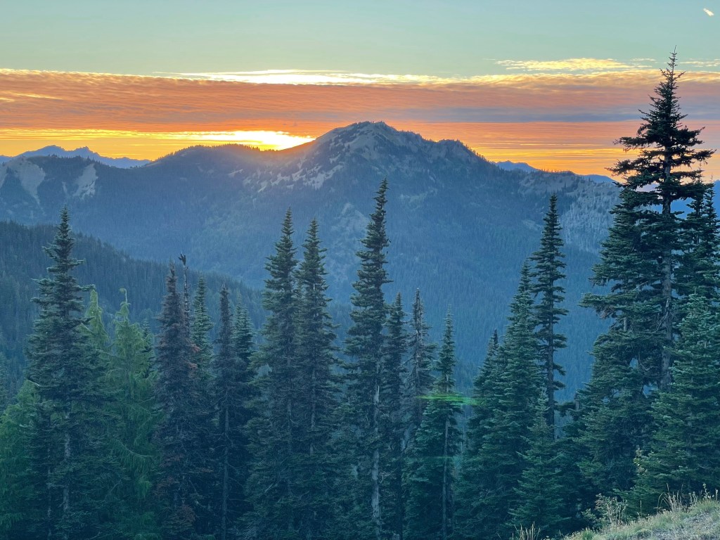
Can you hear the waves crashing against the cliffs? Can you smell the salty sea breeze? What about the trees? Do you hear the wind blowing their leaves around or are they crunching under your feet? How much do you enjoy the aesthetic of lighthouses? How does afternoon tea on a grassy lawn overlooking a glassy pond sound? In one of the most northern parts of the contiguous United States resides Acadia National Park, a scenic masterpiece tucked along the coastline north of almost everything else in the country. With its beautiful beaches, fall foliage, hiking, lighthouses, lobster and seafood, and for about 5 months each year, the first place you can see the sunrise in the country, Acadia National Park is sure to calm your soul and blow your mind.
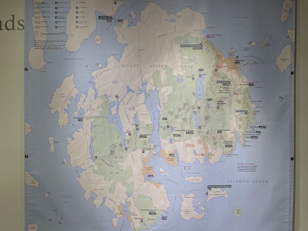
Acadia is one of the most visited national parks of all, ranking at #7 out of 63 with about 4 million annual visitors over the past few years. For the most part, Acadia is a collection of islands with Mount Desert Island being the largest by far, as all the other islands are much smaller and more complicated to get to. Mount Desert Island is easily accessible and can be reached by car since it is close enough to the mainland to be connected by bridge.
The primary tourist area within the boundaries of Acadia National Park is this region of Mount Desert Island. Several smaller satellite regions which do not see as much visitation are the southern Isle au Haut, a small island that can only be reached by mailboat, and an area to the north called the Schoodic Peninsula. There are several other remote islands included within the park boundary but they are not visited as often by tourists, likely due to the complexities of actually getting there.
Reception is not reliable inside the park; however, you may be able to get a signal from some of the roads and near city areas, and sometimes from the higher elevated points on hikes. Unfortunately there is no public Wifi available anywhere inside the park, so be sure to do your research in advance. Bringing a map with you is recommended (and included with your park admission). Downloading a map on your phone or using the official NPS app may significantly help you navigate the specific parts of this park as well as provide information about the areas you decide to visit.


When to go and how long
An active, outdoorsy traveler could easily enjoy several days in the park, but it will depend on the season and how you’d like to spend your time there. A less active visitor would enjoy a day or two checking out the viewpoints, enjoying the scenery from the comfort of their car, maybe taking a cruise, and visiting some of the local restaurants and towns.
Summer is warm and the most enjoyable weather-wise, and marks the beginning of peak tourist season in Acadia (June to September). It is nice enough out to enjoy both the water and the land. It may be foggy in the mornings before the marine layer burns off, and sometimes in the afternoons as well.
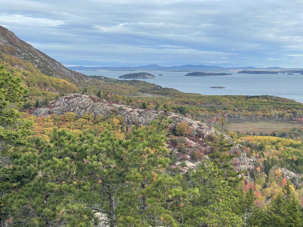
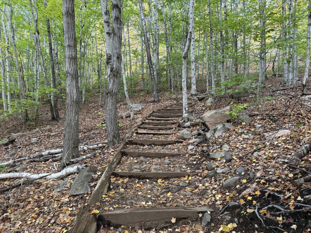
Fall is an incredible time of the year to be up in the northeastern corner of the country, and Acadia might be one of the actual best places to witness it, as it is one of the first places in the country where the colors change since it is so far north. The foliage is extremely vibrant and everyone around here knows it, making this a very chaotic time to visit, especially when it is “peak season” (usually at some point in October). Unless you go near sunrise during this time, you will be sitting in your car for much of the day waiting in lines instead of out exploring the park. While it is less busy before and after the peak, there will still be a lot of visitors around. Temperatures can be chilly and it can be a bit breezy.
Winter is complicated–activities are limited and most of the services that would otherwise be available are not in operation during this time of year. Many roads are closed due to snow, water faucets and public restrooms may not be running, and so on. (I’m sure it’s beautiful though, to see snow and the ocean at the same time… but it will be more logistically complicated for planning purposes.) Otherwise, temperatures are usually below freezing and it may often be windy. This time of year will only attract a very select group of tourists, so for more information, check out Acadia’s official page on visiting in wintertime linked here. (Everything you need to know will be there if you’re into frozen adventuring.)
Springtime is also chilly, especially in the early part of the season, and much of the park will still not be in operation immediately following their winter season. It does warm up and the primary roads typically open back up sometime in April. Once this happens, park visitation begins to increase again. Trails may be extra wet and muddy due to snow melting.
Precipitation is relatively consistent throughout the year, with each month seeing about seven to nine days of rain, snow, or a combination of the two.
Like anywhere else, weather is unpredictable and annual trends may not be accurate year to year. Always check the latest forecast before you go!


Where to stay
There are tons of little inns and hotels near the park, but they can run a bit pricy the closer to the park you are. Staying outside the park in Bangor, Maine may save you some money, but it does add about an hour to your commute each way. The towns of Bar Harbor, Trenton, Ellsworth and Stonington have some hotel options as well, but again, these will be a bit more expensive than staying in Bangor. There are many other small towns in the region with smaller inns and cabin-rentals, but you will have to research what is available to determine what the best option is for you depending on your itinerary. It is always best to secure your reservation in advance, especially if you would like to stay closer to the park.
There are four official campsites inside the park boundary, all of which are open from roughly May to October (exact dates will vary annually). Campgrounds are not in operation during the winter season.
- Blackwoods Campground (eastern Mt Desert Island):
- 281 total campsites of varying type/capacity including small tent sites, drive-up/RV sites, and larger group sites
- leashed pets allowed
- amenities include bathrooms (no showers) and potable water
- coin-operated showers and a general store are available just outside the campground off the nearby Otter Creek Drive
- reservations are highly recommended in advance, and dare I say “required” during peak season as this is the park’s most popular campground due to it’s location on the east side of Mt Desert Island
- less than 10-minute walk from the ocean as well as several popular tourist attractions and trailheads
- Seawall Campground (western Mt Desert Island):
- 202 total campsites of varying type/capacity including small primitive sites, drive-up/RV sites, and larger group sites
- amenities include bathrooms (no showers) and potable water
- reservations are recommended in advance
- less than 10-minute walk from the ocean
- Schoodic Woods Campground (Schoodic Peninsula):
- 89 total campsites of varying type/capacity including small primitive sites, drive-up/RV sites, and larger group sites
- leashed pets allowed
- amenities include bathrooms (no showers) and potable water
- reservations are recommended in advance
- this is the only campground on the mainland region of the park
- Duck Harbor Campground (Isle au Haut):
- 5 total campsites with a 6-person capacity each, no electricity or running water, no pets, pit toilets on site
- accessible only by mail-boat in addition to a 4-mile hike one-way, depending on the season
- reservations required in advance, 3-night maximum stay
- there are no services nearby, you are truly on your own out here!
There are many other campgrounds available in the general surrounding areas but they are not part of the national park.
How to get there
The nearest airport is in Bangor International Airport (BGL) in Bangor, Maine, which is about an hour drive from the entrance to the Mt Desert region of the park. The Portland International Jetport (PWM) in Portland, Maine is also somewhat close-by but will take about a 3-hour drive to get to the park from there. Vehicles are available for rent at both airports.
You will likely be driving… but it is not the only option. To get down to the park from the city of Bangor, you can also get a ride on the Downeast Transportation shuttle, linked here, which costs less than $10 per person as of 2024 when the site was last updated.
There is a local bus route servicing most of the national park’s eastern Mt Desert Island region called the Island Explorer (follow this link to see the latest routes and schedules). This bus company also has routes servicing the western side and Schoodic Peninsula regions. While the bus itself is technically free of charge, you are required to pay the park admission upon your arrival. You can use this bus system to get just about everywhere inside the park (except for Cadillac Mountain, and the Isle au Haut region requires a ferry).

Food and money
This area felt more expensive than a lot of the other national parks I’ve had the opportunity to visit. Between the park and the city of Bangor, Maine, I wasn’t able to find any lodging options that were less than $100 during the weeks of peak fall foliage. Everything near or inside the national park was nearly $200 per night, and it went up from there. Bangor had much more budget-friendly options. Prices will likely be lower outside the peak visitation times.
There are many restaurants scattered around the area so it isn’t necessary to pack a lunch (or food) unless you are visiting Isle au Haut or staying in a campground where you plan on preparing your own meals. At the very least, bring snacks since reception can be spotty and it may take you a moment to locate the closest restaurant outside the park’s perimeter. To my understanding, the Jordan Pond area is home to the only restaurant technically inside the park’s boundary. Many other local restaurants and businesses are seasonal and do not open during the winter.
As far as popular local dishes, lobster is a big one, but basically any type of seafood dish is a good option around here since it is right on the ocean and therefore about as close to the source as you can get. Jordan Pond House is famous for its popovers. Anything with (wild) blueberries, like pancakes and pastries in Bar Harbor, is supposed to be pretty good (pastries are always made better with coffee 😉). Chowders are another popular dish in this region of the country.


What to see on the Bar Harbor (eastern) side of Mount Desert Island
This is the most frequently visited area within Acadia National Park. The Hulls Cove Visitor Center is appropriately located near the perimeter of the park upon entering into this region, making it a great place to stop and check in immediately upon your arrival. Here you can stop in to learn a little bit about the park and consult a park ranger about your visit if you need to. It may be one of the last places you have cell phone reception if you skip the close-by town of Bar Harbor.
Bar Harbor is the largest community on Mount Desert Island, although it is not actually part of the park itself. The town is very cute and packed with lodging options, restaurants, shops, and more. Be aware that parking here can be expensive and most streets in the area require you to feed the parking meters often. Just outside the main city area is the Sieur de Monts Nature Center, complete with a gift shop, along with the Wild Gardens of Acadia, a great place for a leisurely stroll. Both of these spots showcase the local flora and fauna and provide guests a great opportunity to learn about them.
Much of the Mt Desert Island area can be accessed driving the Park Loop Road, a 27-mile journey which will put you face-to-face with many of the main attractions. Note that the majority of this loop is closed during the winter season (December to April).
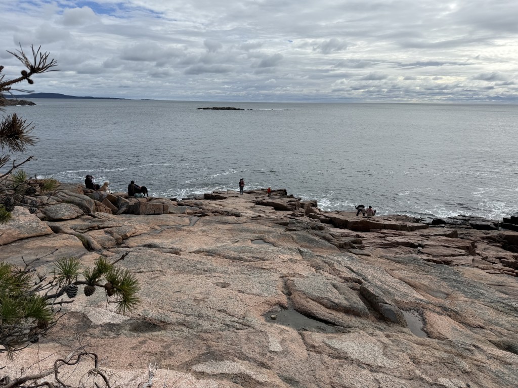
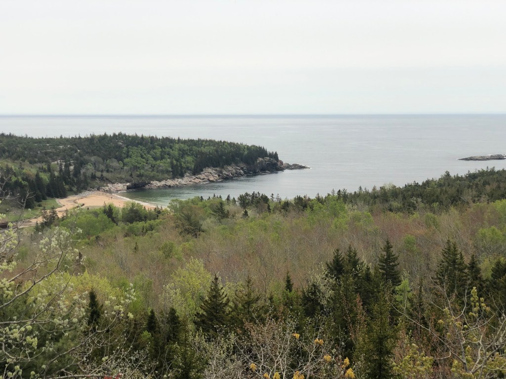
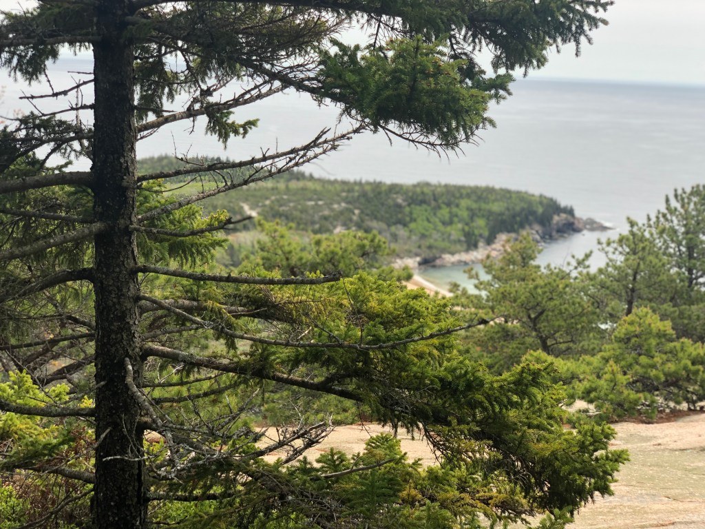
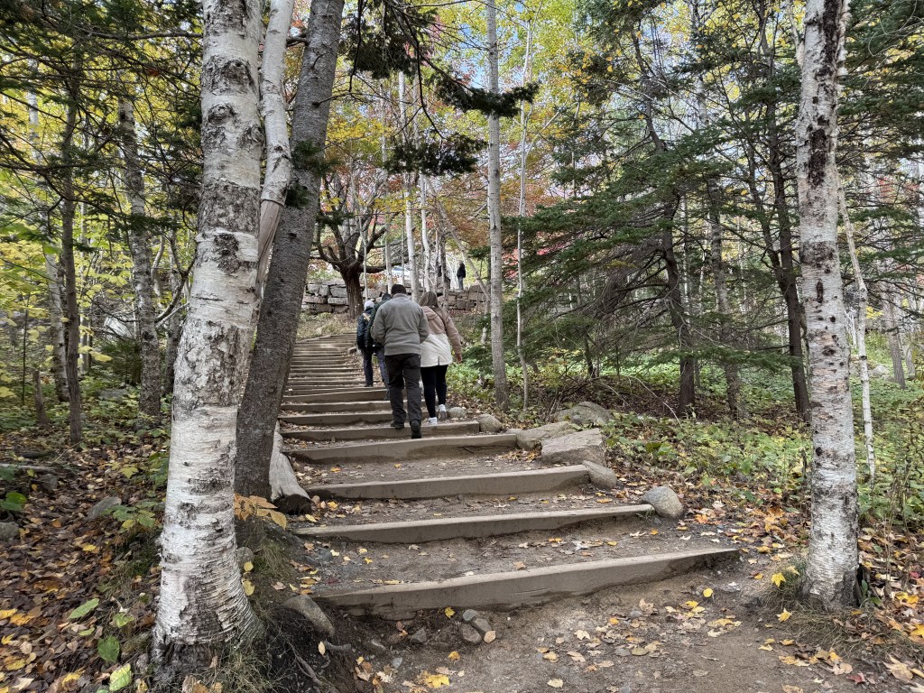
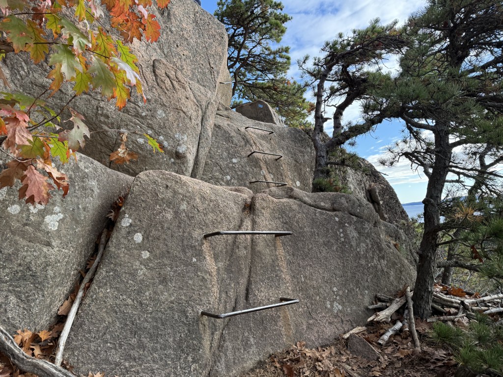
The Beehive is one of the most famous hiking trails in the park. Known for its steep climb up rungs of ladders and across pipe bridges, the journey is certain to take your breath away in more ways than one. From the top you will have sweeping views of the ocean and the rest of Acadia National Park. Instead of going directly back to the parking lot, extend the journey by going to down to “the Bowl” and/or climb the neighboring Gorham Mountain for a new perspective of the Beehive and the surrounding areas, which will also lead you back down to the parking lot using the Ocean Path Trail that parallels the coast. This coastal walk is easy and can be done on its own without the other climbs mentioned in this paragraph. If the weather is nice enough, you can go hang out at the nearby Sand Beach afterwards, where there is actually a sandy beach instead of rocky sea cliffs! This location provides one of the few opportunities in the park to enjoy the water by getting into it.
Another very popular destination in this region is Cadillac Mountain, which for about five months every year is the first place to see the sunrise in the USA (from early October to early March, the rest of the year this “first light” event occurs in two other locations not part of the park). From May through October, tourists do need to make a timed reservation to access the curvy road that leads up to the parking lot, which is basically right at the top and accompanied by a gift shop. For more information about acquiring a timed reservation to this attraction, follow this link about Cadillac Mountain on the official NPS website. If you are unable to get a reservation, you can still get to the top of the mountain by hiking there from several other trailheads inside the park using the interconnecting trail system. Note that the Island Explorer bus does not service Cadillac Mountain at all.
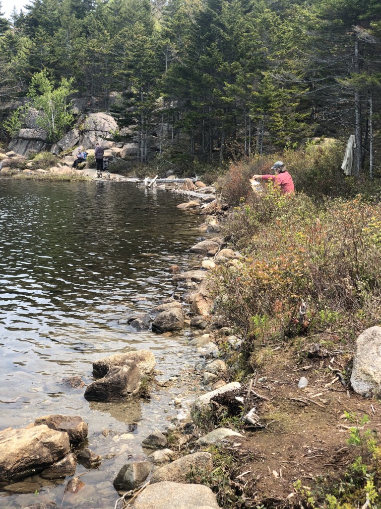
While I’ve not personally had an opportunity to visit Jordan Pond yet, it is one of the most popular destinations inside the park. Many people have recommended the cafe to me and walking the (mostly flat) Jordan Pond Path around the lake, a journey of just over 3-miles. The historic tea house here, called the Jordan Pond House, is famous for its popovers and tea which visitors may sip and eat on the lawn overlooking the water. The parking lot is massive so this place is always popping like its popovers, so be prepared to wait in line for a while. There is also a gift shop in the house. Nearby, hiking trails to “the Bubbles” and Jordan Pond Cliffs are also rated highly, and the Pemetic Mountain Loop trail also looks like a lot of fun for a more adventurous tourist. To learn about more hiking trails in the Jordan Pond area, follow this link.
Horses, bikes, and walkers alike are all welcome on this region’s Carriage Roads (map linked here), a network of relatively easy paths that weave around the eastern side of the island, connecting with many of the popular spots and hiking trails. This can be a relaxing way to slow down and enjoy some time in the outdoors without strenuous activity.
Some other attractions on the east side of Mt Desert Island that don’t require hiking include the Thunder Hole (with its gift shop nearby), Otter Cliffs and Point Overlooks, and Hunters Beach.
As you start moving toward the ocean on any part of Mt Desert Island, the park’s boundaries begin to blur a bit with privately owned areas. There are a few small coastal communities on this east side of the island (Seal Harbor, Asticou, and Northeast Harbor) where you may find various lodging, restaurants, gift shops, and other basic services, as well as near the Blackwoods Campground.


What to see on the Bass Harbor (western) side of Mount Desert Island
The previously mentioned east side of Mt Desert Island definitely has the most stuff going on in all the park, but there are still some things to do on the western side of the island. Much of this side is privately owned and not part of the park, so you will pass through more communities over here (Hall Quarry, Southwest Harbor, Manset, Seawall, Bass Harbor, Tremont, Bernard, Baldwin Corners, Richtown, West Tremont, Seal Cove, Pretty Marsh, Town Hill, and Red Rock Corner). You may be able to find lodging, restaurants, and other services in these areas.
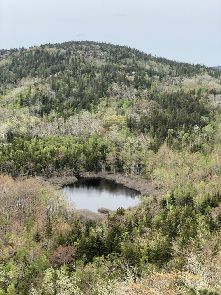
Most of the hiking trails on the western side of the island surround the Long Pond area. There are several mountains here with a variety of trails you can use to climb one or all of them, just choose a trailhead and follow the signs to reach the tops of Beech Mountain (840 ft), Mansell Mountain (948 ft), Western Mountain (807 ft), Little Notch (889 ft), Bernard Mountain (1070 ft), Saint Sauveur Mountain (679 ft), or Acadia Mountain (682 ft). These trails can also get you to the shores of Echo Lake and Long Pond, although swimming is not permitted at Long Pond.
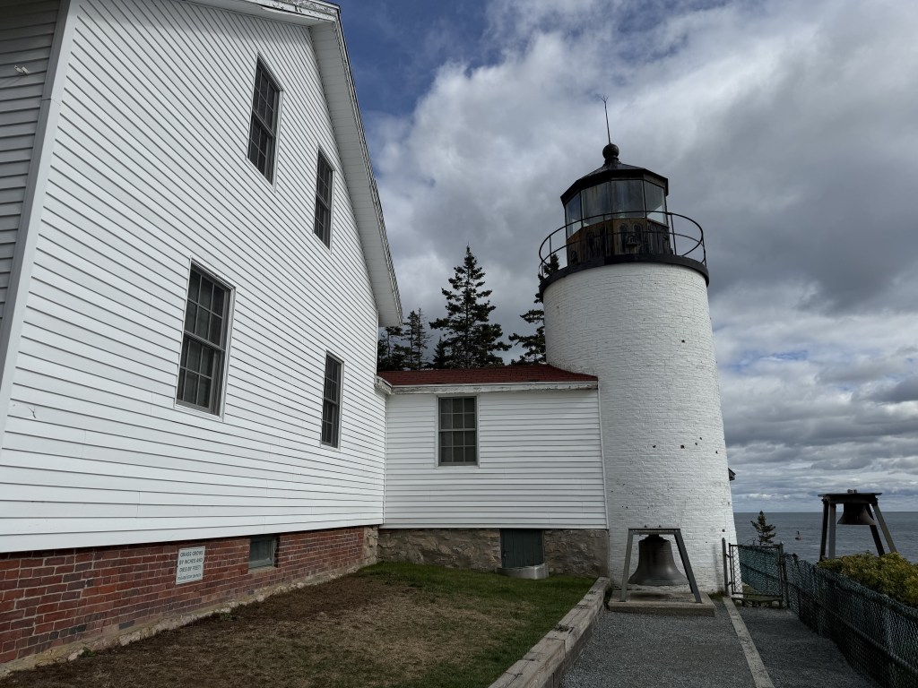
Drive all the way down to the southern tip of the island to see the park’s only accessible lighthouse, the Bass Harbor Head Light, a beautiful sight on a rocky cliffside accompanied by a super short hike. The lighthouse is not open to guests. Note that the parking lot is very small and only fits a little over a dozen cars, so you may be waiting in a line for a few minutes regardless of when you go. There are a few other short walking trails nearby, including the short Wonderland Trail which leads to some tidepools. Down in this southern area is also where the Seawall Campground is located.


What to see on the Schoodic Peninsula
Formerly a US Navy base, in 2002 the military discontinued operations here and handed the property over to the NPS, which is now included as part of Acadia National Park. Known today as the “Schoodic Institute” (official page linked here), there are a bunch of facilities that have been restored for tourism and educational purposes. It is the largest (of 18 total) educational operations in all of the national parks. Available to tourists are lodging and dining options, as well as event grounds that can be used to host up to 125 people. Ranger-led classes and programs are available for curious individuals and entire families to learn about the nature of the area (offerings vary by season). They also work with larger groups of students for field trips. The peninsula is also home to a large campground where there is a ranger station, which are separate from the Institute.
Getting around the peninsula is simple–there is a one-way loop road called Schoodic Loop Road, which according to the official website is about 6-miles in length and mostly follows the perimeter of the peninsula. From the town of Winter Harbor going south, you pass by the campground on your way to the tip of the peninsula where the Schoodic Institute is located, then it heads northeast towards Birch Harbor. In the town areas, there are a few little restaurants and shops to check out.
This part of the park is a little over an hour away from the Mount Desert Island area, and unless you are planning to camp or stay here, you may be able to see most of it in a half-day’s time. Aside from visiting the Schoodic Institute, the most popular activities here are hiking and biking. Most hiking trails in this region are 3 miles or less and rated “easy” to “moderate” in online spaces (follow this link to see the park’s web page on the hiking trails in the Schoodic Peninsula). Aside from biking along the one-way Schoodic Loop Road, there are several other biking trails in the area totaling just over 8 miles, which may also be walked instead of biked.
What to see at Isle au Haut
About half of the island is owned by the NPS and the remaining area is privately owned. There is a tiny little town on the island outside the official park boundary with a tiny little post office and general store, a cute gift shop, as well as some other small community locations, all of which are independent from the national park. Aside from that, there is a ranger station in town and a small primitive campground offered by the park (reachable with a 4-mile hike), and the dock in town. There is no hotel on the island, although if you search far enough in advance, you may be able to book a cabin-like rental. (Good luck, though.)
Ferry trips through “Isle au Haut Boat Services” on their Mail Boat from the city of Stonington are 45-minutes one-way, click here for their website where you will be able to see the latest rates and trip schedule. There is a second drop off point on the island at Duck Harbor available only in tourist season (late spring to fall) which is closer to the campground but further from the town. Your round-trip ticket will cost you about $44 as of 2025, and they operate on a first-come, first-served basis so you cannot reserve your spot in advance (arriving early for your desired trip is required). This company will also transport your bicycle, canoe, or kayak with you for an additional fee. They also offer a cruise to Seal Island which is a popular place tourists can go puffin watching (from a distance, as guests are not permitted to set foot on that island).
Isle au Haut can be explored in two ways:
- as a day trip where you will have several hours/about a half-day on the island between boat rides. The city of Stonington has plenty of available lodging options back on the mainland.
- as an overnight trip, where you are most likely camping, unless you successfully booked a rental home. You will need to bring all your equipment with you, so it is more of a backcountry camping experience (like backpacking).
Once you are there, the beautiful rocky-coasted island is best known for its remote ~18 miles of backcountry hiking trails, mountain biking, sea kayaking/canoeing, fishing and bird-watching. Note that the majority of the hiking trails here are rated as “moderate” difficulty according to online reviews.
For more information about visiting Isle au Haut directly from the NPS, follow this link.

Other things you can do in the park
Swimming is not allowed in most of the lakes and ponds within the national park. Much of these bodies of water are protected and used as local sources of drinking water. The ocean at Sand Beach, as well as Echo Lake Beach and Lake Wood are your options to take a dip if you are interested.
This park attracts a lot of birdwatchers (as do many of the national parks). Follow this link to see the NPS recommended spots to look out for them. From late spring through the bulk of summer, you can take a cruise to see puffins during their nesting season!
There are a few different spots in the park you can check out tidepools when the tide recedes twice a day including on the Schoodic Peninsula, the Wonderland Trail on the western side of Mt Desert Island, and Bar Island (which is only accessible at low tide using a land bridge from the town of Bar Harbor, people do occasionally get trapped there so pay attention to the timing of the tides!). The NPS has a lot more information on their tidepool page linked here. Please do not touch, bother, or destroy the homes of the critters in the tidepools.
Lots of people love fishing, but there are lots of rules which must be followed if you’d like to do so around here. In addition to acquiring a state of Maine fishing license, check here to see what else there is to know about fishing in Acadia National Park directly from the NPS.
Floating out on the water in some type of watercraft is a very popular activity, even the locals have established docks on many lakes, ponds, and harbors in the area. Each body of water does have different rules and regulations that must be followed when exploring this way. Do check out the official NPS page on boating (linked here), and note that various watercraft like kayaks, canoes, paddle boards, and motorboats are available to rent from many different vendors around the region. With that said, keep in mind that there is essentially a “no motor” rule in the lakes and ponds.
Bicycles are allowed on the main roads (NPS page linked here), so long as they are going the same direction as vehicle traffic, as well as on the Carriage Roads. If you are driving, please be aware of their potential presence and share the road. Note that the NPS does not recommend bicyclists to be out on the roads during the busiest times of day (listed as 10a to 4p), but you are free to do so if you choose. Your safety is your responsibility.
Stargazing can be done at night in most of the park. Check out the NPS recommendations on where some good spots might be, linked here. As this region is affected by some distant light pollution from some of the major cities in the northeast, you can still see some beautiful stars out there. The NPS is always looking into ways it can make changes to improve itself and reduce its own artificial light footprint, as many of the national parks have been doing in recent years.
While it is known today as Acadia National Park established in year 1916, this area has history going back centuries. For more information, follow this link to go to the NPS page about Acadia’s historic places and follow this link to learn about the native Wabanaki people.
Other nearby areas you can check out
Just to the south of Mount Desert Island is the lesser known area called Cranberry Isles, which is comprised of Great Cranberry Island, Little Cranberry Island, and a handful of other itty bitty islands. Little Cranberry Island is home to a little town called Islesford and the seasonally open Islesford Historical Museum which is technically part of the national park. This may be of interest to those looking for a more remote adventure with a small town vibe, as the towns on both islands also have several other shops and restaurants, yacht clubs, as well as some cabin rentals for anyone wishing to stay overnight. If you have a boat, this may be a cool place to check out away from the major crowds and explore the coves and beaches along their shores, and maybe go fishing. There is a ferry to reach the Cranberry Isles which operates out of Northeast Harbor on Mount Desert Island for the rest of us (more information on the Cranberry Isles ferry service linked here). One-way ferry fare is $9 (October to April) or $15 (May to October).
While it is not exclusively part of Acadia National Park, between the city of Stonington and Isle au Haut sits an archipelago known as Merchant Row which can be explored on your own by sea kayak or motorboat. For individuals with experience in the ocean, checking out these islands came as a very highly rated activity that I randomly stumbled across during my research.
Other things you might want to know before visiting
Crowds are absolutely insane in the fall season because the trees actually explode with color–this is a very famous spot for foliage. Be prepared to wait for parking in every single lot in the park. You will be driving around in circles. Your only option for avoiding this mess is to take the Island Explorer bus, although that will be packed as well. Arriving before sunrise will be your only opportunity to enjoy some potential peace and quiet before things get crazy.
During the rest of the tourist season, popular hiking trailheads like the Beehive will still be busy, so your best option is to plan to hike early in the morning or much later in the afternoon. By midday on weekdays, parking lots may start to clear out, but you may still end up waiting for a spot. Weekends will likely be packed at any time of day except first thing in the morning. Park tourism is increasing annually and it is unclear what future seasons will bring.
Trails and attractions are subject to plenty of seasonal closures due to the weather, but there are some instances areas are closed to the public due to animal activity, such as nesting season. These closures are usually posted at the top of the NPS website or on a board at the visitor center, so be aware that this is always a possibility during your trip.

My thoughts
Visiting this park during the fall season remains one of my favorite experiences in the northeast region of the US despite the chaos. The leaves on the trees literally looked vibrant as candy. The Beehive hike in the Bar Harbor area is still one of my all-time favorite hikes, although it is rather short, and I enjoyed it exponentially more when I extended it down to “the Bowl” and back up to Gorham Mountain. I didn’t know that I would need to make an advanced reservation to watch the sunrise from Cadillac Mountain, so I will need to return someday during this time of year to watch it, although I am not opposed to hiking up there instead…
While writing this post, I learned a lot about other areas of the park I didn’t know existed. I now have a lot of interest in checking out the Schoodic Peninsula, taking a backpacking trip on Isle au Haut, walking across the land bridge during low tide to Bar Island where there is a beautiful overlook of the town of Bar Harbor, taking a cruise to see the puffins during nesting season, and I would love to take a kayak or paddle board out in one of the ponds or lakes for a low key day on the water. I am also super pumped to have afternoon tea out on the lawn at the Jordan Pond House next time I’m there, whenever that might be. Hopefully the sun is shining and the wind is mellow!
Have you had the opportunity to visit Acadia National Park yet? How about during the fall season? Do you have any favorite spots or hikes? What did I miss? Let me know in the comments below!
Happy traveling! 😄
(And always remember to follow #leavenotrace principles!)
🩵


Leave a comment