Rainforests in Washington state? Incredible sunsets from black-sand beaches? Epic hiking to mountaintops overlooking other mountains, lakes, forests, the ocean, and sometimes even the northern lights? Whale watching? Cute little otters? All in one place? At nearly one million acres, Olympic National Park is the 6th largest national park in the contiguous 48 states, and one of the most biodiverse national parks in all of the country, protecting enormous areas of three completely different varieties of ecosystems. Regardless of when you visit, you will be in for quite the treat as you explore one of the most unique regions of the country, but prepared to get wet! Chances are, you won’t be able to avoid it…
Olympic National Park covers a significant chunk of the Olympic Peninsula of Washington state and is considered a UNESCO World Heritage Site for its rich biological history and incredible beauty. (Follow this link to learn more about this unique status.) There are many indigenous peoples who thrived in the coastal regions for centuries, and to my understanding it is the French and Spanish who first mapped out the mountainous regions here a few centuries ago. There are many legends from the different tribes about journeys people took through the mountains long ago, as well as lore from more modern times.
There are about a dozen different regions of the park to explore, so it is definitely advised to have your plan before you get there. Some regions are right next to each other and can be explored together in a long weekend, but other areas are so remote you would have to spend an entire week to see everything. I was overwhelmed by the seemingly endless options prior to my visits, and knowing what I know now, I definitely would’ve used my time there differently (although I made the best use of my time as I possibly could). Hopefully this post will provide you with some clarity on the best options for putting your trip together, as I am already looking forward to my next adventure here where I can use all this research to plan an epic, well-organized trip!


When to go and how long
Active travelers could easily spend more than a week exploring Olympic National Park. There is so much to do and see, your most difficult task will be trying to choose what to do. Some regions of the park are catered only to the more active individual. For those who are primarily interested in something more low activity or who have limited mobility, a few days would be great for getting a taste of what this park has to offer. This is a park you really need to get out of your car to experience, but either way, you do have a lot of options. Each area within the park is unique, but some are very similar offerings as others.
Summers are the most popular time to visit all the different ecosystems of the park, specifically July and August, which is considered “peak season.” Warmer weather brings with it great opportunities for various water activities as well as the capability to hike to some of the higher elevated regions in the park where there would otherwise be covered in deep snow. This is also when wildflowers will be in full bloom in the higher elevations.
Fall weather tends to get cold fast, as the park *could* start receiving snow at any time. It is known to be chilly, windy, and wet. Some areas see the trees change colors, although much of the natural foliage around here is evergreen, especially at high elevations. Check out the Hoh Rain Forest, Lake Quinault, and Lake Crescent for golden leaves estimated to peak in late October.
Winter tourism varies. For the most part, the high mountains will not be accessible due to snow. Many park roads will be closed, and for the most part guests will be limited to the lower coastal areas, lakes and rain forests. The climate at these lower elevations is more mild. This is also the wettest part of the year, so your chances of getting a clear day are not very high.
Early spring is a continuation of winter, with snow often continuing at higher elevations through April and occasionally all the way into June. At some point in April and May, roads begin to clear of snow and the interior of the park begins opening back up for the year. Once the snow melts away, the land is lush and green, and wildflowers start to pop up in the meadows and higher elevations.
As a general rule, each ecosystem is going to have a different climate and weather forecast, which can definitely complicate your planning. Deep in the rainforest, temperatures will be more stable with less extremes and there will be less wind. Beaches and mountains will be windier, as there isn’t any kind of natural windbreak. Lower elevations will be warmer than higher elevations, so up in the mountains it will be much cooler at any point in the year.
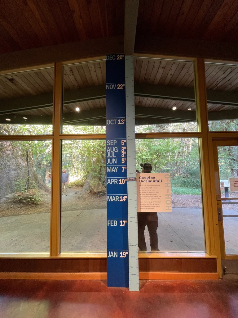
Precipitation amounts vary annually, but it is wettest from October to April, peaking in the winter. During this time, the area will likely see more cloudy days than sunny ones. The western side of the park receives significantly more rain and snow than the eastern side due to the geography and overall natural flow of the climate. Regardless of which season you plan to visit, I would recommend bringing along an umbrella.


Where to stay
Port Angeles, WA is one of the largest cities around the perimeter of the park and is also home to one of the park’s main visitor centers. It is centrally located and about one hour’s drive or less to each of the northern regions of the park: Hurricane Ridge, Deer Park, Lake Crescent, Elwha River Valley, and Sol Duc Hot Springs. Visitors could easily spend a long weekend in this area.
Forks, WA is a great home base for visiting regions on the west side of the park, and is about one hour’s drive from the entire western coastal region of the park from Kalaloch to Ozette Lake, Hoh Rain Forest, Queets River, and Lake Quinault. You could easily spend nearly an entire week exploring this side of the park if the weather is nice enough.
Olympia, WA is the city nearest to the Staircase region, which is a little over an hour’s drive away. The Staircase area is pretty remote and isn’t really close to any other regions of the park. It would be best visited as a camping trip on a nice weekend with good weather.
Olympic National Park has a bunch of official campgrounds. They vary greatly in size, accessibility, and amenities available to campers. For the sake of this post, I will be including relevant campsite information about specific areas at the end of each section, as there are simply too many to detail here and this section would be chaotic and ineffective for planning purposes. (There are 14 official campgrounds!) Note that many of these campgrounds experience regular closures due to weather and road closures, and many sites are first-come, first-served outside of the peak season (summer/early fall). There are also plenty of other campgrounds all over the peninsula that are not affiliated with the park.
- Deer Park Campground / Fairholme Campground (Lake Crescent area) / Graves Creek Campground (Quinault area) / Heart O’ the Hills Campground (near Port Angeles) / Hoh Rain Forest Campground / Kalaloch Campground / Log Cabin Resort RV & Campground (Lake Crescent area) / Mora Campground (coast area near Forks) / North Fork Campground (Quinault area) / Ozette Campground / Queets Campground / Sol Duc Hot Springs RV Park & Campground / South Beach Campground (coastal area south of Forks) / Staircase Campground (near eastern boundary of park)
In addition to campgrounds, the park also hosts lodges in the Kalaloch, Lake Crescent, and Lake Quinault regions, as well as a resort in the Sol Duc Hot Springs area. The cost of staying in the park will likely be higher than staying in the surrounding cities, although it will vary by season. Summer is going to be more expensive just about everywhere.
There are many opportunities for backpacking in the region. ALL overnight backcountry trips require guests to obtain a permit from the park in advance, and trips around the Cape Flattery area will also require a recreation pass from the Makah reservation. The permitting system is not only to protect the park and ensure it isn’t being runneth over by too many people, but also to keep track of who’s out there in case something bad happens so they know where to come looking for you. Follow this link to find out how to get your backcountry permit; there are several different ways to request one, and some areas have additional requirements. The most popular time of year for backpacking is late summer into fall, but year-round you are required to have this permit for overnight camping in the backcountry. There are small campgrounds/campsites sprinkled all over the trails throughout the park.
How to get there
The nearest major airport is the Seattle-Tacoma International Airport (SEA) which sits to the east of the park. From there you will likely want to rent a car to give yourself the most options for your trip, although you do have some limited options if driving is not an option.
If you have the means to, I would recommend driving, as this will give you the most flexibility and opportunity to see the park. Each area will require some driving time to get to, and there are many different regions. For reference to imagine how big this place is, to drive a full loop around the park you would be driving for roughly 6-hours without making any stops (and you would be missing the best views). This isn’t really the type of park you see from the comfort of your car because it is so heavily forested–you really do need to get out to experience it fully, although there are some roadside viewpoints scattered throughout. The Highway 112 Scenic Byway (aka the Strait of Juan de Fuca Highway) is one road you can thoroughly enjoy by driving, and it parallels the park’s northern coastline from the Port Angeles area to nearly the tip of Cape Flattery! Hurricane Ridge Road and Obstruction Point Road also have some nice views up at the higher elevations.
There are several regions that can be reached by bus, but many areas will need to be driven to as there really isn’t a public transportation system directly servicing this park. If you wanted to try to rely on local busses to reach some of the main areas, the Clallam County Transit System (route info linked here) services many of the cities to the north of Olympic National Park such as Port Angeles, Lake Crescent, and extends all the way to Forks. They also offer a seasonal shuttle up to Hurricane Ridge. The west side of the park is serviced by the Jefferson Transit Olympic Connection bus line (linked here) with stops in Forks, the general Hoh area, the Kalaloch region, Queets, and Quinault/Amanda Park. Bus lines are not direct from the airport to the park so there will be transfers regardless of where you are going, and once you arrive, you are pretty much on your own as far as park exploration. There really isn’t any public transportation to the southeastern area since the area is so far away from any cities and requires driving on dirt/gravel roads.
This page on the NPS website about road closures throughout the park is a helpful tool for planning your trip. Regardless of the season, this is definitely worth checking in on. Keep in mind that some roads are not suitable for RVs/trailers.
Food and money
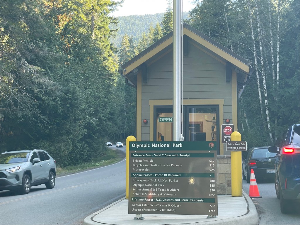
Prices around the area are on the higher side of average, but nothing too crazy. Lodging will likely cost more in peak season (summer and early fall). Lodging inside the park may be more expensive than doing so in the surrounding areas. Dining costs seem pretty reasonable, and are similar inside/outside the park. Save money by packing lunches and staying in hotels outside the park boundaries in local town areas, or by camping in one of the many campgrounds around the peninsula. Bus prices are pretty standard, although you may be transferring a few times and therefore paying more in fares overall. Gas prices are slightly higher everywhere on the west coast than they would be anywhere else in the country, so do keep that in mind if you are driving.
Although this part of the country isn’t really famous for any particular dishes, seafood is an excellent choice since it sits right at the edge of the ocean. This may also be a great place for salmon dishes in particular, as they seasonally migrate upstream in several different areas and spawn within the park itself. Washington state also has many varieties of wild berries, so any pastries, jams/jellies, ice cream, or other dishes that incorporate them may likely be a good choice.
What to see in the Port Angeles region
Port Angeles has plenty of services available from hotels, restaurants, breweries, grocery stores, retail shopping, basic community stuff, a sculpture garden, local history museum, and a public library (with the fastest Wifi I’ve ever seen). There is a paved walking/bike path down by the pier, as well as the Olympic Discovery Trail (ODT), which extends all the way from Port Angeles to the city of La Push on the western coastline. This all makes Port Angeles a great base camp for exploring areas like the close-by Hurricane and Deer Park areas, as well as anything from Lake Crescent to Cape Flattery.
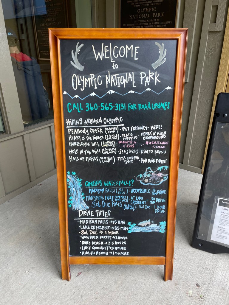
The Olympic National Park Visitor Center is located just at the edge of the city of Port Angeles at the foot of Hurricane Ridge Road. There is a small network of short nature trails here including the Peabody Creek Trail (which is dog-friendly) that highlights the creek and rainforest. At the visitor center, guests can check out a few informative exhibits and small gift shop. There is also a Wilderness Information Center here where you can acquire permits and rent bear canisters.
Driving up Hurricane Ridge Road leads to the Heart O’ the Hills Entrance Station/Ranger Station, where there is a campground and several trailheads. The Heart O’ the Forest Trailhead is about a 4.5-mile “moderately easy” round-trip trek through the rainforest. The Lake Angeles Trailhead leads to a “challenging” 12-mile loop through the rainforest, several mountains and ridges, and Lake Angeles. Go left at the fork in the beginning of the trail and walk a “difficult” 3.5-miles to reach Lake Angeles if you just want to visit the lake and skip the ridges, which ends up being a total of 7-miles round-trip out and back.
- Heart O’ the Hills Campground
- about 100 total sites, open year-round, first-come, first-served
- some RV-sized sites (no hookups) and lots of tent sites, potable water and flushing restrooms
- specifically listed as “family-friendly,” this is the closest campground to the city of Port Angeles
- follow this link to see NPS information about the Heart O’ the Hills campground area
What to see in the Hurricane Ridge area
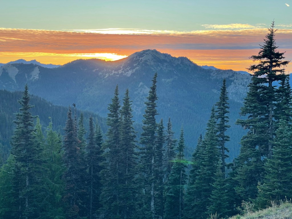
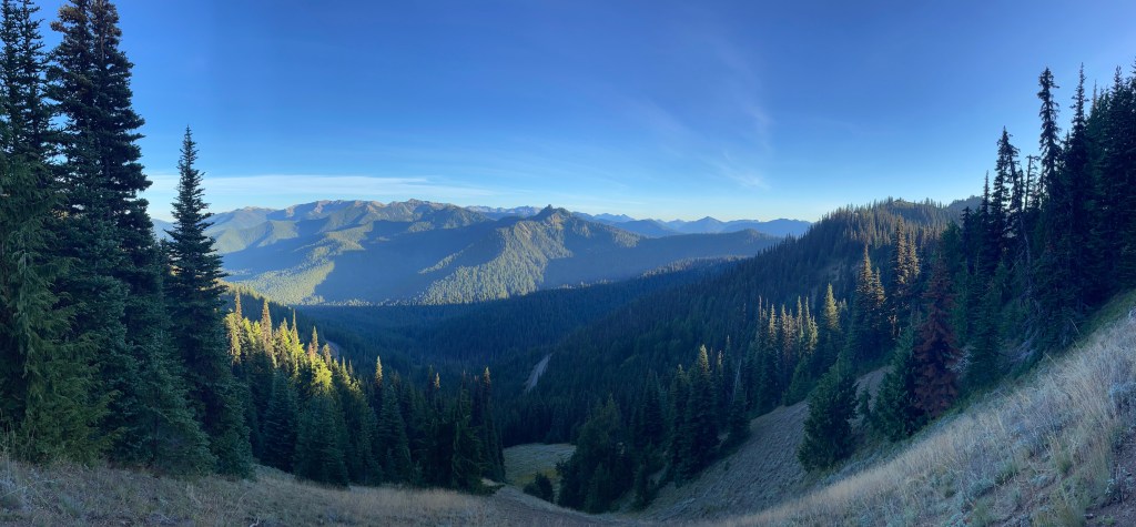
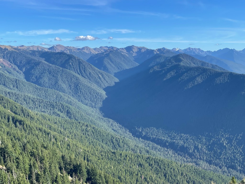
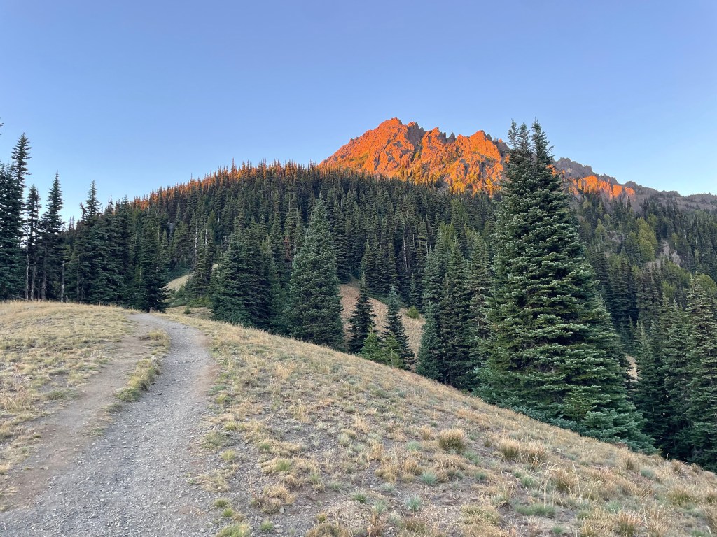
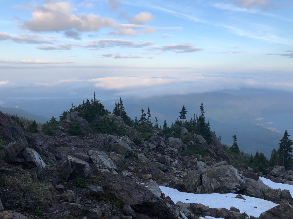
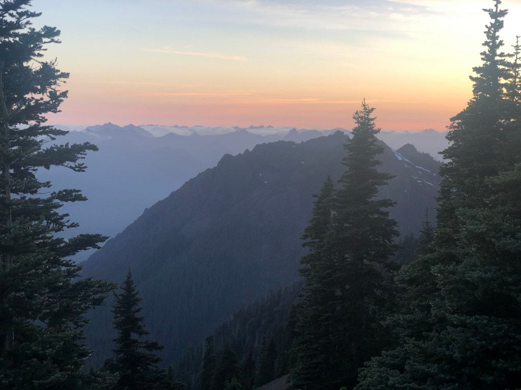
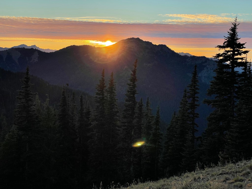
Hurricane Ridge is home to loads of epic hiking opportunities and is one of the park’s most popular destinations. There is a large parking area with beautiful views, and there are several different trailheads and trails of varying difficulties to reach some of the higher alpine locations and mountaintops. The views around here are truly breathtaking once you reach elevations above the thick forests below.
From the Heart O’ the Hills Entrance Station/Ranger Station, Hurricane Ridge Road leads back into a more mountainous area of the park. On the way up there, the road passes one small parking area at the Switchback Trailhead, which leads up to Mount Angeles and Klahhane Ridge, but this trail also extends all the way back down to Lake Angeles (closer to the Heart O’ the Hills area) as well as further up to Hurricane Ridge (next paragraph) if you wanted to turn either of those into a much longer hike. Note that the climb to the peak of Mount Angeles gets technical near the top and requires rock scrambling, and there is no clear trail path. Your route will determine how long your hike is since there are several ways to get there.
Hurricane Ridge Road leads up to a major parking lot at the top. Short trails to the north of the parking area include the Big Meadow Loop or the Cirque Rim Nature Trail (both are less than a mile) and the hike to the Sunrise Viewpoint is a little over a mile out-and-back. Longer trail options include taking the Hurricane Ridge Trail all the way to Mount Angeles where it connects to the Switchback Trail, Klahhane Ridge, and the Heart O’ the Hills areas.
Unfortunately the Hurricane Ridge Day Lodge/Visitor Center was lost in a fire in 2023. Currently closed are the cafe, gift shop, and equipment rentals, but temporary restroom facilities are available. It sounds like they started the construction to rebuild but it hasn’t been completed yet. There is a ski and snowboard area in this Hurricane region, usually open during the winter-time on weekends, so long as the road is clear enough to get up there. This is one of only a few ski lifts that remain operating inside the entire national park system, and the lodge will hopefully re-open by next season. You can still go skiing, snowboarding, snowshoeing and tubing/sledding in the area, but you do have to bring your own stuff or rent equipment elsewhere. The private company Olympic Hiking Co. offers a winter shuttle (follow this link for schedule information) to get up the mountain for anyone without chains or experience driving on snowy mountain roads. Public transportation can get you here in the summer.
On the south side near the parking lot is Obstruction Point Road (no RVs/trailers), which branches off from Hurricane Ridge Road and is said to be a nice scenic drive (although it is closed to vehicles in the off-season due to snow). It is common to see bicyclists out here and some people may choose to walk the road when the other trails in the area get too crowded or when it is closed to vehicle traffic. It is about 7.5-miles to the end of the road where the Obstruction Point Trailhead is located. There are a couple short trails along the way, including the PJ Lake Trail (rated “difficult” in online spaces) and Eagle Point Trail (“moderate” difficulty), both of which are about 1.5-mile round trip. At the end of the road, the trailhead leads to longer, more challenging trails that will bring you to several more other hiking destinations like Badger Valley, Elk Mountain, Grand Lake, Grand Pass, and Grand Valley. There are some multi-day trails back here fantastic for backpacking, such as Lost Valley and Obstruction Peak, and these trails will also connect to the Deer Park region (next section).
Just past the Hurricane Visitor Center parking lot on the far end, a narrow, winding road leads through a forested area to the Hurricane Hill Nature Trailhead and a second, smaller additional parking area. No RVs/trailers should use this road. The Hurricane Hill hike is the most popular in this region based on the quantity of online reviews, is rated as “moderate” difficulty, and is just over 3-miles round trip. Many people end up walking the narrow road from the main parking lot, so be aware there may be pedestrians around, especially on the busiest days.
- There are no major campgrounds in the immediate area, with the nearest overnight options near Port Angeles.

What to see in the Deer Park area
Access from Deer Park Road is just to the east of Port Angeles. The journey takes about 45-minutes to drive from the city as the road is not paved and weaves a curvy route through the mountains. This region is not accessible in the winter due to snow (usually October to June), and the campground is closed. Deer Park is a less popular area than its neighboring Hurricane region due to the complications in accessing it, but it does offer very similar hiking opportunities to guests. Some of the trails connect to those in the Hurricane area at Obstruction Point.
At the very end of Deer Park Road is a small parking lot at the Blue Mountain Trailhead. The Rainbow Shadow Nature Trail loops around from this parking lot to the top of Blue Mountain. The walk is less than a mile round-trip, and Blue Mountain is supposed to be a great place to watch both sunrises and sunsets, as well as a good opportunity to see the aurora on nights it is strong enough to see as far south as Washington.
Just before the road ends is where the campground is located, as well as several other trailheads. The Three Forks Trailhead has great opportunity for multi-day hikes that go out to Sentinell Peak, Cameron Pass, and Grey Wolf Pass. These trails can be looped around and connected back to Obstruction Point in Hurricane Ridge.
Near the campground is the Deer Park Ranger Station and Deer Park Trailhead, which provides a more direct route to Obstruction Point and some of the other spots in that region like Badger Valley, Elk Mountain, Grand Lake, Grand Pass, and Grand Valley.
- Deer Park Campground
- 14 total sites, open from June to October, first-come, first-served
- no RVs/tents only, pit toilets only, you must pack out all your own trash
What to see in the Elwha River Valley area
This little community sits between Port Angeles and Lake Crescent, and offers a few options for a more remote stay in a lodge or cabin-rental, none of which are affiliated with the park. There really isn’t anything in the area as far as services are concerned.
In this area on the east side of the Elwha River you will find a quick walk to the frequently visited Madison Falls from a small parking lot. Near the parking area is where the road closure begins, and the remainder of Olympic Hot Springs Road goes back to the Elwha Ranger Station (not in operation) and beyond, but this is all closed until further notice due to a road washout. The road is usable as a bike or walking path (with a slight detour at the washout) and follows the river upstream for about 9-miles, then leads to a 1.5-mile hiking trail and finally some natural hot springs. Bicyclists often ride this road but will have to ditch their bike for the last bit of trail before the hot springs. You might get this whole place to yourself since the round-trip journey to the hot springs is over 20-miles. To my understanding, these springs are not being maintained or monitored regularly by the NPS. There are several other hiking destinations in this area including Griff Creek, Glines Canyon, Humes Ranch, Cascade Rock, and more, but those are going to be longer distances.
On the west side of the river is the trailhead to the West Elwha River Trail, which follows the river up into the mountains. With the exception of Madison Falls, all of these trails are a lot less visited than most of the others in the area due to the road closure.
This area has been closed to vehicle traffic for many years and is said to be undergoing a “major restoration project.” No clear statements have been made regarding the timeline of its reopening to the public.
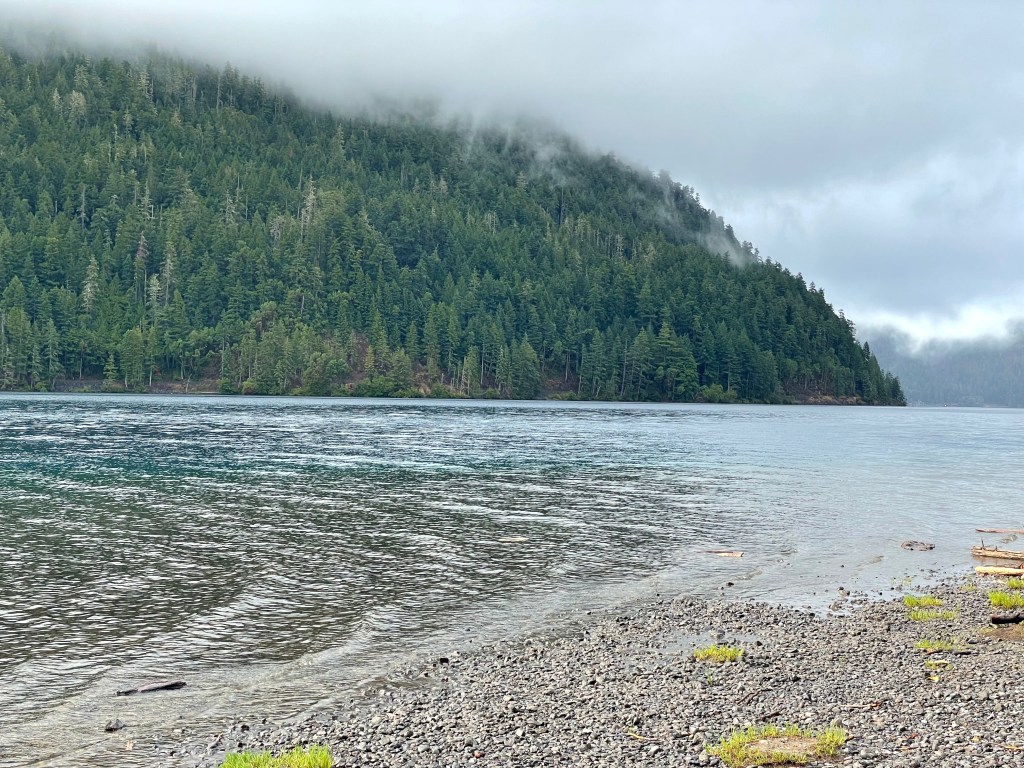
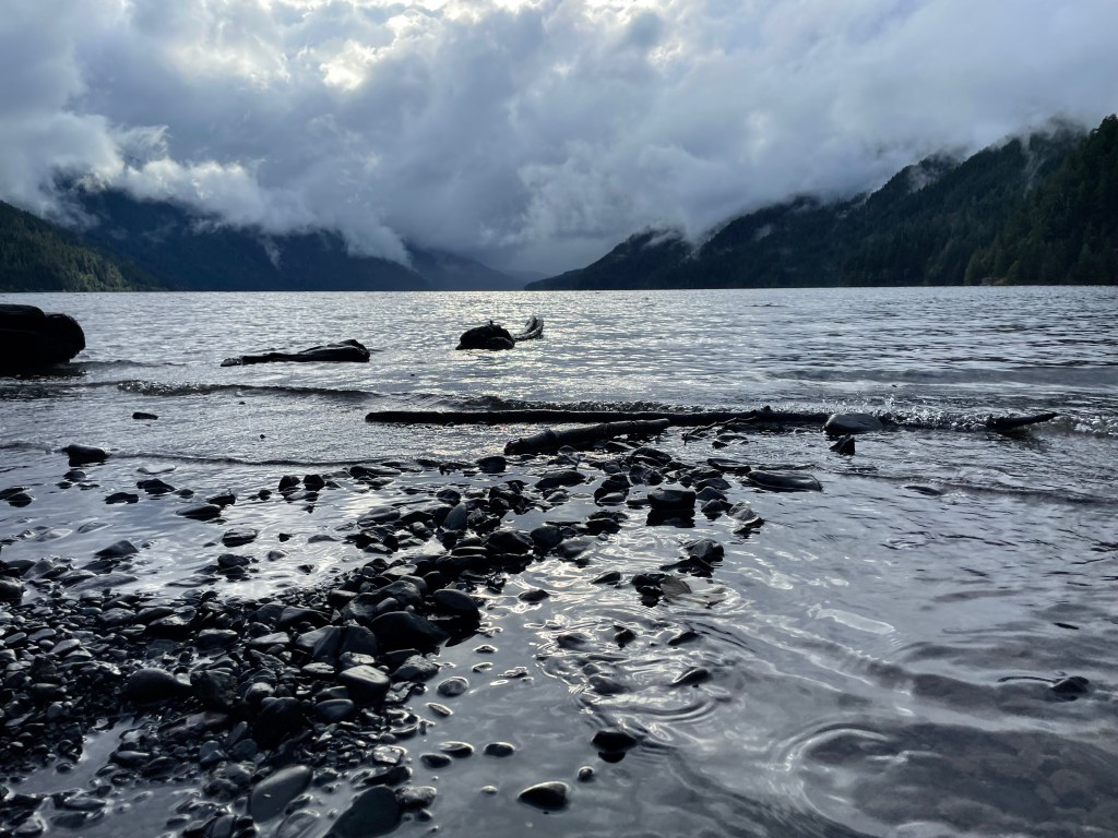
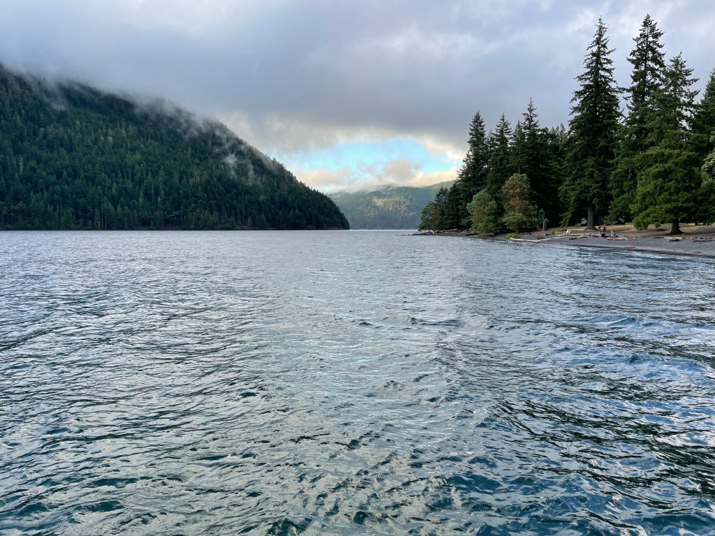
What to see in the Lake Crescent region
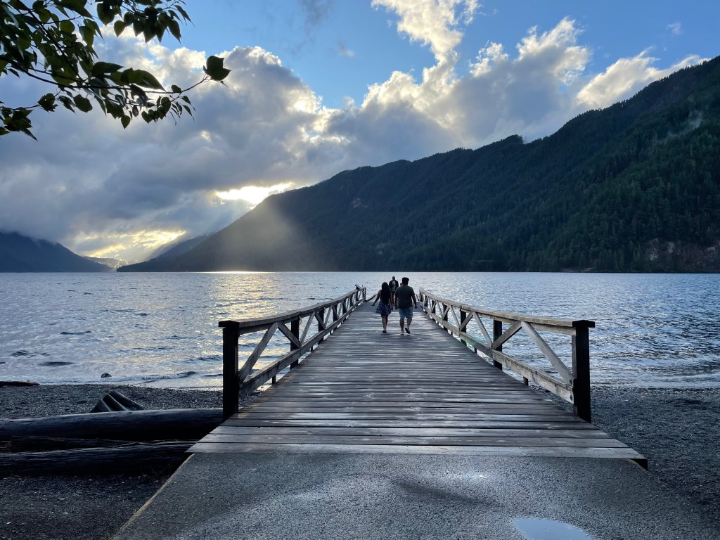
The Lake Crescent area is perhaps another one of the most visited regions in the park. The area near the Mount Storm King Ranger Station is a popular area with lots of parking, a gift shop, lodge, and restaurant, as well as several hiking trails and incredible views of the lake. Near the ranger station along the lake’s rim is the Lake Crescent Pier, and you can walk out on it for a really beautiful view as well as launch your own non-motorized boat or kayak.
One of the most notable hikes in this area is the walk to Marymere Falls, which is rated as “moderately easy,” and tracks at about 2-miles round-trip from either Marymere Falls Trailhead, there is one by the lodge and a second one by the ranger station, both of which require you to cross under Highway 101.
The Mount Storm King hike is one of the most popular hikes in the entire park and also departs from the Marymere Falls Trailhead at the ranger station. The journey is about 4-miles round-trip and has over 2k feet of elevation gain. It is much more difficult than the walk to the falls, and according to online reviews, includes some ropes to pull yourself up some of the steeper sections which can be especially slippery when wet. The views really do look like they’re worth the trouble though!
From the Storm King area heading towards the western side of the lake, there are several roadside pullouts with lovely overlooks of the lake, and some of them are also accompanied by picnic areas. You will also pass by the Aurora Creek Trailhead, a challenging nearly 9-mile round-trip hike with over 4k feet of elevation gain that leads up to Aurora Ridge and Peak.
At the western end of the lake is the Fairholme area. In addition to a campground (more info below), there is a general store open during the warmer months only, and in the summer offers boat rentals as well. The campground is right at the shore of the lake, and also has a boat launch area and a 3/4-mile walking trail loop through the rainforest, but is otherwise not connected to any major hiking trails. (Reviews say the hike isn’t really something to go out of your way for, but it makes for a nice little adventure if you’re camping there.)
Continuing in a clockwise loop around the lake on Camp David Jr. Road, you would next encounter Camp David Jr. County Park, a group event space that must be reserved in advance, and otherwise doesn’t really offer anything to guests (more Camp David Jr. info linked here). Just past that is the Pyramid Peak trailhead, a difficult, roughly 7-mile round-trip hike which leads up to Pyramid Peak where there is a small lookout structure and a beautiful overlook of Lake Crescent. This is not a frequently trafficked trail, likely due to the difficulty. Across the street from the trailhead is the North Shore picnic area. Camp David Jr. Road reaches a dead-end here, but a paved path called the Spruce Railroad Trail (also part of the Olympic Discovery Trail) continues from this point clockwise around the lake. Before it connects back to another road at the far north side of the lake, there is a tiny detour at Devil’s Punchbowl which includes a bridge popular for water activities. Online, there are lots of photos of people jumping into the lake here.
The Spruce Railroad Trail connects back to East Beach Road, which runs along the northeastern rim of Crescent Lake. East Beach Road branches off from Highway 101. This is where the Log Cabin Resort RV & Campground is located, and must be accessed from the east side of the lake if you are arriving by car. There are cabin rentals here and a small campground for RVs and tents, as well as the Sunnyside Café, a small general store, laundry facilities, e-bike and kayak rentals. Note that these additional services are only in operation during the busy season, usually May to September. East Beach itself is just down the road from the resort/campground, and is a very popular tourist spot for swimming and water activities.
- Fairholme Campground
- 88 total sites, open April to September, some sites are reservable, otherwise it is first-come, first-served
- some RV-sized sites and lots of tent sites, potable water and flushing restrooms, also has an RV dump station
- online reservations for Fairholme Campground can be made here with Recreation.gov from mid-May to September
- Log Cabin Resort RV & Campground
- 38 total sites, open May to September, call in advance to reserve a spot (official Log Cabin RV & Campground page linked here)
- RV sites with hookups, group and single tent-sites, cabin rentals
- laundry room, potable water and flushing restrooms with showers, also has an RV dump station
What to see in the Sol Duc Hot Springs region
Near the west end of Lake Crescent, Sol Duc Hot Springs Road branches off from Highway 101 and leads to the Sol Duc Hot Springs Resort about 12-miles back, and this drive is packed with some great opportunities to experience the park.
First you will pass by the trailhead for Aurora Ridge, a long and difficult but very peaceful hike that never actually rises above the tree line. This is not a very popular hike but may be of interest to you if you are seeking some solitude.
During spawning season for the local salmon population (late summer to early fall), you can stop at the Salmon Cascades Nature Trail and watch them as they travel upstream in the Sol Duc River and jump up the falls. This phenomenon happens several places inside the park, but this is one of the most easily accessible opportunities to witness it for yourself.
Next trailhead is the North Fork Trailhead, which follows the North Fork Sol Duc River upstream through the canyons and rainforest. Be aware that it is necessary to cross the river at some points in the trail. This is another very long and difficult hike looked over by most visitors which may be of interest to backpackers.
Just past that is the Ancient Groves Trailhead, a very popular path for experiencing the old growth rainforest up-close. This loop trail is less than a mile and is considered to be relatively easy, and gives visitors the opportunity to view some lovely mossy trees. This is the last trailhead along the route before reaching the resort and campground, although there is technically two trailheads (one on either side of the loop).
Just before arriving to the hot springs area is the park’s Eagle Ranger Station. The hot springs area with the resort and campground includes (3) mineral pools and (1) freshwater pool, all managed by the NPS, and can only be used when the resort and surrounding area are open to the public (seasonal). They have daily quotas as well, and operate on a first-come, first-served basis. Admission costs $12 to $18 per 1.5-hour soak, dependent on age. Purchase your tickets at the front dest of the resort. Discounts are offered based on military and disability status, as well as to large groups of 10 or more. They also offer towel rentals for $5. Food is available at the Springs Restaurant and gift shop when the resort is open.
There are a few hiking trails that depart from the grounds of the hot springs:
- Mink Lake Trailhead takes you on a “difficult” 5-mile round-trip walk to the lake and back through the rainforest. You can go further on this trail to other lakes as well.
- Lover’s Lane Trailhead can be used to walk to Sol Duc Falls (but there is a shorter route further up the road)
- B Loop Trailhead runs parallel to and between Lover’s Lane and the main road, it is said to be better maintained, also connects to Sol Duc Falls
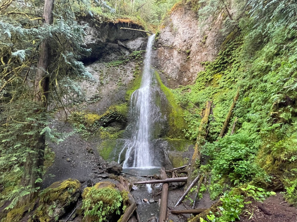
Sol Duc Hot Springs Road continues beyond the resort to a dead end where there is another parking area at the Sol Duc Falls Nature Trailhead. The journey to Sol Duc Falls is about 2-miles round-trip out-and-back, and for a longer adventure hikers can walk to Deer Lake (about 7-miles round-trip out-and-back), but this trail also leads deep into the park and connects with many other trails for those looking for a longer backpacking adventure. The Lover’s Lane Trail connects at Sol Duc Falls and can be used to return back to the campground/resort area.
- Sol Duc Hot Springs RV Park & Campground
- 82 total sites, open from about March to October/November
- full service campground, potable water, hookups and full restrooms available
- reservations for the Sol Duc Hot Springs Campground can be made at Recreation.gov (linked here), most can be reserved in advance but they do hold some for walk-up visitors
More information from the NPS about the Sol Duc region is linked here.

What to see in the Kalaloch coastal region (south of Forks, WA)
(going north from South Beach to the town of La Push near Forks)
South Beach is the campground by 1st Beach Trail where there is also a short nature trail. Heading north, there are 3 more numbered beach trails. The 2nd Beach Trail is a quick walk from the road and no major parking lot. Up the road a bit more is the Kalaloch area which has a lodge and campground, lots of parking, and another opportunity for beach access. There is also a little gift shop at the lodge, along with a dining option at the Creekside Restaurant.
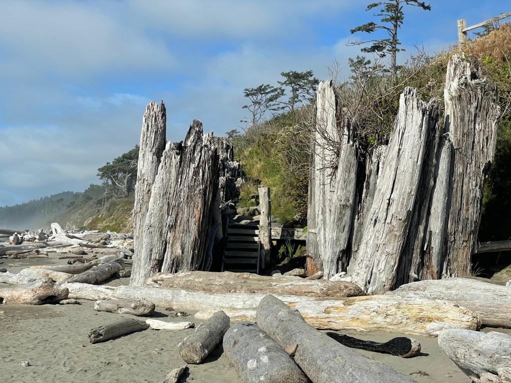
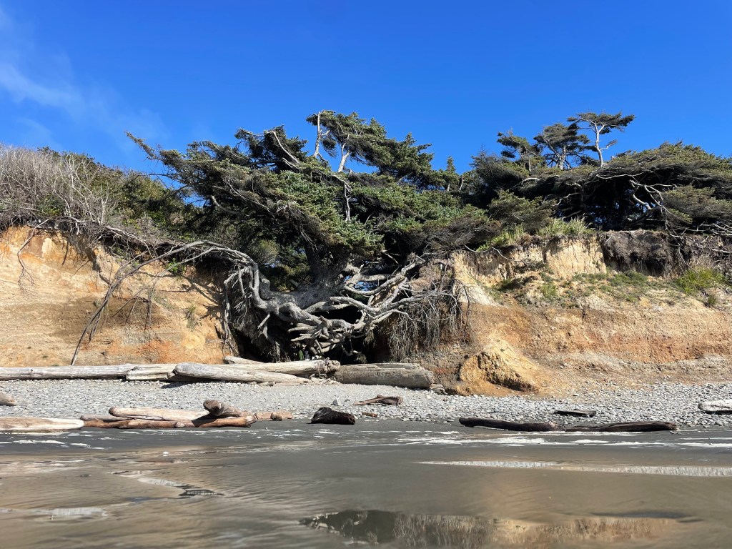
The famous Tree of Life is located just north of the Kalaloch Campground; however, its days are numbered. Once a massive tree thriving atop a cliff, its roots have been washed away over years of rainfall and erosion. If you search online for photos of this epic tree, you will notice that it is sinking closer and closer to the beach level, and as of my visit in September 2024, it seems to be almost there. Several trailheads provide access to the tree. You can come straight down to the beach from the campground, or park north of the tree on the side of the road and walk south for a bit of a longer, quieter walk. It’s up to you. Please be respectful and do not try to climb the tree or mess around with its roots so more people have the opportunity to see it before its presence is washed away with the sands of time. Side note, there is also a nature trail near the Kalaloch Campground where you can walk through a rain forest area for 1.5 miles.
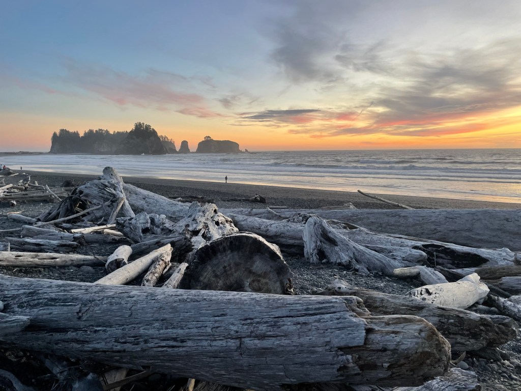
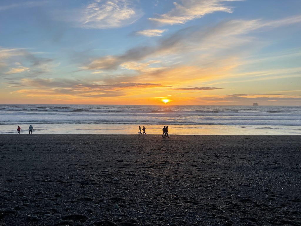
Up the road a little more is 3rd Beach Trail with another short walk from a roadside parking area, and quickly after that is the 4th Beach Trail which is accompanied by a public pit toilet and small parking lot. Continuing north towards Ruby Beach, you will pass the Big Cedar Tree, a short detour on the landlocked side of the road. The tree is a quick walk from the parking lot. There a couple more “unnamed” beach roadside access points before reaching Ruby Beach, which has a large parking area. Here is a picturesque sandy beach with tide pools, lots of driftwood, and some really big rocks. This is a pebbly black sand beach (not soft sand). On a clear day, it would be a lovely spot to enjoy the sunset. This area is also one of the park’s recommended spots for observing tide pools.
There is a brief break in park protected coastline at this point, and you will drive across the Hoh River here. The Oil City Beach Trailhead is on the north side of the river, which leads to some beautiful sandy beaches with some paralleling cliffs and forests. This is a long, uninterrupted stretch of coastline with no road access, and depending how far you walk, would provide a great opportunity to get some solitude.
Finally upon reaching the town of La Push at the northern mouth of the Quillayute River, there are several more “numbered” beaches with their own nature trails/access points in addition to a community with a few restaurants, lodging options, and other services.
Just east of the towns of La Push (south of the river) and Mora (north) is Forks, Washington, which is the largest city on the western side of Olympic National Park. Forks would make a fantastic base for tourists looking to spend a few days exploring the west side of Olympic National Park. This town is apparently incorporated into the Twilight film series in some way (I’ve never seen the movies so I don’t actually know), but it attracts some extra tourists for this reason, specifically La Push.
- Kalaloch Campground
- 170 total sites, open year-round, reservations required from May to September but otherwise first-come, first-served
- flushing toilets, potable water, and a dump station available, no RV hookups
- reservations for Kalaloch campsites can be made here on Recreation.gov
- South Beach Campground
- 55 total sites, open May to October, first-come, first-served
- flushing toilets available, no potable water
Find more information about the Kalaloch region from the NPS linked here.

What to see in the Ozette coastal region (north of Forks, WA)
(going north from the town of Mora near Forks to Makah National Fish Hatchery)
On the northern side of the Quillayute River is the community of Mora, where you won’t really find any services like restaurants or lodging as most of that is on the south side of the river in La Push or inland towards Forks. There is a park official campground at Mora, though, and Rialto Beach is a very famous spot in this area. The mostly flat coastal walk is less than a mile from the town of Mora or you can park at the beach, and if you continue along up the coast, a mile later you will see the Hole-in-the-Wall Rock. This beautiful coastline is popular to photographers with its giant rock “haystacks.” As with all the other beaches in the park, be aware of changing tides, and also note this is one of the best spots in the park for observing the tidepools. There are also some dispersed camping options in this area (permits required).
In between Mora and the Ozette Lake community is an extremely long strip of coastline that is protected by the national park and is a beautiful place to walk and relax on a sunny day or watch a sunset so long as you don’t mind walking back in the dark. The uninterrupted coastline can be accessed from either end.
Ozette Lake is home to another official park campground. Many hiking trails lead from here to the beaches of the ocean, but will require individuals to walk a bit further than some of the other access points, with a roughly 3-mile hike each way. North of the lake are a couple more opportunities to see shoreline, including the notable Shi-Shi Beach. Recreation in this northern region is also part of the native Makah Reservation, and in addition to your park admission you are required to obtain a recreation pass from them as well. There are several other beaches in this northern area but some of them are not part of the national park, including the ones at the tip near Cape Flattery, the most northwestern point in the contiguous 48 states. From here you can even see Canada off in the distance!
- Mora Campground (near Forks)
- 94 total sites, open year-round, reservations required from May to September but otherwise first-come, first-served
- flushing toilets, potable water, and dump station available, no hookups
- reservations for Mora campground can be made here
- more details about the Mora area from the NPS is linked here
- Ozette Campground ***currently closed due to a road washout***
- 15 total sites, open year-round, first-come, first-served
- pit toilets and potable water available
- more information about the Ozette Lake area from the NPS is linked here
What to see in the Hoh Rain Forest region ***currently closed due to a road washout***
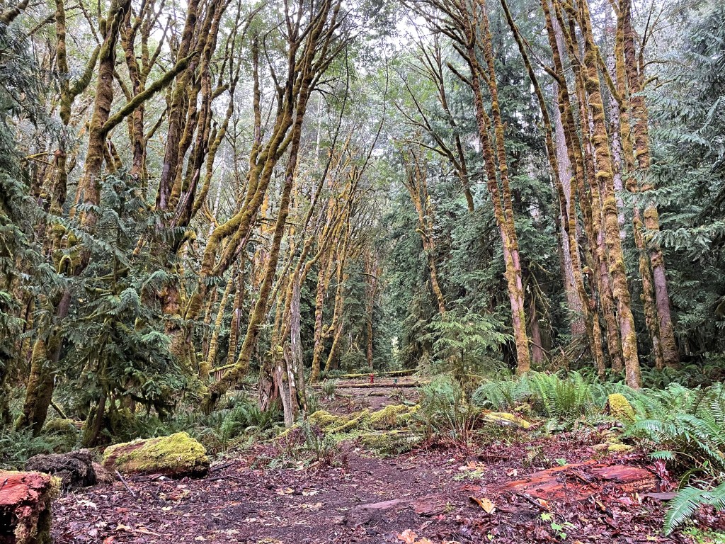
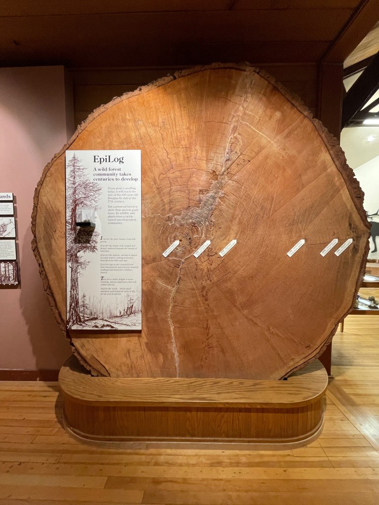
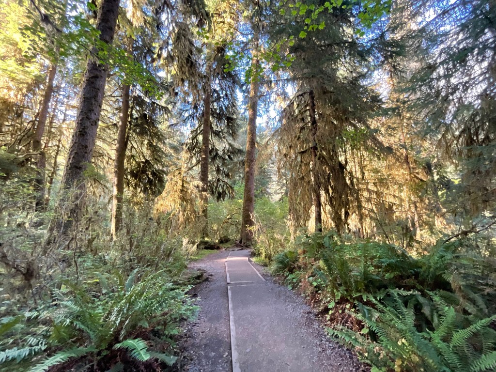
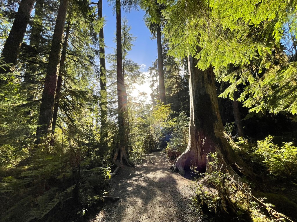
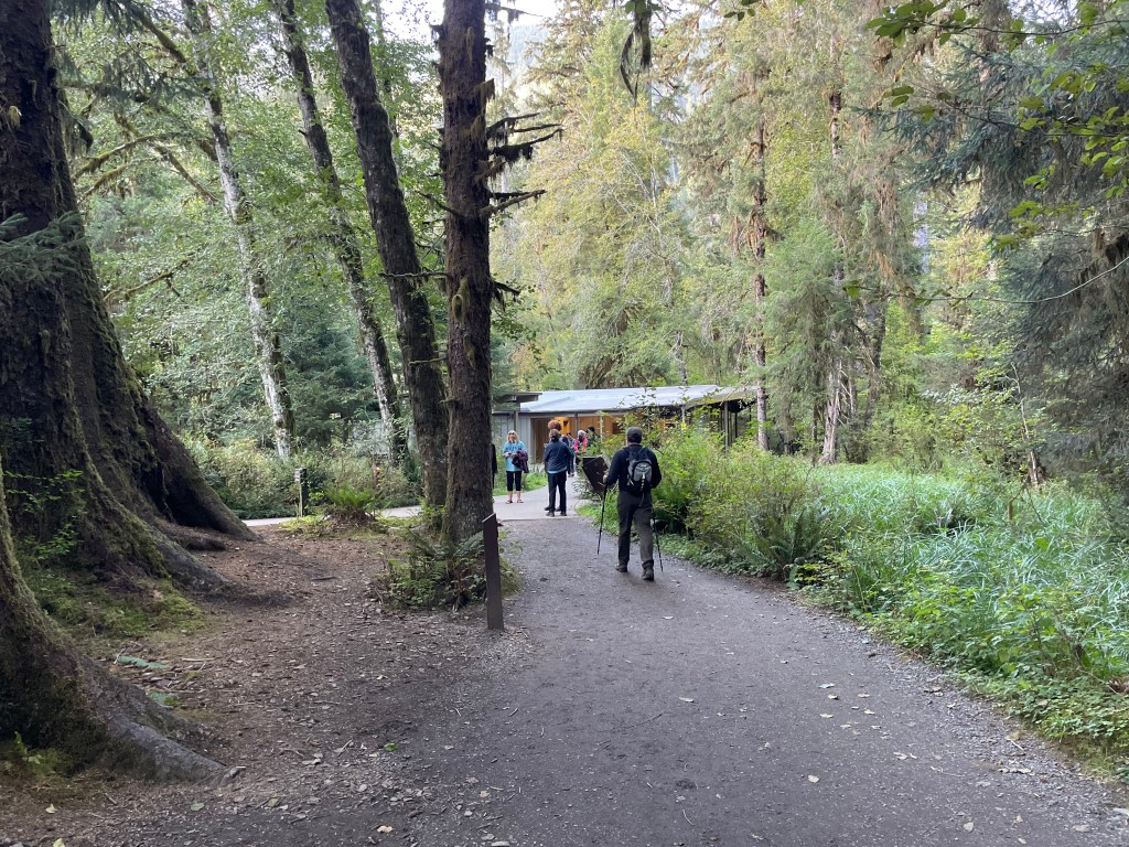
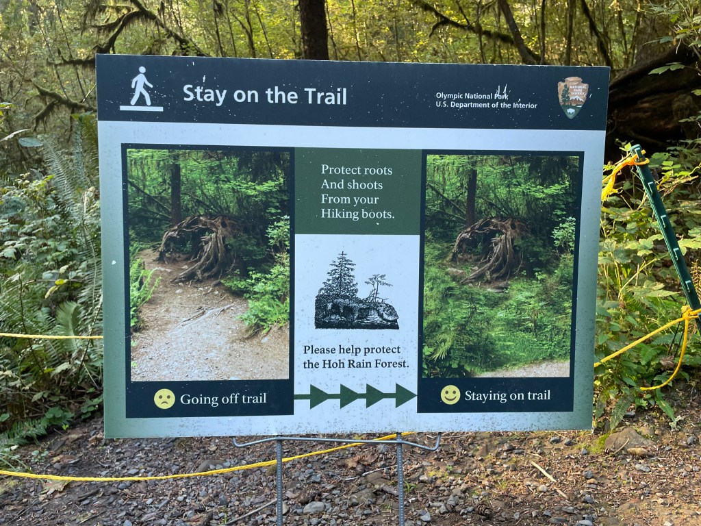
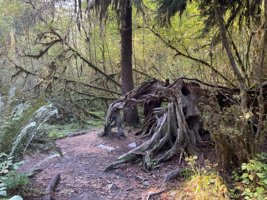
While there are many different spots within Olympic National Park where you can walk around the rainforest, the Hoh region focuses more heavily on it. This region is accessed by driving the beautiful Upper Hoh Road where it branches off from Highway 101 south of the city of Forks. A short loop trail that is about 1-mile departs from the Hoh Rainforest Visitor Center and leads guests through a beautiful mossy area referred to as the Hall of Mosses. This highly popular trail doesn’t take too long and is rated as “easy” in online spaces. The path is not paved and does have a few stairs to climb, but you will encounter some lovely scenery and photo ops while walking. There is a tiny network of interweaving trails in this area and you could see everything by walking a couple miles.
Also from the visitor center is the trailhead of the mostly flat Hoh River Trail which leads deep into the park’s interior to places like the west side of Mount Olympus (the highest peak in the park at 7,980ft), the named Blue Glacier (a highly studied glacier for scientists), and other glacier fields, which are melting rapidly and may be completely gone within the next century at their current melting rates. Most of those trails will require backpacking/backcountry experience and some will even require rock-climbing. Note that any overnight trip inside the park requires a permit. As those spots are not really the type of journey you do in one day, you could still make the trek on the Hoh River Trail through the rainforest to Mineral Creek Falls (about 5.5-miles round-trip) or Five-Mile Island (about 10-miles round trip) from the visitor center.
This area is otherwise pretty small. The road leading to the visitor center is very pretty and parallels the Hoh River. There is also a ranger station and campground in this area.
- Hoh Rain Forest Campground ***currently closed due to a road washout***
- 78 total sites, open year-round, reservations required from June to September but otherwise first-come, first-served
- flushing toilets and potable water available, no RV hookups
- when the road is repaired, reservations for the campground can be made here
*Unfortunately in December 2024, Upper Hoh Road was washed out and currently there are no immediate plans to restore it. It is unclear when this issue will be resolved.*
What to see in the Queets River area
This region of the park is a small, narrow strip lining either side of the Queets River from the coast at its southern point near the Kalaloch area and upstream to where it connects back to the bulk of the park, protecting both the river and it’s neighboring rainforest. Lower Queets Road is not a thru-road and a portion of it closed many years ago due to a landslide on what was formerly just “Queets Road.” The NPS built a new route to reach the area at Upper Queets Road. The road is not recommended for RVs/trailers. The area sits at a lower elevation and may be less prone to major seasonal road closures due to snow, and is almost open year-round. It is visited less often than many of the other regions of the park and is somewhat more difficult to access, but does attract boaters and fishers as there are 3 different boat launching points along the riverbed (Hartzell Creek on Lower Queets Road/Streator Crossing and Queets Campground on Upper Queets Road).
There is a small unstaffed ranger station tucked away upstream along with the small campground, but there are otherwise no services in the area. You are on your own out there. There are two noteworthy hiking trails: 1. Sam’s River Loop Trail, a 3-mile loop along the riverbed and through rainforest, mostly flat but you may be walking through a bit of water, and 2. Queets River Trail, a trail that follows the river upstream for many miles through the rainforest, it does not connect to any other park trails as it gets deeper into the park.
- Queets Campground
- 20 total sites, open year-round, first-come, first-served
- pit toilets only, no potable water, primitive sites
For more information on the Queets region, follow this link to see a map of the area by the NPS.
What to see in the Lake Quinault area
Lake Quinault is a very popular area of the park catered to tourism and seems to be well-known for its sunsets, hiking, biking, fishing, and watercraft opportunities. There are two small first-come, first-served campgrounds included as part of Olympic National Park, but the lake has several other camping opportunities around its perimeter outside the national park boundary which can be reserved. The town of Amanda Park sits on the west side of the lake and offers basic services like a grocery store, gas station, restaurant and coffee shop. You can even get here from Seattle using public transportation (route linked here).
Lake Quinault is also home to several hotels, including the park’s own Lake Quinault Lodge, which also has a gift shop, heated indoor pool, historic dining room with a beautiful view overlooking the lake, various tours, and watercraft rentals. Some popular activities include biking the loop of road around the lake, exploring the area on foot by hiking trail, fishing in the lake itself or lower Quinault River (unique rules apply in this region due to it also being part of the native Quinault Reservation), and relaxing on the shores of the lake. If you’re not planning to stay overnight, this is also a great place for a picnic pitstop, especially if you are planning to visit the nearby coastal areas at Kalaloch. Near the lodge is the Quinault Office of the Olympic National Forest (check operating hours in advance, it varies by season/day of week), which is where you can pick up and request backcountry permits as well as rent bear canisters if you are planning a multi-day hike.
For the most part, the hiking trails in the immediate area at the lodge all explore various creeks and the rainforest surrounding the lake. You could potentially make your hike as short as a half-mile, or connect a few of the trails around the lodge and walk a handful of miles.
Just up South Shore Road from the lodge going counterclockwise you can check out the world’s largest Spruce Tree, a short walk from the parking area. South Shore Road then breaks from the lake and heads east into the rainforest. The next trailhead, Colonel Bob Trail, is a difficult roughly 13-mile trek round-trip through the rainforest and up to the peak where you have views of the lake, neighboring mountains, and even the ocean in the distance. I would only recommend this for highly active hikers seeking a challenge as the trail has over 5k feet of elevation gain. Reviews say there aren’t any sweeping mountain views until the end of the hike. Near the top of the trail, keep left at the fork.
Just past the trailhead for the Colonel Bob Trail is a waterfall on the side of the road, called Merriman Falls. No hiking necessary. South Shore Road goes back several miles before it connects to North Shore Road. Along the route is the Fletcher Canyon Trailhead, a moderately difficult walk through the rainforest by a creek, about 4-miles round-trip.
Where it connects with North Shore Road, South Shore Road turns into Graves Creek Road. Several miles back from that point is the Graves Creek Campground, which has a short nature trail and the Graves Creek Trailhead. This seems to be a great point for embarking on longer multi-day trips through the backcountry to places like the Six Ridge Trail, Dosewallips Trail, Enchanted Valley Chalet, O’Neil Pass, and Anderson Glacier, among other destinations. For those who just want a single day adventure near the campground here, the moderately difficult journey out-and-back to Pony Bridge is about 5-miles, or there is a more challenging 16-mile round-trip climb up-and-back to/from Lake Sundown.
North Shore Road is also packed with great hiking opportunities. At its easternmost point is the North Fork Campground, and trailheads that lead back into the mountains for more multi-day backpacking trip options such as Skyline Ridge (which looks incredible). For something shorter, Irely Lake is a relatively easy 2-mile round-trip walk from the campground and back. Most of the other hiking options on North Fork Road are closer to Lake Quinault.
At the north shore of Lake Quinault is the Maple Glade Nature Trail and Kestner Homestead Trail, both quick easy walks in the rainforest, and at the lake itself is a picnic area and the trail to July Creek Overlook. Each of these three trails are all about a mile or less. There are also some other resorts and cabin rentals at the north shore, along with the park’s Quinault Rain Forest Ranger Station where visitors can purchase gifts and learn about the park. Operating hours are limited (check in advance).
- Graves Creek Campground
- 30 total sites, open year-round, first-come, first-served
- pit toilets year-round, running restrooms in summertime, no potable water, mostly primitive sites
- North Fork Campground
- 9 total sites, open year-round, first-come, first-served
- pit toilets only, no potable water, primitive sites
Follow this link to see some official information from the NPS about the Lake Quinault region.
What to see in the Staircase area
There aren’t really any “major” attractions that bring tourists in large numbers to spots in this region; and because this remote area is so far off the beaten path and only open seasonally, it is visited less often than some of the other regions (based on the number of reviews the hiking trails have compared to those other regions). The nearest major city is Olympia, WA. Vehicle access is seasonal and based on the status of Staircase Road. Accessing Olympic National Park from the southeast requires visitors to drive through other wilderness areas that are not officially part of the national park, although they are still protected areas. There are numerous other camping options in the area.
The campground here is just beyond the northern end of Lake Cushman near the riverbed of the North Fork Skokomish River. There are no services in the area aside from the Staircase Ranger Station (open during summer season only), where you can get additional park info, obtain permits, and rent bear canisters if you are planning to be out in the backcountry. Lake Cushman is close enough to check out in the area for swimming, boating, fishing and enjoying picnics, although it is not part of the park. On days with nice weather, it will likely be packed with visitors.
Hiking options are abundant both inside and outside the park boundary. Directly at the campground, there are 4 trailheads: North Fork Skokomish Trailhead, Wagonwheel Lake Trailhead, Shady Lane North Trailhead, and Staircase Rapids Trailhead. Choose your own adventure! The 2-mile Staircase Rapids Loop Trail is the most popular, and most of the other trails are a lot longer.
I did the trail to Mount Ellinor (just outside the park boundary in the Mount Skokomish Wilderness) and it was one of my favorite hiking experiences in the state to date, and I imagine that a lot of the trails around here offer similar experiences to the Deer Park and Hurricane Ridge regions due to their location and mountainous terrain. If you’re planning to go hiking anywhere on the southeastern side of the park, just know you are kinda on your own. Most of the roads back here are dirt/gravel, and I would recommend driving a car that has some decent ground clearance although you should be okay with any standard vehicle.
- Staircase Campground (at the southeastern boundary near Lake Cushman)
- 49 total sites, open May to September, reservations can be made on Recreation.gov (linked here)
- if the unpaved access road is still open in October, sites are available for walk-ups
- flushing toilets and potable water available when campground is open
For more details about the Staircase area, see the NPS web page linked here.
Other activities you can do around the park
There are a few places that are particularly attractive to bicyclists (such as the Spruce Railroad, Hurricane Ridge/Obstruction Point Road, Lake Quinault area, and the Olympic Discovery Trail) and there may be private tours available. Bikes are not allowed on most park trails and are primarily limited to paved areas. If you are driving, please be aware and share the road if you see anyone.
Olympic NP has many ranger stations, visitor centers, information centers, and park-official campgrounds. Check in with one of them to see if there are any ranger-led activities or talks in the area, they will vary depending on which areas you are in. Busier areas during the busier seasons will be more likely to have something, but there aren’t really any guarantees there will be something going on while you are there.
The night sky can be seen here from the coasts and the mountains. Despite experiencing some light pollution from the neighboring city of Seattle, you can still see plenty of stars up there, and on some (very) rare occasions, even the northern lights even put on a show. Check here to see if the park is offering any programs during your visit after dark. This is more of a summer activity since they see a lot of clouds and rain during the other seasons of the year, but any clear night is a good opportunity.
Boats, kayaks, canoes, and paddle boards are all popular activities for those looking to spend a day (or a dozen) out on the water. The NPS page actually has a lot of good information on their boating page (linked here) about the coastline, lakes and rivers, and rules and regulations. Various rentals are available in different areas around the park, but be sure to do that research and make your plan before you get there!
Fishing is a popular activity for both boaters and non-boaters. Follow this link to learn exactly where in the park you can fish, and what the rules are in each location directly from the NPS. Also be aware that if certain fish populations are low they may ban fishing entirely in some regions for the entire season, or until there are signs of improvement. Some locations or types of fish are catch-and-release only.
Observing tidepools is a popular activity in the coastal areas of the park. The NPS has some great information on where to see them (linked here) and what to look for (linked here). Please respect the homes of these critters and leave them in peace.
Go whale watching–there are several companies that offer tours out into the ocean on a boat looking for whales (Port Angeles and Kalaloch). It doesn’t seem that they are officially affiliated with the NPS so you will have to book them through private companies. Best times of year are said to be April/May (peak) and October/November. It is noted that you will likely see lots of other sea life as well, like otters and sea lions! Animal watching on land is also popular.

Other things you might want to know before visiting
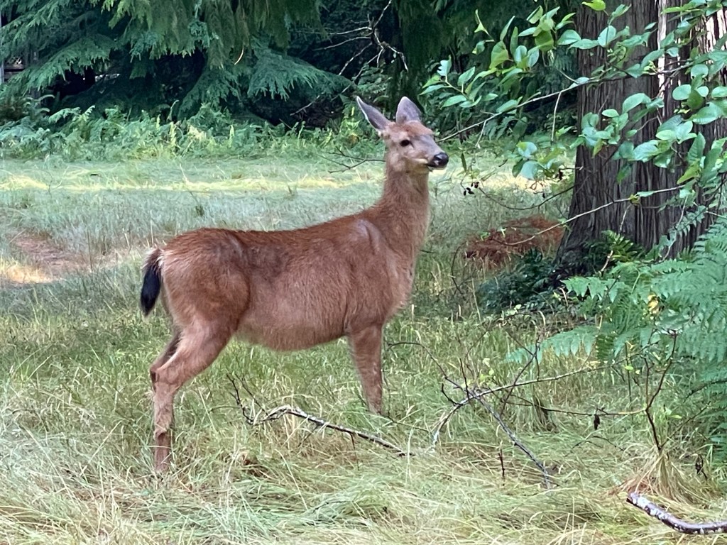
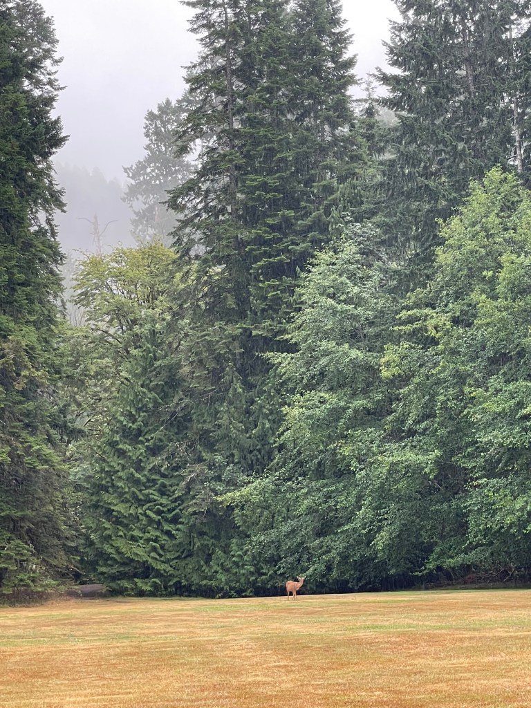
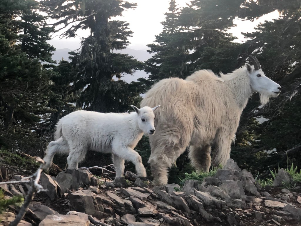
Animal sightings are common anywhere in the park, and we need to respect all wildlife for both theirs and our own safety. Be alert and always on the lookout for black bears, cougars, deer, elk and goats. Check out the NPS page linked here for some park official information on bear safety. They’re usually more afraid of you than you are of them, but I wouldn’t f*ck around and find out if I were you. Do not feed or harass the wildlife under any circumstance.
Reception is inconsistent through the park, but you can usually find some near the main roads and towns. Once you start getting deep into the nature of the park and its surrounding areas, most cell service will probably be spotty at best, if not nonexistent entirely. Wi-fi is available at the park lodges and resorts in the Kalaloch, Lake Crescent, Lake Quinault and Sol Doc Hot Springs areas.
Unless specifically stated, dogs are not allowed on any hiking trails inside the park. As far as I could find, dogs are ok on paved surfaces and in campgrounds, and the official park lodges/resorts will accommodate them for an additional fee (so long as the dog-friendly rooms are available). There are only 6 short walking trails that are approved for their presence. Follow this link to see where/when you can keep your dog with you in Olympic National Park. If you are planning to do some hiking in the park, this probably isn’t the best place to bring your pet. Service animals are allowed, but there are still some rules about where they should/shouldn’t go (NPS info about service animals linked here).
Options are limited in Olympic National Park for individuals with limited mobility as most of the park is wilderness. My research suggests that the following areas would be the best places to consider visiting for anyone with these restrictions: Mora, Kalaloch, Lake Quinault, Hoh Rain Forest, Lake Crescent, Hurricane, and Port Angeles. Find more detailed information on the NPS page about accessibility linked here.
My thoughts
This might be one of the most difficult blog posts I’ve ever written, as there was SO MUCH information to look though about this park online, I had a hard time cutting it down and organizing it into something that was helpful and easy to digest. The simple fact of the matter is that this place is massive, and it would probably take a month in peak season to see it all.
I’ve been lucky enough to visit this national park on two separate occasions, and both times I was completely overwhelmed by my options. While I did truly enjoy my experience on both visits, I do feel like I could have made better use of my time if I had all the information in this post ahead of my visit. The weather ended up playing a major role in the decisions I made, as I opted not to hike up Mt Storm King due to a storm, and I would love to go back for that some time since it is supposed to be a very highly rated hike.
Swimming in the Lake Crescent area in general has my attention for a future visit, and maybe biking the Spruce Railroad Trail. I would also loooveee to do some backpacking, like in the Hurricane/Obstruction Point/Deer Park area, someplace back by Lake Quinault, or even in the very remote southeastern regions of the park by Staircase. The photos I saw on the internet of these areas and the backcountry glaciers look incredible, and I feel like photos never do any places the justice they deserve. A whale watching cruise out on the ocean also sounds pretty exciting, as well as seeing other critters in addition to the whales. I also want to go watch a sunset on practically every beach on the western coastline, they all look amazing, as well as go all the way up to Cape Flattery. A relaxing weekend in the Lake Quinault area (including a meal or two at the historic dining room) with a day trip to the Kalaloch beaches also sounds lovely.
Anyways, writing this post has been extremely long and rather exhausting to produce to be honest, and I think I need a vacation! Should I go to Olympic National Park? 😉 (I think it’s too cold currently, but I am really looking forward to my next visit whenever that might be.)
Have you had the opportunity to visit Olympic National Park yet? Did it rain while you were out exploring? What is your favorite beach? Did you have any favorite hikes or find any hidden gems? What did I miss? (Honestly, probably a lot!) Let me know in the comments below!
Happy traveling! 😄
(And always remember to follow #leavenotrace principles!)
💙


Leave a reply to ΓΕΩΡΓΙΟΣ ΣΤΑΥΡΑΚΑΚΗΣ Cancel reply